
Aberdeen Western Peripheral Route
Encyclopedia
Aberdeen
Aberdeen is Scotland's third most populous city, one of Scotland's 32 local government council areas and the United Kingdom's 25th most populous city, with an official population estimate of ....
, in Aberdeenshire
Aberdeenshire
Aberdeenshire is one of the 32 unitary council areas in Scotland and a lieutenancy area.The present day Aberdeenshire council area does not include the City of Aberdeen, now a separate council area, from which its name derives. Together, the modern council area and the city formed historic...
, Scotland
Scotland
Scotland is a country that is part of the United Kingdom. Occupying the northern third of the island of Great Britain, it shares a border with England to the south and is bounded by the North Sea to the east, the Atlantic Ocean to the north and west, and the North Channel and Irish Sea to the...
. First announced in January 2003, the construction has not yet begun. It was approved by ministers in late 2009.
It has been particularly supported by NESTRANS
NESTRANS
Nestrans is a partnership between Aberdeen City Council and Aberdeenshire Council which was a voluntary partnership until it was made statutory by the then Scottish Executive now Scottish Government, in 2006. Its main role is to develop and deliver strategic transport plans across the North East...
, the Scottish Executive
Scottish Executive
The Scottish Government is the executive arm of the devolved government of Scotland. It was established in 1999 as the Scottish Executive, from the extant Scottish Office, and the term Scottish Executive remains its legal name under the Scotland Act 1998...
's planning group for Aberdeen and Aberdeenshire
Aberdeenshire
Aberdeenshire is one of the 32 unitary council areas in Scotland and a lieutenancy area.The present day Aberdeenshire council area does not include the City of Aberdeen, now a separate council area, from which its name derives. Together, the modern council area and the city formed historic...
.
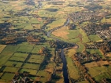
The high-speed dual carriageway
Dual carriageway
A dual carriageway is a class of highway with two carriageways for traffic travelling in opposite directions separated by a central reservation...
is projected to cost over £350million and create an alternative route from north to south Aberdeen, bypassing the city. Currently the only dual carriageway route from north to south is through the city itself, along the original 1930s bypass, Anderson Drive which is unsuitable for heavy goods vehicles as they cannot cross the Bridge of Dee
Bridge of Dee
The Bridge of Dee or Brig o' Dee is a road bridge over the River Dee in Aberdeen, Scotland. The term is also used for the surrounding area of the city. Dating from 1527, the bridge crosses at what was once the City of Aberdeen's southern boundary...
at its South end. Since Anderson Drive was built, the city has expanded beyond the road considerably.
Congestion relief
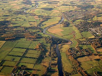
The proposed development has been designed to have a positive impact on traffic along routes which are congested during rush hour, particularly Aberdeen's Anderson Drive, King Street and Union Street.Other intentions of this project would be a slight reduction in traffic congestion on the bridges into central Aberdeen, which is sandwiched between the River Dee
River Dee, Aberdeenshire
The River Dee is a river in Aberdeenshire, Scotland. It rises in the Cairngorms and flows through Strathdee to reach the North Sea at Aberdeen...
and the River Don
River Don, Aberdeenshire
The River Don is a river in north-east Scotland. It rises in the Grampians and flows eastwards, through Aberdeenshire, to the North Sea at Aberdeen. The Don passes through Alford, Kemnay, Inverurie, Kintore, and Dyce...
, by reducing heavy goods vehicles that do not need to enter the city itself. There will also be a reduction in the volume of traffic heading towards Aberdeen Airport
Aberdeen Airport
Aberdeen Airport is an international airport, located at Dyce, a suburb of Aberdeen, Scotland, approximately northwest of Aberdeen city centre. 2.76 million passengers used Aberdeen Airport in 2010, a reduction of 7.4% compared with 2009, making it the 15th busiest airport in the UK...
and the adjacent industrial estates at Dyce
Dyce
Dyce is a civil parish and suburb of Aberdeen, Scotland, about north west of Aberdeen city centre, and best known as the location of the city's airport. It is on the River Don.- History :...
.
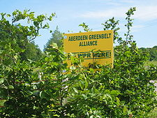
Controversy
The bypass has caused controversy among local people who live along the proposed route. Some of the areas affected are amongst the most expensive in the city and its surrounding area. It will particularly affect the people in MilltimberMilltimber
Milltimber is a suburb to the west of Aberdeen, Scotland. It is situated approximately 8 miles inland of the North Sea, around 6 miles west of Aberdeen....
, Bieldside
Bieldside
Bieldside is a suburb to the west of Aberdeen, Scotland, together with its neighbouring village of Cults. It has one pub/restaurant Bieldside is a suburb to the west of Aberdeen, Scotland, together with its neighbouring village of Cults. It has one pub/restaurant Bieldside is a suburb to the west...
and Cults.
External links
Anti-bypass pressure groups:
- Road Sense, opposing community
- Aberdeen Greenbelt Alliance
- Friends of the Earth
- Scottish Green Party
The bypass in the news: