
A3055 road
Encyclopedia
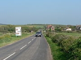
The A3055 is an A-Class
Road on the Isle of Wight
in Southern England
. It forms the Southern portion of the circular around-the-Island A-class loop, the northern section being the A3054
. The stretch along the south-west coast of the Island is formed by the Military Road.
Because of the road's relatively short length, there are no confirmatory signs with distances, although on a few direction signs at junctions you may find the distance to the next major place. The final destination of the road (Freshwater/Totland or Ryde), in common with most UK roads, is not signed along the whole length of the route. As well as fitting with national practice, this is also because anybody wishing to travel from Totland to Ryde by road would do so via the North coast A3054
, as it is much more direct.
which starts at Chale
in the East and ends at Freshwater Bay
in the West. The high standard of construction means that the road has needed little major work since it was built in the late nineteenth century until recent damage caused by sea erosion has caused it to be closed on several occasions for repair.
The road from Chale to Niton
was built as a diversionary inland route following the collapse of the previous coastal road in 1928. It is of similar construction and mostly from the same time period to the stretch to the west of Chale which was re-built and upgraded at this time. This length of road is not usually understood to be covered by the term 'Military Road' and its name on street maps and signs is different.
The section from Brook
to Freshwater Bay is a clearway, so stopping on this section is only permitted at the five car parking areas, of which one is free, and the rest are operated with a charge to those who are not members of the National Trust
. Along the rest of the route, there is no such restriction, but most motorists choose only to stop in designated car parks.
In Summer 2009 the Isle of Wight Council
was warned that the future of the road would be under threat unless it acted quickly to preserve it. This is partly due to a new chine
appearing in the cliffs making the road only 10 metres away from the cliff edge at its narrowest point. In March councillors are due to discuss whether the road is worth retaining or whether it should be abandoned. Moving the road further inland will also be discussed along with several other proposals, all of which will include consultation with bodies such as the AONB Partnership, Department of the Environment Food and Rural Affairs, Natural England, the National Trust and the Environment Agency.
The harsh weather over winter 2009-10 caused a large number of landslides. By February 2010, another land slip on the section between Brook and Hanover car park, brought the cliff edge to about 5 metres away from the edge of the road. The coastal path was lost, and the council erected traffic barriers along the side of the road to alert drivers.
A further landslide, on the same section, on 23 February 2010, brought the edge of the cliff to virtually the edge of the road. The road was reduced to single file, with traffic light control. On 30th March the Isle of Wight Council will meet to discuss the future of the road, however have already been told the road is on its last legs with the best option being to close it off at both sides, turning it into a large cul-de-sac and improving car parking facilities on both sides.
Great Britain road numbering scheme
The Great Britain road numbering scheme is a numbering scheme used to classify and identify all roads in Great Britain. Each road is given a single letter, which represents the road's category, and a subsequent number, with a length of between 1 and 4 digits. Originally introduced to arrange...
Road on the Isle of Wight
Isle of Wight
The Isle of Wight is a county and the largest island of England, located in the English Channel, on average about 2–4 miles off the south coast of the county of Hampshire, separated from the mainland by a strait called the Solent...
in Southern England
Southern England
Southern England, the South and the South of England are imprecise terms used to refer to the southern counties of England bordering the English Midlands. It has a number of different interpretations of its geographic extents. The South is considered by many to be a cultural region with a distinct...
. It forms the Southern portion of the circular around-the-Island A-class loop, the northern section being the A3054
A3054 road
The A3054 is an A-Class Road on the Isle of Wight in Southern England. It forms the Northern half of the circular around-the-Island A-class loop, the southern half being the A3055...
. The stretch along the south-west coast of the Island is formed by the Military Road.
Because of the road's relatively short length, there are no confirmatory signs with distances, although on a few direction signs at junctions you may find the distance to the next major place. The final destination of the road (Freshwater/Totland or Ryde), in common with most UK roads, is not signed along the whole length of the route. As well as fitting with national practice, this is also because anybody wishing to travel from Totland to Ryde by road would do so via the North coast A3054
A3054 road
The A3054 is an A-Class Road on the Isle of Wight in Southern England. It forms the Northern half of the circular around-the-Island A-class loop, the southern half being the A3055...
, as it is much more direct.
Military Road
The Military Road (named as such on street maps) is the section of the A3055 regional coast road on the Isle of WightIsle of Wight
The Isle of Wight is a county and the largest island of England, located in the English Channel, on average about 2–4 miles off the south coast of the county of Hampshire, separated from the mainland by a strait called the Solent...
which starts at Chale
Chalé
Chalé is a Brazilian municipality located in the state of Minas Gerais. The city belongs to the mesoregion of Zona da Mata and to the microregion of Manhuaçu.-See also:* List of municipalities in Minas Gerais-References:...
in the East and ends at Freshwater Bay
Freshwater, Isle of Wight
Freshwater is a large village and civil parish at the western end of the Isle of Wight, England. Freshwater Bay is a small cove on the south coast of the Island which also gives its name to the nearby part of Freshwater....
in the West. The high standard of construction means that the road has needed little major work since it was built in the late nineteenth century until recent damage caused by sea erosion has caused it to be closed on several occasions for repair.
The road from Chale to Niton
Niton, Isle of Wight
Niton is a village on the Isle of Wight, near Ventnor with a thriving population of 1142, supporting two pubs, several churches,a pottery workshop/shop, a pharmacy and 3 local shops including a post office...
was built as a diversionary inland route following the collapse of the previous coastal road in 1928. It is of similar construction and mostly from the same time period to the stretch to the west of Chale which was re-built and upgraded at this time. This length of road is not usually understood to be covered by the term 'Military Road' and its name on street maps and signs is different.
The section from Brook
Brook, Isle of Wight
-Background:It is situated on the south west coast of the Island between Brighstone and Freshwater, and borders a section of rugged coastline , the Back of the Wight, facing into the English Channel and towards the famous Needles and west Wight cliffs....
to Freshwater Bay is a clearway, so stopping on this section is only permitted at the five car parking areas, of which one is free, and the rest are operated with a charge to those who are not members of the National Trust
National Trust for Places of Historic Interest or Natural Beauty
The National Trust for Places of Historic Interest or Natural Beauty, usually known as the National Trust, is a conservation organisation in England, Wales and Northern Ireland...
. Along the rest of the route, there is no such restriction, but most motorists choose only to stop in designated car parks.
In Summer 2009 the Isle of Wight Council
Isle of Wight Council
The Isle of Wight Council is a local council. It is a unitary authority covering the Isle of Wight, South East England. It is currently made up of 40 seats, with the Conservatives as ruling party with 24 councillors at the latest local election in June 2009....
was warned that the future of the road would be under threat unless it acted quickly to preserve it. This is partly due to a new chine
Chine
A chine is a steep-sided river valley where the river flows through coastal cliffs to the sea. Typically these are soft eroding cliffs such as sandstone or clays. The word chine originates from the Saxon "Cinan" meaning a gap or yawn....
appearing in the cliffs making the road only 10 metres away from the cliff edge at its narrowest point. In March councillors are due to discuss whether the road is worth retaining or whether it should be abandoned. Moving the road further inland will also be discussed along with several other proposals, all of which will include consultation with bodies such as the AONB Partnership, Department of the Environment Food and Rural Affairs, Natural England, the National Trust and the Environment Agency.
The harsh weather over winter 2009-10 caused a large number of landslides. By February 2010, another land slip on the section between Brook and Hanover car park, brought the cliff edge to about 5 metres away from the edge of the road. The coastal path was lost, and the council erected traffic barriers along the side of the road to alert drivers.
A further landslide, on the same section, on 23 February 2010, brought the edge of the cliff to virtually the edge of the road. The road was reduced to single file, with traffic light control. On 30th March the Isle of Wight Council will meet to discuss the future of the road, however have already been told the road is on its last legs with the best option being to close it off at both sides, turning it into a large cul-de-sac and improving car parking facilities on both sides.