
8th Ward of New Orleans
Encyclopedia
The 8th Ward is a section of New Orleans, Louisiana
. It is one of the Downtown
Wards of New Orleans
, with a Creole
history.
 The 8th Ward is a narrow strip stretching from the Mississippi River
on the south to Lake Pontchartrain
in the north. East, or "down," is the 9th Ward
, the boundary being Franklin Avene, Almonaster Avenue, then People's Avenue, and a line straight north into the Lake at part of the University of New Orleans
campus. On the west, or "upper" side, the boundary is Elysian Fields Avenue, the boundary with the 7th Ward of New Orleans
.
. Other than the narrow high ground of Gentilly Ridge, the majority of the area between Claiborne Avenue and the Lake was little developed until improved drainage was initiated at the start of the 20th century (see: Drainage in New Orleans
).
In the 19th century, in the area from Gentilly Ridge to the lake, the People's Avenue Canal formerly stretched along the ward's back boundary, with the Lower Line Protection Levee
in back of it, marking the city limit of New Orleans. This section of the canal has been filled in, but a raised railroad line built atop the old levee still gives a distinct dividing line from the neighborhoods of the 9th Ward on the other side.
On the upper edge of the Ward, the commercially important Pontchartrain Railroad ran for about 100 years, connecting the Riverfront with Milneburg
on the Lakefront.
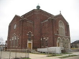
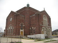
Neighborhoods in the 8th Ward include the Marigny Rectangle, St. Roch, Gentilly Terrace, Milneburg, Seabrook and Lake Oaks.
New Orleans, Louisiana
New Orleans is a major United States port and the largest city and metropolitan area in the state of Louisiana. The New Orleans metropolitan area has a population of 1,235,650 as of 2009, the 46th largest in the USA. The New Orleans – Metairie – Bogalusa combined statistical area has a population...
. It is one of the Downtown
Downtown New Orleans
In New Orleans, Louisiana, USA, "downtown" has historically referred to neighborhoods along the Mississippi River down-river from Canal Street, including the French Quarter, Treme, Faubourg Marigny, Bywater, the 9th Ward, and other neighborhoods...
Wards of New Orleans
Wards of New Orleans
The city of New Orleans, Louisiana is divided into 17 wards. Politically, the wards are used in voting in elections, subdivided into precincts. Under various previous city charters of the 19th century, aldermen and later city council members were elected by ward. The city has not had officials...
, with a Creole
Louisiana Creole people
Louisiana Creole people refers to those who are descended from the colonial settlers in Louisiana, especially those of French and Spanish descent. The term was first used during colonial times by the settlers to refer to those who were born in the colony, as opposed to those born in the Old World...
history.
Mississippi River
The Mississippi River is the largest river system in North America. Flowing entirely in the United States, this river rises in western Minnesota and meanders slowly southwards for to the Mississippi River Delta at the Gulf of Mexico. With its many tributaries, the Mississippi's watershed drains...
on the south to Lake Pontchartrain
Lake Pontchartrain
Lake Pontchartrain is a brackish estuary located in southeastern Louisiana. It is the second-largest inland saltwater body of water in the United States, after the Great Salt Lake in Utah, and the largest lake in Louisiana. As an estuary, Pontchartrain is not a true lake.It covers an area of with...
in the north. East, or "down," is the 9th Ward
Ninth Ward of New Orleans
The Ninth Ward or 9th Ward is a distinctive region of New Orleans, Louisiana that is located in the easternmost downriver portion of the city. It is geographically the largest of the 17 Wards of New Orleans....
, the boundary being Franklin Avene, Almonaster Avenue, then People's Avenue, and a line straight north into the Lake at part of the University of New Orleans
University of New Orleans
The University of New Orleans, often referred to locally as UNO, is a medium-sized public urban university located on the New Orleans Lakefront within New Orleans, Louisiana, United States. It is a member of the LSU System and the Urban 13 association. Currently UNO is without a proper chancellor...
campus. On the west, or "upper" side, the boundary is Elysian Fields Avenue, the boundary with the 7th Ward of New Orleans
7th Ward of New Orleans
The 7th Ward is a section of New Orleans, Louisiana. It is geographically the second largest of the 17 Wards of New Orleans, after the 9th Ward.-Boundaries and geography:...
.
History
As in most of New Orleans, the area along natural high ground of the riverfront was developed for urban use first. This is now part of Faubourg MarignyFaubourg Marigny
The Marigny is a neighborhood of the city of New Orleans. A subdistrict of the Bywater District Area, its boundaries as defined by the City Planning Commission are: North Rampart Street and St...
. Other than the narrow high ground of Gentilly Ridge, the majority of the area between Claiborne Avenue and the Lake was little developed until improved drainage was initiated at the start of the 20th century (see: Drainage in New Orleans
Drainage in New Orleans
Drainage in New Orleans, Louisiana has been a major concern since the founding of the city in the early 18th century, remaining an important factor in the history of New Orleans through today....
).
In the 19th century, in the area from Gentilly Ridge to the lake, the People's Avenue Canal formerly stretched along the ward's back boundary, with the Lower Line Protection Levee
Levee
A levee, levée, dike , embankment, floodbank or stopbank is an elongated naturally occurring ridge or artificially constructed fill or wall, which regulates water levels...
in back of it, marking the city limit of New Orleans. This section of the canal has been filled in, but a raised railroad line built atop the old levee still gives a distinct dividing line from the neighborhoods of the 9th Ward on the other side.
On the upper edge of the Ward, the commercially important Pontchartrain Railroad ran for about 100 years, connecting the Riverfront with Milneburg
Milneburg
Milneburg is a neighborhood of the city of New Orleans. A subdistrict of the Gentilly District Area, its boundaries as defined by the City Planning Commission are: Leon C. Simon Drive to the north, People's Avenue to the east, Filmore Avenue to the south and Elysian Fields Avenue to the west...
on the Lakefront.
Neighborhoods in the 8th Ward include the Marigny Rectangle, St. Roch, Gentilly Terrace, Milneburg, Seabrook and Lake Oaks.