

-up
Encyclopedia
Suffix
In linguistics, a suffix is an affix which is placed after the stem of a word. Common examples are case endings, which indicate the grammatical case of nouns or adjectives, and verb endings, which form the conjugation of verbs...
commonly found in place names in south western
Southwest, Western Australia
The Southwest is a loosely defined area in the southwest corner of Western Australia. Various regionalisations have provided formal definitions of the area, but these do not coincide.* For the drainage division, see Southwest corner of Western Australia...
Western Australia
Western Australia
Western Australia is a state of Australia, occupying the entire western third of the Australian continent. It is bounded by the Indian Ocean to the north and west, the Great Australian Bight and Indian Ocean to the south, the Northern Territory to the north-east and South Australia to the south-east...
.
The suffix originated in a dialect of Noongar
Noongar
The Noongar are an indigenous Australian people who live in the south-west corner of Western Australia from Geraldton on the west coast to Esperance on the south coast...
, an Indigenous Australian language, in which "-up" means "place of". The suffix "-in" or "-ing" has a similar meaning in a related dialect of Noongar. Places tended to be named after their distinctive features, whereby the place names could be used to create a "mental map" allowing Indigenous Australians to determine where water, food and other raw materials could be found. These sites were often located near sources of fresh water, leading to the common misconception that "up" and "in" mean "near water".
The meanings and the pronunciations of many of these names has been lost over time.
A number of these places were at one stage named with a suffix "-upp". This was as a result of the Western Australian Lands and Surveys Department
Landgate
Landgate, formerly the Department of Land Information , the Department of Land Administration and the Department of Lands and Surveys is the statutory authority responsible for Western Australia's property and land information.-Current activities:Landgate maintains the official register of land...
adopting a system of spelling Indigenous Australian names devised by the Royal Geographical Society
Royal Geographical Society
The Royal Geographical Society is a British learned society founded in 1830 for the advancement of geographical sciences...
. In simple terms, the system set the pronunciation of consonants as in English and vowels as in Italian. Using this system meant that "up" would be pronounced "oop" (uːp), whereas the names were meant to be pronounced "up" (ʌp). The solution was deemed to be that doubling the following consonant would shorten the preceding vowel, thus "upp". This spelling convention was rescinded for towns in south west Western Australia in 1915 as the Australian pronunciation of "u" was almost always short.
The usage of some terms are for the name of Noongar groups as well as places Pinjarup is one of a number of names for one group - and it has been utilised and changed to the place name of Pinjarra.
List of places
The following is a list of locations in Australia which end in "-up".| Name | Location | Place name meaning (where known) |
|---|---|---|
| Amelup Amelup, Western Australia Amelup is a small town in the Great Southern region of Western Australia located on Chester Pass Road.The Amelup service station is located 9km North of the Stirling Range National Park situated between the Stirling Range and Borden.... |
34°14′18"S 118°13′16"E | |
| Badgebup Badgebup, Western Australia Badgebup is a small community in the Great Southern region of Western Australia. The town is located between the towns of Katanning and Nyabing. The Badgebup Reserve, north of the town, forms part of the Kwobrup-Badgebup Important Bird Area.-Name:... |
33.602°N 117.884°W | "place of wild rushes" |
| Bailup Bailup, Western Australia Bailup is a Western Australian locality and rural residential estate located north-east of the state capital, Perth, along Toodyay Road. The area is split between the Shire of Toodyay and Shire of Mundaring, the latter of which contains most of the land area.... |
31.740°N 116.311°W | Aboriginal unknown origin. |
| Balgarup | "place of the black boy trees" (Xanthorrhoea preissii Xanthorrhoea preissii Xanthorrhoea preissii , with the common name Balga, is a widespread species of perennial monocot in Southwest Australia. This plant, and other members of the genus Xanthorrhoea, are also known as grasstrees... ). |
|
| Balingup Balingup, Western Australia Balingup is a town located in the South West of Western Australia, south of the state capital, Perth, and southeast of the town of Donnybrook.The town takes its name from Balingup Pool, located on the Balingup Brook which flows through the town... |
33.787°N 115.982°W |
Derived from the name of an Aboriginal warrior, Balingan. |
| Banjup Banjup, Western Australia Banjup is a suburb of Perth, Western Australia, located within the City of Cockburn. Its postcode is 6164.-History :Named in the mid 1950s from the lake in the District. During the survey of the Jandakot Agricultural Area in 1889, surveyor James Oxley recorded the name of Lake Bangup... |
32.124°N 115.876°W | Named for Banjupp Lake. |
| Barragup Barragup, Western Australia Barragup is a locality near Mandurah, Western Australia, located north of Pinjarra Road and east of the Serpentine River within the Shire of Murray. Its postcode is 6209. At the 2006 census, Barragup had a population of 965.... |
32.544°N 115.794°W | Not known. |
| Beenup Byford, Western Australia Byford is a suburb on the southeastern edge of Perth, Australia, originally founded as the townsite of Beenup in 1906.Beenup took its name from the railway siding there, a corruption of the Aboriginal name of nearby Beenyup Brook... |
32.222°N 116.001°W | A corruption of the Aboriginal name of nearby Beenyup Brook. Now known as Byford. |
| Binningup Binningup, Western Australia Binningup is a town located on the coast in the South West region of Western Australia between Mandurah and Bunbury. At the 2006 census, Binningup had a population of 950.-History:... |
33.149°N 115.689°W | Apparently an Aboriginal name, but not necessarily traditional. |
| Boranup Hamelin Bay, Western Australia Hamelin Bay is a bay and a locality on the south west coast of Western Australia between Cape Leeuwin and Cape Naturaliste. It is named after French explorer Jacques Félix Emmanuel Hamelin who sailed through the area in about 1801... |
||
| Boyanup Boyanup, Western Australia Boyanup is a town located on the South Western Highway in the South West agricultural region, 195 km south of Perth and 18 km south-east of Bunbury, Western Australia.... |
33.486°N 115.73°W | "a place of quartz" |
| Boyup Brook Boyup Brook, Western Australia Boyup Brook is a town located in the south-west of Western Australia, south-southeast of Perth and northeast of Bridgetown.The name Boyup is derived from the name of a nearby pool "Booyup", an Aboriginal term meaning "place of big stones" or "place of big smoke" .The town's economy is... |
33.834°N 116.388°W | "place of smoke" |
| Burekup Burekup, Western Australia Burekup is a small town located on the South Western Highway in the South West Region of Western Australia.The town is built on the Collie River and was originally a railway siding on the Pinjarra-Picton line that was established in 1910 and known at the time as Boorekup.Following a request from... |
33°19′0"S 115°48′0"E | The Aboriginal name of a wildflower that grows profusely in the locality. |
| Carbunup River Carbunup River, Western Australia Carbunup River is a small town in the South West region of Western Australia. It is situated between Dunsboroughand Margaret River on the banks of the Carbunup River.... |
33°42′0"S 115°11′0"E | " Variously "place of a kindly stream" , "place of cormorants", and "place of the stinkwood thicket. |
| Cardup | "place of the racehorse goanna". | |
| Chinocup Chinocup, Western Australia Chinocup is a small town in the Great Southern region of Western Australia. It is situated between the towns of Nyabing and PingrupOriginally a station on the now abandoned Nyabing to Pingrup railway, land was soon in demand in the area around the station and blocks were surveyed and released in 1923... |
33°32′0"S 118°23′0"E | an Aboriginal word of unknown meaning. |
| Condingup Condingup Condingup is a town in the Goldfields-Esperance region of Western Australia. The town is in the Shire of Esperance local government area, south east of the state capital, Perth. At the 2006 census, Condingup and the surrounding region had a population of 429.... |
33°45′S 122°32′E | an Aboriginal word of unknown meaning. |
| Coodanup Coodanup, Western Australia Coodanup is a northern suburb of Mandurah, Western Australia. Its Local Government Area is the City of Mandurah.-History:The name "Coodanup" is of unknown origin, although clearly a Noongar word - the WA gazetteer states that in 1836, Lieutenant Henry Bunbury noted "Colanup" was the local name for... |
32.554°N 115.744°W | Unknown. |
| Cookernup Cookernup, Western Australia Cookernup is a town located in the South West of Western Australia just off the South Western Highway, between Waroona and Harvey.-History:In 1835, Stephen Henty and Thomas Peel were the first Europeans to visit the area, being guided through the reaches of the Harvey River by local Aboriginal... |
32.994°N 115.893°W | "the place of the swamp hen". |
| Coolbellup Coolbellup, Western Australia Coolbellup is a suburb in Perth, Western Australia, located within the local government area of the City of Cockburn.Coolbellup takes its name from the Aboriginal name for the nearby North Lake; confusingly, there is also an adjoining suburb with the name of North Lake.-History:The original... |
32.082°N 115.818°W |
The Aboriginal name of a lake in the area. |
| Cooloongup Cooloongup, Western Australia Cooloongup is an outer southern suburb of Perth, the capital city of Western Australia, located within the City of Rockingham. It is principally a suburb of residential dwellings.-History:... |
32.296°N 115.780°W |
"place of children". |
| Coolup Coolup, Western Australia Coolup is a small town in the Peel region of Western Australia. The town is situated just off the South Western Highway and close to the Murray River.The area was first settled in 1886 and the townsite was gazetted in 1899.... |
32°44′0"S 115°52′0"E | "place of the wild turkey". |
| Coomalbidgup | 33°38′0"S 121°22′0"E | "Possum scratches up a tree & there is water there". |
| Cowaramup Cowaramup, Western Australia Cowaramup is a town in the South West of Western Australia, 12 kilometres north of Margaret River in the Shire of Augusta-Margaret River.-Name:... |
33.8514°N 115.1059°W | believed to be derived from "Cowara", the Aboriginal name for the Purple-crowned Lorikeet Purple-crowned Lorikeet The Purple-crowned Lorikeet, Glossopsitta porphyrocephala, is a lorikeet found in scrub and mallee of southern Australia... (Glossopsitta porphyrocephala). |
| Culeenup | ||
| Dalyellup Dalyellup, Western Australia Dalyellup is an outer southern suburb of Bunbury, a city in Western Australia, located within the Shire of Capel local government area. The suburb was established in 1999 when the Department of Housing and Works entered into a joint venture with Satterley Property Group to develop Dalyellup Beach... |
33.402°N 115.625°W | |
| Dalyup Dalyup, Western Australia Dalyup is a small town in Western Australia located about east of Perth between Munglinup and Esperance on the South Coast Highway in the Goldfields-Esperance region of Western Australia.... |
33°43′0"S 121°36′0"E | Possibly the Noongar word for the King Parrot Australian King Parrot The Australian King Parrot is endemic to eastern Australia. It is found in humid and heavily forested upland regions of the eastern portion of the continent, including eucalyptus wooded areas in and directly adjacent to subtropical and temperate rainforest... or Hookbill Hookbill Hookbill could refer to* the avicultural term for members of the parrot family based on the shape of the bill, distinguishing them from softbills and other birds such as doves and finches. This indicates the bird will use the bill to be an active climber and is recommended to be put in a cage with... . |
| Dandalup North Dandalup, Western Australia North Dandalup is a small town in the Peel region of Western Australia along the South Western Highway between Serpentine and Pinjarra. Its local government area is the Shire of Murray... |
32.519°N 115.968°W | Not known. |
| Dardanup Dardanup, Western Australia Dardanup is a small town in the South West region of Western Australia. The town is located in the fertile Ferguson valley and is close to the Ferguson River.The area was first settled in 1852 by Thomas Little who named his property Dardanup Park... |
33°24′0"S 115°45′0"E | Believed to be a variation of the Aboriginal word "Dudingup" the meaning of which is not known. |
| Dinninup Dinninup, Western Australia Dinninup is a small town located in the South Waet region of Western Australia. It is situated between Boyup Brook and Kojonup.The towns name is Aboriginal in origin and is the name of a brook that is situated close to town. First recorded by surveyors in 1877, the meaning of the name is unknown... |
33°49′0"S 116°32′0"E | An Aboriginal name of unknown meaning. |
| Dwellingup Dwellingup, Western Australia Dwellingup is a town in Western Australia, located in a timber and fruitgrowing area in the Darling Range east-south-east of Pinjarra. At the 2006 census, Dwellingup had a population of 346.-Name:... |
32.715°N 116.064°W | "place of nearby water". |
| Gelorup | ||
| Gidgegannup Gidgegannup, Western Australia Gidgegannup is a township northeast of Perth, the capital city of Western Australia. The name Gidgegannup comes from a Noongar word meaning "Place where spears are made", and was first recorded by passing surveyors in 1852.... |
31.792°N 116.198°W | "place where spears are made". "Gidgie" is the word for spear. |
| Gnowangerup Gnowangerup, Western Australia Gnowangerup is a town located south east of Katanning in the Great Southern region of Western Australia. The townsite was first gazetted in 1908 under the spelling of Ngowangerupp. Local dissatisfaction with this spelling led to it being altered to Gnowangerup in 1913.A branch railway from... |
33.938°N 118.008°W | "place where the mallee hen nests" (Leipoa ocellata). |
| Gwelup Gwelup, Western Australia Gwelup is a suburb of Perth, the capital city of Western Australia, and is located 12 km north of Perth's central business district along the Mitchell Freeway. Its Local Government Area is the City of Stirling.-History and Environment:... |
31.8762°N 115.7989°W | "the lake that shifted position", derived from "Gwelgannow" which means to "shift the position" and "step aside". |
| Gwindinup | 33°31′0"S 115°44′0"E | May be a local spelling of the nearby Gynudup Brook. |
| Jacup | ||
| Jandabup Jandabup, Western Australia Jandabup is a suburb of Perth, Western Australia, located within the City of Wanneroo. The suburb takes its name from the nearby Jandabup Lake on the Swan coastal plain.... |
31.741°N 115.851°W | "place of little eagle". |
| Jerdacuttup Jerdacuttup, Western Australia Jerdacuttup is a small town in Western Australia located east south east of Perth between Ravensthorpe and Hopetoun in the Goldfields-Esperance region of Western Australia... |
33°43′0"S 120°28′0"E | Named for the Jerdacuttup River Jerdacuttup River Jerdacuttup River is a river located in the Goldfields-Esperance region of Western Australia.The water in the river is naturally saline.The river rises on the edge of the Yilgarn Plateau north of Ravensthorpe below Mounth Short and drains on the Eastern Side of the Ravensthorpe Range before flowing... . |
| Jerramungup Jerramungup, Western Australia Jerramungup is a Western Australian town located in the Great Southern agricultural region, southeast of Perth just west of the Gairdner River. The town of Jerramungup was established in 1953 as a war service settlement area... |
33.942°N 118.916°W | "place of upstanding yate trees" (Eucalyptus cornuta Eucalyptus cornuta Eucalyptus cornuta, commonly known as Yate, is a tree which occurs in an area between Busselton and Albany in Western Australia.... ). |
| Jingalup Jingalup, Western Australia Jingalup is a town in the Great Southern region of Western Australia located between the towns of Kojonup and Cranbrook. The town is located on Murrin Brook which is a tributary of the Tone River.... |
33°58′0"S 117°02′0"E | A contraction of nearby Kodjingalup Well. |
| Joondalup | 31.745°N 115.766°W | "place of whiteness or glistening". |
| Joweelingup | ||
| Karnup Karnup, Western Australia Karnup is an outer southern suburb of Perth, the capital city of Western Australia, located within the City of Rockingham.... |
32.368°N 115.827°W | A local Aboriginal name, the meaning of the name is not known. |
| Karrakup Karrakup, Western Australia Karrakup is a locality southeast of Perth, Western Australia, within the Shire of Serpentine-Jarrahdale. The name derives from the Noongar name for the Red-tailed Black Cockatoo and was adopted as a suburb name in 1997.... |
32.256°N 116.07°W | From "Karrak", the Nyoongar word for the red-tailed black cockatoo Red-tailed Black Cockatoo The Red-tailed Black Cockatoo , also known as Banksian- or Banks' Black Cockatoo, is a large cockatoo native to Australia. This species was known as Calyptorhynchus magnificus for many decades until the current scientific name was officially conserved in 1994. It is more common in the drier parts... which is prevalent in the area. |
| Karrinyup Karrinyup, Western Australia Karrinyup is a suburb of Perth, the capital city of Western Australia, and is located 12 km north of Perth's central business district. Its Local Government Area is the City of Stirling... |
31.87°N 115.778°W | Originally Careniup, of unknown meaning. |
| Kebaringup | 34°02′0"S 118°09′0"E | A local Aboriginal name, the meaning of the name is not known. |
| Kendenup Kendenup, Western Australia Kendenup is a small town in the Great Southern region of Western Australia, within the Shire of Plantagenet. It is south east of Perth and north of Mount Barker. The Great Southern Railway passes through the town, being one of the original stations on the line... |
34.486°N 117.629°W | Of Aboriginal origin, of unknown meaning. |
| Kirup Kirup, Western Australia Kirup is situated between Donnybrook and Mullalyup on the South Western Highway, 228 km south of Perth, Western Australia at the entrance of the Blackwood River valley. Kirup was originally settled as a timber town exporting railway sleepers.... |
33.707°N 115.892°W | "the place of summer flies". |
| Kojonup Kojonup, Western Australia Kojonup is a town located 256 km south-east of Perth, Western Australia along Albany Highway.The name Kojonup is believed to refer to the "Kodja" or stone axe made by Indigenous Australians from the local stone.... |
33.838°N 117.152°W | "place of the stone axe". |
| Kudardup Kudardup, Western Australia Kudardup is a locality in the South West region of Western Australia. The locality is in the Shire of Augusta-Margaret River and on the Bussell Highway, south of the state capital, Perth. In March 1961 Kudardup was devastated by bush fires... |
34.263°N 115.124°W | Named for Coodardup Mill. |
| Kulikup | 33°50′0"S 116°41′0"E | Not known. |
| Kundip | 33°41′0"S 120°11′0"E | Not known. |
| Kuringup | "place of wattle gum". | |
| Kwobrup Kwobrup, Western Australia Kwobrup is a small town in the Shire of Kent, in the Wheatbelt region of Western Australia. It is located on the Katanning to Nyabing branch line. The Kwobrup Reserve, north of the town, forms part of the Kwobrup-Badgebup Important Bird Area.... |
33°36′S 117°58′E | "good place". |
| Mandogalup Mandogalup, Western Australia Mandogalup is a suburb of Perth, Western Australia, located within the Town of Kwinana. Its postcode is 6167.The area of this suburb was originally referred to as "7 Mile Camp", but when a townsite was declared here in 1923 it was named "Balmanup". Lake Balmanup was an alternative name for... |
32.205°N 115.815°W | An Aboriginal name, the meaning of which is unknown. |
| Manjimup Manjimup, Western Australia Manjimup is a town in Western Australia, south of the state capital, Perth. The town of Manjimup is a regional centre for the largest shire in the South West of Western Australia. At the 2006 census, Manjimup had a population of 4,239.-History:... |
34.238°N 116.142°W | An Aboriginal name said to be derived from "Manjin", a broad leafed marsh flag with an edible root. |
| Marbelup | 34°59′0"S 117°44′0"E | Not known. |
| Marrinup | ||
| Mariginiup Mariginiup, Western Australia Mariginiup is an outer northern suburb of Perth, Western Australia, located within the City of Wanneroo.... |
31.722°N 115.827°W | "to pull out flag leaved flax". |
| Mayanup Mayanup, Western Australia Mayanup is a small town located in the South Waet region of Western Australia. It is situated between Boyup Brook and Kojonup. At the 2006 census, Mayanup had a population of 323.... |
33°56′0"S 116°27′0"E | No meaning or source for the name given. |
| Metricup | ||
| Moodiarrup | 33°37′0"S 116°48′0"E | Not known. |
| Mullalyup Mullalyup, Western Australia Mullalyup is a town in the South West region of Western Australia, situated between Kirup and Balingup on the South Western Highway, south of Perth.The name is taken from the nearby Mullalyup Brook, and was first noted by John Forrest in 1898... |
33.745°N 115.948°W | "the place where the young men had their noses pierced". |
| Mungalup | 33°24′0"S 116°06′0"E | Not known. |
| Munglinup Munglinup, Western Australia Munglinup is a small town located in the Goldfields-Esperance region of Western Australia.The town is located along the South Coast Highway between Ravensthorpe and Esperance and close to the Munglinup River.... |
33°43′0"S 120°52′0"E | A local Aboriginal word. |
| Muradup Muradup, Western Australia Muradup is a small town in the Great Southern region of Western Australia located between Kojonup and Boyup Brook. The town is situated along the Balgarup River.... |
33°51′0"S 116°59′0"E | An Aboriginal name. |
| Myalup Myalup, Western Australia Myalup is a town located on the coast in the South West region of Western Australia between Mandurah and Bunbury. At the 2006 census, Myalup had a population of 144.-History:... |
33.102°N 115.694°W | An Aboriginal name derived from a nearby swamp. |
| Nannup Nannup, Western Australia Nannup is a town and shire in the South West region of Western Australia, approximately south of Perth on the Blackwood River at the crossroads of Vasse Highway and Brockman Highway, linking Nannup to most of the Lower South West's regional centres... |
33.982°N 115.765°W | "stopping place" or "place of parrots". |
| Narrikup Narrikup, Western Australia Narrikup is a small town between Albany and Mount Barker in the Great Southern region of Western Australia. At the 2006 census, Narrikup had a population of 515.... |
34.774°N 117.702°W | "place of abundance" |
| Needilup Needilup, Western Australia Needilup is a town in the Great Southern Region of Western Australia that is situated between Ongerup and Jerramungup along the Gnowangerup-Jerramungup Road.... |
33°57′0"S 118°46′0"E | Not known. |
| Neerabup Neerabup, Western Australia Neerabup is a rural locality in Perth, the capital of Western Australia. Its Local Government Area is the City of Wanneroo.-History:Prior to European settlement, Noongar Aboriginal people had lived in the area for more than 40,000 years, taking advantage of the abundant food and water around the... |
31.691°N 115.777°W | Possibly "swampy place" or "small basin or lake". |
| Noggerup | 33°35′0"S 116°10′0"E | Not known. |
| Nornalup Nornalup, Western Australia Nornalup is a small town located in the Great Southern region of Western Australia. The town is located along the South Coast Highway and on the banks of the Frankland River. The name derives from the local indigenous language: "Place of the Black Snake" - Norne - meaning "black snake" -up meaning... |
34.991°N 116.822°W | "place of black snake" (Norn, a name of a Pseudechis Pseudechis The genus Pseudechis contains the group of elapids commonly referred to as the Black Snakes. These snakes are found in every Australian state with the exception of Tasmania and some species are found in Papua New Guinea.... species). |
| Nowergup Nowergup, Western Australia Nowergup is a rural locality about north of Perth, Western Australia. Its Local Government Area is the City of Wanneroo.-History:The suburb of Nowergup takes its name from Lake Nowergup... |
31.637°N 115.746°W | "place of sweet water". |
| Ongerup Ongerup, Western Australia Ongerup is a town located 410 km south-east of Perth and 54 km east of Gnowangerup in the Great Southern region of Western Australia.- History :The name Ongerup means Place of the male kangaroo in the local Noongar language.... |
33.966°N 118.486°W | "place of the male kangaroo". |
| Palgarup Palgarup, Western Australia Palgarup is a small town situated between Yornup and Manjimup on the South West Highway. At the 2006 census, Palgarup had a population of 398.... |
34.174°N 116.175°W | |
| Peringillup | 33°56′0"S 117°38′0"E | Not known. |
| Pingrup Pingrup, Western Australia Pingrup is a small town in the Great Southern region of Western Australia.The name of the town is Indigenous Australian in origin and was the name of a lake that is close to the townsite.The meaning of the word is unknown. The name first appeared on charts of the area in 1873.The townsite came into... |
33°32′0"S 118°30′0"E | Believed to mean "grassy place". |
| Pootenup | 34°14′0"S 117°38′0"E | "place of the native hybrid mallee tree". |
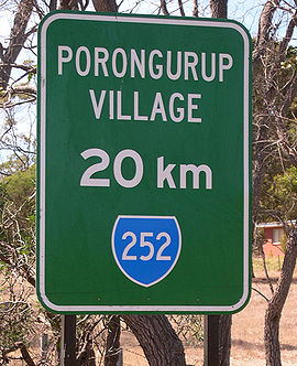
| Porongurup Porongurup, Western Australia Porongurup is the name of a small mountain range in the Shire of Plantagenet in Western Australia and of a small village on the northern slopes of the range. At the 2006 census, Porongurup had a population of 370.The name is derived from the Aboriginal place-name, and consequently arrived with no... |
34.664°N 117.874°W | |
| Qualeup | 33°50′0"S 116°48′0"E | The Aboriginal name of a nearby lake. |
| Quigup | 33°58′0"S 115°42′0"E | Not known. |
| Quindalup Quindalup, Western Australia Quindalup is a small town in the South West region of Western Australia. It is situated along Caves Road between Busseltonand Dunsborough on Geographe Bay. At the 2006 census, Quindalup had a population of 1,015.... |
33°32′0"S 116°00′0"E | "place of quendas" (Isoodon obesulus). |
| Tambellup Tambellup, Western Australia The townsite of Tambellup is located in Western Australia's Great Southern Agricultural region, 317 km south-east of Perth on the Great Southern Highway where it crosses the Gordon River... |
34.041°N 117.642°W | possibly "place of thunder". |
| Wadjemup | 31.998°N 115.546°W | Noongar name for Rottnest Island Rottnest Island Rottnest Island is located off the coast of Western Australia, near Fremantle. It is called Wadjemup by the Noongar people, meaning "place across the water". The island is long, and at its widest point with a total land area of . It is classified as an A Class Reserve and is managed by the... , meaning "place across the water". |
| Wagerup Wagerup, Western Australia Wagerup is a town located in the Peel region of Western Australia just off the South Western Highway, between Waroona and Harvey.-History:... |
32.948°N 115.905°W | "Place of emus". |
| Wannanup Wannanup, Western Australia Wannanup is a residential suburb in Western Australia, located southwest of Mandurah and south-southwest of the state capital, Perth. It is surrounded on three sides by water — the Indian Ocean to the west, the Harvey Estuary to the east and the Dawesville Channel to the south — and is home to... |
32.598°N 115.644°W | |
| Wattleup Wattleup, Western Australia Wattleup is a southern suburb of Perth, Western Australia, located within the City of Cockburn.As of 2001, it has been part of the Hope Valley-Wattleup development program, which has meant the demolition of most of the houses in the area for future industry. Wattleup had many market gardens in the... |
32.170°N 115.824°W | Named for Wattleup Road. |
| Wokalup Wokalup, Western Australia Wokalup is a town located in the South West region of Western Australia along the South Western Highway, between Harvey and Brunswick Junction. At the 2006 census, Wokalup had a population of 449.... |
33.11°N 115.881°W | Not known. Humorously said to mean "the confusion experienced by nocturnal animals during an eclipse". |
| Wonnerup Wonnerup, Western Australia The townsite of Wonnerup is located south of Perth and east of Busselton. It was gazetted a townsite in 1856, deriving its name from the nearby Wonnerup Inlet.The name is Aboriginal, having been shown on maps of the region since 1839... |
33.624°N 115.42°W | "place of the Aboriginal woman's digging or fighting stick". |
| Yallingup Yallingup, Western Australia Yallingup is a town in the South West region of Western Australia, south of Perth. Yallingup is a popular tourist destination because of its beaches and limestone caves, and proximity to Leeuwin-Naturaliste National Park.-History and industry:... |
33.640°N 115.028°W | |
| Yalup Brook | 32°54′0"S 115°54′0"E | |
| Yangebup Yangebup, Western Australia Yangebup is a southern suburb of Perth, Western Australia. Located in the City of Cockburn, the suburb takes its name from the nearby Yangebup Lake.- History :... |
32.129°N 115.819°W | Derived from the Aboriginal word “yanget”, the name of a native flax or bullrush. |
| Yornup Yornup, Western Australia Yornup is a small town in the South West region of Western Australia, situated between Bridgetown and Manjimup on the South Western Highway.Yornup's name is of Noongar Aboriginal origin. It was primarily a milling settlement, and Greenacres Mill continues to this day... |
34.056°N 116.17°W | |
| Yunderup | 32.576°N 115.791°W | Derived from “Yoondooroop”, the original spelling of one of the islands in the Murray River Murray River (Western Australia) The Murray River is a river in the southwest of Western Australia which played a significant part in the expansion of Aboriginal settlement in the area south of Perth after the arrival of British settlers at the Swan River Colony in 1829.... delta. |
Further reading
- Milne, Rod. (1992) Ups and ings : Aboriginal place names of south western W.A Perth, W.A.: R. Milne
External links
- http://www.slwa.wa.gov.au/find/guides/wa_history/place_names State Library of Western Australia guide to researching West Australian place names