

Ystwyth Trail
Encyclopedia
Rail trail
A rail trail is the conversion of a disused railway easement into a multi-use path, typically for walking, cycling and sometimes horse riding. The characteristics of former tracks—flat, long, frequently running through historical areas—are appealing for various development. The term sometimes also...
linking Aberystwyth
Aberystwyth
Aberystwyth is a historic market town, administrative centre and holiday resort within Ceredigion, Wales. Often colloquially known as Aber, it is located at the confluence of the rivers Ystwyth and Rheidol....
, Llanfarian
Llanfarian
Llanfarian is a village located in the district county of Ceredigion, Mid-Wales, south of the administrative centre Aberystwyth.The 2001 census showed Llanfarian as having a population of 1442....
, Ystrad Meurig
Ystrad Meurig
Ystrad Meurig is a village in Ceredigion, Wales. It lies on the B4340 road northwest of the town of Tregaron.- History & Amenities :...
and Tregaron
Tregaron
Tregaron is a market town in the county of Ceredigion, Wales, lying on the River Brenig , a tributary of the River Teifi. The town is twinned with Plouvien, in Finistere, France. According to the 2001 Census, Tregaron's population was 1,183, of whom 68.8% spoke Welsh fluently.-History:Tregaron...
in Ceredigion
Ceredigion
Ceredigion is a county and former kingdom in mid-west Wales. As Cardiganshire , it was created in 1282, and was reconstituted as a county under that name in 1996, reverting to Ceredigion a day later...
, Wales
Wales
Wales is a country that is part of the United Kingdom and the island of Great Britain, bordered by England to its east and the Atlantic Ocean and Irish Sea to its west. It has a population of three million, and a total area of 20,779 km²...
. Cycling
Cycling
Cycling, also called bicycling or biking, is the use of bicycles for transport, recreation, or for sport. Persons engaged in cycling are cyclists or bicyclists...
and walking
Walking
Walking is one of the main gaits of locomotion among legged animals, and is typically slower than running and other gaits. Walking is defined by an 'inverted pendulum' gait in which the body vaults over the stiff limb or limbs with each step...
are permitted along the entire length while horseriding is permitted on several sections only.
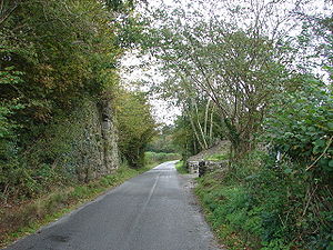
The £1.7m Ystwyth Trail was partially completed in September 2008 and runs along part of the former redundant track bed of the Old Manchester & Milford Railway a Great Western Railway
Great Western Railway
The Great Western Railway was a British railway company that linked London with the south-west and west of England and most of Wales. It was founded in 1833, received its enabling Act of Parliament in 1835 and ran its first trains in 1838...
branch line. It remains incomplete, as several sections of the former railway line were not purchased to create the trail due to extensive lobbying by local councillors of Ceredigion County Council
Ceredigion County Council
Ceredigion County Council is the governing body for the county of Ceredigion, one of the unitary authorities of Wales.-Political makeup:Elections take place every four years...
against the trail, as existing landowners and farmers objected to the construction of the trail. Diversions of the trail have now been carried out onto narrow sections of existing public roads to link these missing sections, but has created a non continuous trail with intermediate road sections which on narrow roads which have considerable safety issues due to their narrowness, many bends and no traffic speed limits. Due to these objections and lobbying, it is unlikely that this trail will be developed or completed any further.
The Ystwyth Trail links with other routes via Lampeter
Lampeter
Lampeter is a town in Ceredigion, South West Wales, lying at the confluence of the River Teifi and the Afon Dulas.-Demographics:At the 2001 National Census, the population was 2894. Lampeter is therefore the smallest university town in both Wales and the United Kingdom...
and Devil's Bridge
Devil's Bridge, Ceredigion
Devil's Bridge is a village in Ceredigion, Wales.- Description :The bridge spans the Mynach, a tributary of the Rheidol. The bridge is unusual in that three separate bridges are coexistent, each one built upon the previous bridge...
creating a link with both the Lôn Cambria and Lôn Teifi long distance cycling routes (Sustrans
Sustrans
Sustrans is a British charity to promote sustainable transport. The charity is currently working on a number of practical projects to encourage people to walk, cycle and use public transport, to give people the choice of "travelling in ways that benefit their health and the environment"...
national network
National Cycle Network
The National Cycle Network is a network of cycle routes in the United Kingdom.The National Cycle Network was created by the charity Sustrans , and aided by a £42.5 million National Lottery grant. In 2005 it was used for over 230 million trips.Many routes hope to minimise contact with motor...
routes 81 and 82).