
Wyoming Highway 74
Encyclopedia
Wyoming Highway 74 is an extremely short state highway completely in the town
of Saratoga, Wyoming
. At 0.13 mile (0.2092142 km), it is the shortest Wyoming state highway.
(1st Street). This section is not maintained by WYDOT, but is maintained locally. However, the approaches and the actual bridge over the North Platte River
are maintained by WYDOT. WYO 74 then terminates at County Route 504.
between Saratoga and Ryan Park, before that designation was moved south to its present-day routing.
Town
A town is a human settlement larger than a village but smaller than a city. The size a settlement must be in order to be called a "town" varies considerably in different parts of the world, so that, for example, many American "small towns" seem to British people to be no more than villages, while...
of Saratoga, Wyoming
Saratoga, Wyoming
Saratoga is a town in Carbon County, Wyoming, United States. The population was 1,736 at the 2000 census.Saratoga is the home of the Steinley Cup microbrew competition, usually held in August at Veterans Island Park, a playground and picnic facility located on a small island in the North Platte...
. At 0.13 mile (0.2092142 km), it is the shortest Wyoming state highway.
Route description
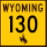
WYO 74 begins at Wyoming Highway 130Wyoming Highway 130
Wyoming Highway 130 is known locally as the Snowy Range Road. It makes its way west from Laramie across the plains, and rises over the Medicine Bow Mountains. The road then turns north through the town of Saratoga, and ends at Interstate 80. The stretch of road over the mountains is a National...
(1st Street). This section is not maintained by WYDOT, but is maintained locally. However, the approaches and the actual bridge over the North Platte River
North Platte River
The North Platte River is a major tributary of the Platte River and is approximately long counting its many curves, It travels about distance. Its course lies in the U.S...
are maintained by WYDOT. WYO 74 then terminates at County Route 504.
History
Wyoming Highway 74 was once part of Wyoming Highway 130Wyoming Highway 130
Wyoming Highway 130 is known locally as the Snowy Range Road. It makes its way west from Laramie across the plains, and rises over the Medicine Bow Mountains. The road then turns north through the town of Saratoga, and ends at Interstate 80. The stretch of road over the mountains is a National...
between Saratoga and Ryan Park, before that designation was moved south to its present-day routing.