
Wyoming Highway 10
Encyclopedia
Wyoming Highway 10 is a 9.12 miles (14.7 km) Wyoming
State Road known as Jelm Mountain Road that is located in southwestern Albany County.
in Woods Landing south to the Wyoming
-Colorado
State Line and continues into Colorado as Larimer County Route 103. WYO 230 serves the Jelm Mountain Observatory (at an elevation 9656 feet). Mileposts along WYO 10 increase from north to south (0.00 to 9.12).
Wyoming Highway 10 is the lowest numbered state route in Wyoming.
Wyoming
Wyoming is a state in the mountain region of the Western United States. The western two thirds of the state is covered mostly with the mountain ranges and rangelands in the foothills of the Eastern Rocky Mountains, while the eastern third of the state is high elevation prairie known as the High...
State Road known as Jelm Mountain Road that is located in southwestern Albany County.
Route description
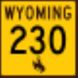
WYO 10 is a north–south route that runs from Wyoming Highway 230Wyoming Highway 230
Wyoming Highway 230 is known locally as Rivers Road and travels from Wyoming Highway 130 approximately south of Saratoga south from there to intersect WYO 70 in Riverside and then heads southeast to the Colorado-Wyoming State Line. The Route continues southeast in Colorado as Colorado State...
in Woods Landing south to the Wyoming
Wyoming
Wyoming is a state in the mountain region of the Western United States. The western two thirds of the state is covered mostly with the mountain ranges and rangelands in the foothills of the Eastern Rocky Mountains, while the eastern third of the state is high elevation prairie known as the High...
-Colorado
Colorado
Colorado is a U.S. state that encompasses much of the Rocky Mountains as well as the northeastern portion of the Colorado Plateau and the western edge of the Great Plains...
State Line and continues into Colorado as Larimer County Route 103. WYO 230 serves the Jelm Mountain Observatory (at an elevation 9656 feet). Mileposts along WYO 10 increase from north to south (0.00 to 9.12).
Wyoming Highway 10 is the lowest numbered state route in Wyoming.