
Worden, Montana
Encyclopedia
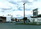
Worden is a census-designated place
(CDP) in Yellowstone County
, Montana
, United States
. The population was 506 at the 2000 census. Worden, along with Ballantine
, Huntley
, and Pompey's Pillar
, is part of the Huntley Project
, an irrigation district
established by the United States Bureau of Reclamation
in 1907.
Worden is home to a number of restaurants, bars, stores, churches, and other services. It is also the home of the Huntley Project School System, consisting of an elementary, junior high, and high school. Huntley Project High School
's team name is the "Red Devils."
. When the Northern Pacific Railroad was surveyed and built in the early 1880s, a station called "Clermont" was supposedly built 21 miles from Billings
, just across the tracks from present-day Worden.
The town of Worden was mapped out in 1907 as part of the Huntley Project
. Irrigation transformed the area into an agricultural district and attracted immigrants. The town had a German Congregational church and a Methodist church. A newspaper, The Yellowstone County News, was based here.
According to the United States Census Bureau
, the CDP has a total area of 2 square miles (5.2 km²), all of it land.
Worden is located along U.S. Route 312.
of 2000, there were 506 people, 223 households, and 136 families residing in the CDP. The population density
was 254.1 people per square mile (98.2/km²). There were 239 housing units at an average density of 120.0 per square mile (46.4/km²). The racial makeup of the CDP was 96.25% White, 0.59% African American, 0.99% Native American, 0.20% Asian, 0.40% from other races
, and 1.58% from two or more races. Hispanic or Latino of any race were 3.56% of the population.
There were 223 households out of which 27.8% had children under the age of 18 living with them, 46.6% were married couples
living together, 11.2% had a female householder with no husband present, and 39.0% were non-families. 35.4% of all households were made up of individuals and 17.5% had someone living alone who was 65 years of age or older. The average household size was 2.27 and the average family size was 2.97.
In the CDP the population was spread out with 25.5% under the age of 18, 8.1% from 18 to 24, 25.7% from 25 to 44, 23.7% from 45 to 64, and 17.0% who were 65 years of age or older. The median age was 40 years. For every 100 females there were 96.1 males. For every 100 females age 18 and over, there were 89.4 males.
The median income for a household in the CDP was $22,625, and the median income for a family was $38,393. Males had a median income of $22,434 versus $20,156 for females. The per capita income
for the CDP was $14,319. About 3.8% of families and 8.5% of the population were below the poverty line, including 8.9% of those under age 18 and 16.5% of those age 65 or over.
Census-designated place
A census-designated place is a concentration of population identified by the United States Census Bureau for statistical purposes. CDPs are delineated for each decennial census as the statistical counterparts of incorporated places such as cities, towns and villages...
(CDP) in Yellowstone County
Yellowstone County, Montana
-National protected areas:* Nez Perce National Historical Park * Pompeys Pillar National Monument-Demographics:As of the census of 2000, there were 129,352 people, 52,084 households, and 34,219 families residing in the county. The population density was 49 people per square mile . There were...
, Montana
Montana
Montana is a state in the Western United States. The western third of Montana contains numerous mountain ranges. Smaller, "island ranges" are found in the central third of the state, for a total of 77 named ranges of the Rocky Mountains. This geographical fact is reflected in the state's name,...
, United States
United States
The United States of America is a federal constitutional republic comprising fifty states and a federal district...
. The population was 506 at the 2000 census. Worden, along with Ballantine
Ballantine, Montana
Ballantine is a census-designated place in Yellowstone County, Montana, United States. The population was 346 at the 2000 census. Ballantine, along with the communities of Pompey's Pillar, Worden, and Huntley, is part of the Huntley Project, an irrigation district created by the United States...
, Huntley
Huntley, Montana
Huntley is a census-designated place in Yellowstone County, Montana, United States. The population was 411 at the 2000 census. Huntley lent its name to the Huntley Project, a federal irrigation project that began delivering water to the arid district in 1907...
, and Pompey's Pillar
Pompey's Pillar, Montana
Pompey's Pillar is an unincorporated community in Yellowstone County, Montana, United States.-History:Founded in 1907, Pompey's Pillar was built and named after the site of a famous natural landmark where William Clark inscribed his name on July 25, 1806 during his trip down the Yellowstone River...
, is part of the Huntley Project
Huntley Project
The Huntley Project is an irrigation project in southern Montana that was established by the United States Bureau of Reclamation in 1907. The district includes the towns of Huntley, Worden, Ballantine, and Pompeys Pillar....
, an irrigation district
Irrigation district
In the United States an irrigation district is a cooperative, self-governing public corporation set up as a subdivision of the State government, with definite geographic boundaries, organized, and having taxing power to obtain and distribute water for irrigation of lands within the district;...
established by the United States Bureau of Reclamation
United States Bureau of Reclamation
The United States Bureau of Reclamation , and formerly the United States Reclamation Service , is an agency under the U.S...
in 1907.
Worden is home to a number of restaurants, bars, stores, churches, and other services. It is also the home of the Huntley Project School System, consisting of an elementary, junior high, and high school. Huntley Project High School
Huntley Project High School
Huntley Project High School is a high school in Worden, Montana. Home of the Red Devils, the Huntley Project School District serves students living in four small Montana communities: Worden, Ballantine, Huntley, and Pompey's Pillar, with total population nearing 3,000 people...
's team name is the "Red Devils."
History
Worden is located on land designated in 1868 as part of the Crow Indian ReservationCrow Indian Reservation
The Crow Indian Reservation is the homeland of the Crow Tribe of Indians of the State of Montana in the United States. The reservation is located in parts of Big Horn, Yellowstone, and Treasure counties in southern Montana...
. When the Northern Pacific Railroad was surveyed and built in the early 1880s, a station called "Clermont" was supposedly built 21 miles from Billings
Billings, Montana
Billings is the largest city in the U.S. state of Montana, and is the principal city of the Billings Metropolitan Area, the largest metropolitan area in over...
, just across the tracks from present-day Worden.
The town of Worden was mapped out in 1907 as part of the Huntley Project
Huntley Project
The Huntley Project is an irrigation project in southern Montana that was established by the United States Bureau of Reclamation in 1907. The district includes the towns of Huntley, Worden, Ballantine, and Pompeys Pillar....
. Irrigation transformed the area into an agricultural district and attracted immigrants. The town had a German Congregational church and a Methodist church. A newspaper, The Yellowstone County News, was based here.
Geography
Worden is located at 45°57′39"N 108°9′49"W (45.960697, -108.163568).According to the United States Census Bureau
United States Census Bureau
The United States Census Bureau is the government agency that is responsible for the United States Census. It also gathers other national demographic and economic data...
, the CDP has a total area of 2 square miles (5.2 km²), all of it land.
Worden is located along U.S. Route 312.
Demographics
As of the censusCensus
A census is the procedure of systematically acquiring and recording information about the members of a given population. It is a regularly occurring and official count of a particular population. The term is used mostly in connection with national population and housing censuses; other common...
of 2000, there were 506 people, 223 households, and 136 families residing in the CDP. The population density
Population density
Population density is a measurement of population per unit area or unit volume. It is frequently applied to living organisms, and particularly to humans...
was 254.1 people per square mile (98.2/km²). There were 239 housing units at an average density of 120.0 per square mile (46.4/km²). The racial makeup of the CDP was 96.25% White, 0.59% African American, 0.99% Native American, 0.20% Asian, 0.40% from other races
Race (United States Census)
Race and ethnicity in the United States Census, as defined by the Federal Office of Management and Budget and the United States Census Bureau, are self-identification data items in which residents choose the race or races with which they most closely identify, and indicate whether or not they are...
, and 1.58% from two or more races. Hispanic or Latino of any race were 3.56% of the population.
There were 223 households out of which 27.8% had children under the age of 18 living with them, 46.6% were married couples
Marriage
Marriage is a social union or legal contract between people that creates kinship. It is an institution in which interpersonal relationships, usually intimate and sexual, are acknowledged in a variety of ways, depending on the culture or subculture in which it is found...
living together, 11.2% had a female householder with no husband present, and 39.0% were non-families. 35.4% of all households were made up of individuals and 17.5% had someone living alone who was 65 years of age or older. The average household size was 2.27 and the average family size was 2.97.
In the CDP the population was spread out with 25.5% under the age of 18, 8.1% from 18 to 24, 25.7% from 25 to 44, 23.7% from 45 to 64, and 17.0% who were 65 years of age or older. The median age was 40 years. For every 100 females there were 96.1 males. For every 100 females age 18 and over, there were 89.4 males.
The median income for a household in the CDP was $22,625, and the median income for a family was $38,393. Males had a median income of $22,434 versus $20,156 for females. The per capita income
Per capita income
Per capita income or income per person is a measure of mean income within an economic aggregate, such as a country or city. It is calculated by taking a measure of all sources of income in the aggregate and dividing it by the total population...
for the CDP was $14,319. About 3.8% of families and 8.5% of the population were below the poverty line, including 8.9% of those under age 18 and 16.5% of those age 65 or over.