
Woodville North, South Australia
Encyclopedia
Woodville North is a north-western suburb
of Adelaide
10km from the Adelaide city centre
, in the state of South Australia
, Australia
and falls under the City of Charles Sturt
. The post code for Woodville North is 5012. It is adjacent to Pennington
, Athol Park
, Woodville Gardens
, Mansfield Park
, Woodville
and Kilkenny
. It is bordered to the east by Hanson Road to the west by Carlton Crescent, to the south by Torrens Road
and to the north by Hamilton Road. The suburb is residential, apart from an industrial pocket to the northwest.
, in Woodville
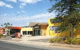
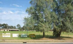
. There are a few shops and medical practices on Hanson Road, but the closest shopping centre is the Arndale Shopping Centre. The Finsbury Reserve on Park Avenue provides a venue for recreation. The al-Khalil mosque on Torrens Road provides a facility for Islamic worship.
Woodville North Post Office opened on 14 February 1966. An earlier office of the same name was renamed Kilkenny North
in 1964.
used to run parallel to Audley Street, mainly to service the industrial activity in the area, but this was removed in 1979 due to the industrial decline. The Finsbury railway station itself previously occupied the site of the al-Khalil mosque.
Suburb
The word suburb mostly refers to a residential area, either existing as part of a city or as a separate residential community within commuting distance of a city . Some suburbs have a degree of administrative autonomy, and most have lower population density than inner city neighborhoods...
of Adelaide
Adelaide
Adelaide is the capital city of South Australia and the fifth-largest city in Australia. Adelaide has an estimated population of more than 1.2 million...
10km from the Adelaide city centre
Adelaide city centre
The Adelaide city centre is the innermost locality of Greater Adelaide, known by locals simply as "The City" or "Town". The locality is split into two key geographical distinctions: the city "square mile", bordered by North, East, South and West Terraces; and that part of the Adelaide Parklands...
, in the state of South Australia
South Australia
South Australia is a state of Australia in the southern central part of the country. It covers some of the most arid parts of the continent; with a total land area of , it is the fourth largest of Australia's six states and two territories.South Australia shares borders with all of the mainland...
, Australia
Australia
Australia , officially the Commonwealth of Australia, is a country in the Southern Hemisphere comprising the mainland of the Australian continent, the island of Tasmania, and numerous smaller islands in the Indian and Pacific Oceans. It is the world's sixth-largest country by total area...
and falls under the City of Charles Sturt
City of Charles Sturt
The City of Charles Sturt is a Local Government Area in the western suburbs of Adelaide, South Australia, stretching to the coast.It came into being on 1 January 1997 as a result of the amalgamation of the City of Hindmarsh Woodville and the City of Henley and Grange...
. The post code for Woodville North is 5012. It is adjacent to Pennington
Pennington, South Australia
Pennington is an outer urban suburb of Adelaide, South Australia. It is located in the City of Charles Sturt.The suburb is residential, apart from a light industrial pocket to the south.-History:...
, Athol Park
Athol Park, South Australia
Athol Park is a north-western suburb of Adelaide, South Australia. It is located in the City of Charles Sturt.-Geography:The suburb lies at the western end of Grand Junction Road, which also forms its northern boundary...
, Woodville Gardens
Woodville Gardens, South Australia
Woodville Gardens is a north-western suburb of Adelaide 10km from the CBD, in the state of South Australia, Australia and falls under the City of Port Adelaide Enfield. It is adjacent to Woodville North, Mansfield Park, Ferryden Park, and Kilkenny. The post code for Woodville Gardens is 5012...
, Mansfield Park
Mansfield Park, South Australia
Mansfield Park is a north-western suburb of Adelaide 10 km from the CBD, in the state of South Australia, Australia and falls under the City of Port Adelaide Enfield. It is adjacent to Wingfield, Angle Park, Woodville Gardens, and Athol Park. The postcode for Mansfield Park is 5012. It is bounded...
, Woodville
Woodville, South Australia
Woodville is a suburb of Adelaide, situated about 8 kilometres northwest of the Central Business District of Adelaide. It lies within the City of Charles Sturt. The postcode of Woodville is 5011...
and Kilkenny
Kilkenny, South Australia
Kilkenny is a suburb of Adelaide, South Australia. It is located in the City of Charles Sturt.-History:The area incorporating the current suburb of Kilkenny was subdivided in 1849 as the Township of Kilkenny..-Demographics:...
. It is bordered to the east by Hanson Road to the west by Carlton Crescent, to the south by Torrens Road
Torrens Road, Adelaide
Torrens Road is an arterial road in the northwestern suburbs of Adelaide, Australia. The road travels in a southeast-northwest direction and is parallel with Port Road for most of its length. Major roads that intersect Torrens Road include South Road, Churchill Road and Regency Road...
and to the north by Hamilton Road. The suburb is residential, apart from an industrial pocket to the northwest.
Facilities
There is no primary school in the area; the nearest are the public Pennington Primary School, the R-2 campus of Pennington Junior Primary School, and Ridley Grove Primary School in the adjacent suburbs of Pennington and Woodville Gardens. Currently, the local zone high school is Woodville High SchoolWoodville High School (Australia)
Woodville High School, is a secondary school in Woodville, a north western suburb of Adelaide, South Australia. It was opened at its current site in 1915, open to all ethnicities....
, in Woodville
Woodville, South Australia
Woodville is a suburb of Adelaide, situated about 8 kilometres northwest of the Central Business District of Adelaide. It lies within the City of Charles Sturt. The postcode of Woodville is 5011...
. There are a few shops and medical practices on Hanson Road, but the closest shopping centre is the Arndale Shopping Centre. The Finsbury Reserve on Park Avenue provides a venue for recreation. The al-Khalil mosque on Torrens Road provides a facility for Islamic worship.
History
The southern pocket of Woodville North used to be a much stronger and active industrial area, with a Government Supply Depot for military purposes operating in the area during the Second World War, which was the basis for the existence of a railway line and station that is now the location of an Islamic mosque .Woodville North Post Office opened on 14 February 1966. An earlier office of the same name was renamed Kilkenny North
Kilkenny, South Australia
Kilkenny is a suburb of Adelaide, South Australia. It is located in the City of Charles Sturt.-History:The area incorporating the current suburb of Kilkenny was subdivided in 1849 as the Township of Kilkenny..-Demographics:...
in 1964.
Transport
Hanson Road is served by the 253, 254 and the 253X & 254X express bus services. Torrens Road is served by the 230, 232 and 100 services. Park Avenue is served by the 252 service. The Finsbury railway lineFinsbury railway line, Adelaide
The Finsbury railway line is a defunct railway in north western Adelaide which was used mainly for industrial purposes in the 20th century. It ran through the suburbs of Woodville, Woodville North, Pennington and Ottoway, connecting the Outer Harbor railway with the Dry Creek to Port Adelaide...
used to run parallel to Audley Street, mainly to service the industrial activity in the area, but this was removed in 1979 due to the industrial decline. The Finsbury railway station itself previously occupied the site of the al-Khalil mosque.