
Wolfhole Crag
Encyclopedia
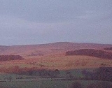
Wolfhole Crag is a lonely and seldom-visited hill in the Forest of Bowland
in Lancashire
, England
. Its seclusion is due in part to its low profile and long approach walks. A long path approaches from Ward's Stone
in the west which is fraught with bogs. Another tarmac
path from Tarnbrook meets this half way. A final path comes from the north east from the Hornby Road in the direction to White Hill. The summit consists of two large (10m high) buttresses of gritstone some unusually shaped waist-high rocks and the usual trig point
. The buttresses contain a number of recorded rock climbs, including the two farthest "hard grit" routes (E7 & E6) from the road in the entire UK. Both climbs were ascended in 2001 by Neil Kershaw and Greg Chapman. It’s quite possible to not see another human being all day there.
Wolfhole Crag marks the northwesternmost boundary of the civil parish of Bowland Forest High
, the historic Forest of Bowland
as well as the Lordship of Bowland
.
Forest of Bowland
The Forest of Bowland, also known as the Bowland Fells, is an area of barren gritstone fells, deep valleys and peat moorland, mostly in north-east Lancashire, England. A small part lies in North Yorkshire, and much of the area was historically part of the West Riding of Yorkshire...
in Lancashire
Lancashire
Lancashire is a non-metropolitan county of historic origin in the North West of England. It takes its name from the city of Lancaster, and is sometimes known as the County of Lancaster. Although Lancaster is still considered to be the county town, Lancashire County Council is based in Preston...
, England
England
England is a country that is part of the United Kingdom. It shares land borders with Scotland to the north and Wales to the west; the Irish Sea is to the north west, the Celtic Sea to the south west, with the North Sea to the east and the English Channel to the south separating it from continental...
. Its seclusion is due in part to its low profile and long approach walks. A long path approaches from Ward's Stone
Ward's Stone
Ward's Stone is the highest hill in the Forest of Bowland. Its flat top hides two trig points nearly a kilometre apart. The western trig point sits atop of large rocks, including one, the Ward's Stone, that is so large it attracts boulderers and climbers....
in the west which is fraught with bogs. Another tarmac
Tarmac
Tarmac is a type of road surface. Tarmac refers to a material patented by Edgar Purnell Hooley in 1901...
path from Tarnbrook meets this half way. A final path comes from the north east from the Hornby Road in the direction to White Hill. The summit consists of two large (10m high) buttresses of gritstone some unusually shaped waist-high rocks and the usual trig point
Trig point
A triangulation station, also known as a triangulation pillar, trigonometrical station, trigonometrical point, trig station, trig beacon or trig point, and sometimes informally as a trig, is a fixed surveying station, used in geodetic surveying and other surveying projects in its vicinity...
. The buttresses contain a number of recorded rock climbs, including the two farthest "hard grit" routes (E7 & E6) from the road in the entire UK. Both climbs were ascended in 2001 by Neil Kershaw and Greg Chapman. It’s quite possible to not see another human being all day there.
Wolfhole Crag marks the northwesternmost boundary of the civil parish of Bowland Forest High
Bowland Forest High
Bowland Forest High is a civil parish in the Ribble Valley district of Lancashire, England, covering some 20,000 acres of the Forest of Bowland. According to the 2001 census, the parish had a population of 163.. The parish includes the settlements of Hareden, Sykes, and Dunsop Bridge. It covers...
, the historic Forest of Bowland
Forest of Bowland
The Forest of Bowland, also known as the Bowland Fells, is an area of barren gritstone fells, deep valleys and peat moorland, mostly in north-east Lancashire, England. A small part lies in North Yorkshire, and much of the area was historically part of the West Riding of Yorkshire...
as well as the Lordship of Bowland
Lordship of Bowland
The Lordship of Bowland, an ancient English title connected with the Forest of Bowland in the northwest of England, was once thought lost and was only recently rediscovered. It disappeared from sight in 1885 when the estates of the Towneleys, one of Lancashire’s great aristocratic families, were...
.