

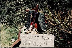
Wilmot Pass
Encyclopedia

Continental divide
A continental divide is a drainage divide on a continent such that the drainage basin on one side of the divide feeds into one ocean or sea, and the basin on the other side either feeds into a different ocean or sea, or else is endorheic, not connected to the open sea...
of New Zealand
New Zealand
New Zealand is an island country in the south-western Pacific Ocean comprising two main landmasses and numerous smaller islands. The country is situated some east of Australia across the Tasman Sea, and roughly south of the Pacific island nations of New Caledonia, Fiji, and Tonga...
's South Island
South Island
The South Island is the larger of the two major islands of New Zealand, the other being the more populous North Island. It is bordered to the north by Cook Strait, to the west by the Tasman Sea, to the south and east by the Pacific Ocean...
. It connects Doubtful Sound
Doubtful Sound
Doubtful Sound is a very large and naturally imposing fjord in Fiordland, in the far south west of New Zealand. It is located in the same region as the smaller but more famous and accessible Milford Sound...
, a deep indentation in the coast of Fiordland
Fiordland
Fiordland is a geographic region of New Zealand that is situated on the south-western corner of the South Island, comprising the western-most third of Southland. Most of Fiordland is dominated by the steep sides of the snow-capped Southern Alps, deep lakes and its ocean-flooded, steep western valleys...
, to the valley of the West Arm of Lake Manapouri
Lake Manapouri
Lake Manapouri is a lake in the South Island of New Zealand. Its name is Maori for "sorrowful heart", though this name is misapplied due to an early cartographical error...
. The pass is named after E. H. Wilmot, a former surveyor-general of New Zealand, who had noted it while surveying the area in 1897. It lies between Mount Wilmot and Mount Mainwaring. On the east side the Spey River drains to Lake Manapouri and on the west side the Lyvia River
Lyvia River
The Lyvia River is a river of Fiordland, New Zealand. It rises in the Dingwall Mountains and flows north-eastward into Doubtful Sound at Deep Cove.-References:...
drains to Deep Cove.
History
University of Otago Professor Mainwaring-Brown died while exploring the area to the west of Lake Manapouri in 1888. Mount Mainwaring, on the north side of the pass, is named in his honour. R. Murrell was the first European to ascend the pass while searching for Mainwaring-Brown the same year. E. H. Wilmot, who was to become Surveyor General of New Zealand in 1914, surveyed the area extensively in 1897. Tracks were cut to both Doubtful and Dusky SoundDusky Sound
Dusky Sound is a fiord on the south west corner of New Zealand, in Fiordland National Park.-Geography:One of the most complex of the many fjords on this coast, it is also one of the largest, 40 kilometres in length and eight kilometres wide at its widest point...
s and huts established, but these fell into disrepair. In 1921 Leslie Murrell established a tourist lodge at Deep Cove, reopened the track and conducted walking trips from Manapouri. The Manapouri-Doubtful Sound Tourist Company later took over operations, building additional huts.
Road
The pass is crossed by a road which was constructed to facilitate development of the Manapouri Hydroelectricity ProjectManapouri Power Station
Manapouri Power Station is an underground hydroelectric power station on the western arm of Lake Manapouri in Fiordland National Park, in the South Island of New Zealand...
. The road is notable as being the only road on the New Zealand mainland which is disconnected from the rest of the roading network. The road is home to several waterfall
Waterfall
A waterfall is a place where flowing water rapidly drops in elevation as it flows over a steep region or a cliff.-Formation:Waterfalls are commonly formed when a river is young. At these times the channel is often narrow and deep. When the river courses over resistant bedrock, erosion happens...
s, notably the Stella Falls.
Until the 1960s, the Wilmot Pass was only accessible from the sea or via the Wilmot Pass walking track. The 21 km unsealed road was constructed between 1963 and 1965 to accommodate heavy equipment transporters moving equipment loads of up to 97 tonnes from ships off-loading at Doubtful Sound for the construction on the Manapouri Underground Powerstation. A number of tour operators now transport tourists across Lake Manapouri by boat and over the Wilmot Pass by bus to lodges or a variety of boats and yachts on Doubtful Sound for day and overnight cruises.
A 10 kilometres (6.2 mi) tailrace tunnel connects the sound with the lake. The tunnel was completed in late 1969, and the power station became operational the following year. A second tunnel was started in 1997 and became operational in 2002.