

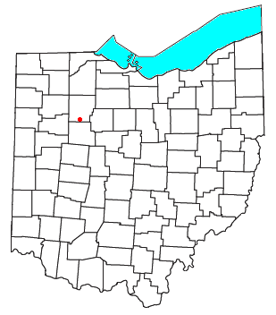
Williamstown, Ohio
Encyclopedia
Unincorporated area
In law, an unincorporated area is a region of land that is not a part of any municipality.To "incorporate" in this context means to form a municipal corporation, a city, town, or village with its own government. An unincorporated community is usually not subject to or taxed by a municipal government...
in southern Madison Township
Madison Township, Hancock County, Ohio
Madison Township is one of the seventeen townships of Hancock County, Ohio, United States. The 2000 census found 2,156 people in the township.-Geography:Located in the southern part of the county, it borders the following townships:...
, Hancock County
Hancock County, Ohio
Hancock County is a county located in the state of Ohio, United States. As of the 2010 census, the population was 74,782. Its county seat is Findlay and was named for John Hancock, the first signer of the Declaration of Independence...
, Ohio
Ohio
Ohio is a Midwestern state in the United States. The 34th largest state by area in the U.S.,it is the 7th‑most populous with over 11.5 million residents, containing several major American cities and seven metropolitan areas with populations of 500,000 or more.The state's capital is Columbus...
, United States
United States
The United States of America is a federal constitutional republic comprising fifty states and a federal district...
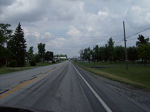
. Although it is unincorporated, it has a post office
Post office
A post office is a facility forming part of a postal system for the posting, receipt, sorting, handling, transmission or delivery of mail.Post offices offer mail-related services such as post office boxes, postage and packaging supplies...
, with the ZIP code
ZIP Code
ZIP codes are a system of postal codes used by the United States Postal Service since 1963. The term ZIP, an acronym for Zone Improvement Plan, is properly written in capital letters and was chosen to suggest that the mail travels more efficiently, and therefore more quickly, when senders use the...
of 45897. It lies at the intersection of U.S. Routes 30
U.S. Route 30
U.S. Route 30 is an east–west main route of the system of United States Numbered Highways, with the highway traveling across the northern tier of the country. It is the third longest U.S. route, after U.S. Route 20 and U.S. Route 6. The western end of the highway is at Astoria, Oregon; the...
and 68
U.S. Route 68
U.S. Route 68 is an east–west United States highway that runs for from northwest Ohio to western Kentucky. The highway's western terminus is at U.S. Route 62 in Reidland, Kentucky. Its eastern terminus is at Interstate 75 in Findlay, Ohio...
.