

West Homestead, Pennsylvania
Encyclopedia
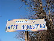
West Homestead is a borough in Allegheny County
, Pennsylvania
, 8 miles (12.9 km) southeast of Pittsburgh, on the Monongahela River
. Heavy industries associated with nearby steel mill
s existed here. Established were axle works, brickworks, and manufactories of machinery, car wheels, etc. In 1910, 3,009 people lived in west Homestead. The population was 1,929 at the 2010 census.
According to the United States Census Bureau
, the borough has a total area of 1 mi2, of which 0.9 mi2 is land and 0.1 mi2, or 9.90%, is water.
. This large "LifeStyle" shopping center was built on the former site of the US Steel Works. Most of the structures associated with the steel mills on this site were demolished during construction. Still standing in the Waterfront development are some of the brick stacks from the Homestead Steel Works. In addition, near the river is a former mill structure known as the Pump House which was restored by the developer.
Sandcastle Waterpark
is a waterpark that has 14 water slides and 3 speed slides and the newest addition the Blue Tooba Looba.
of 2000, there were 2,197 people, 956 households, and 623 families residing in the borough. The population density
was 2,408.9 people per square mile (932.2/km²). There were 1,106 housing units at an average density of 1,212.7 per square mile (469.3/km²). The racial makeup of the borough was 89.53% White, 8.83% African American, 0.18% Native American, 0.55% Asian, 0.05% from other races
, and 0.86% from two or more races. Hispanic or Latino of any race were 0.55% of the population.
There were 956 households out of which 22.9% had children under the age of 18 living with them, 47.3% were married couples
living together, 12.9% had a female householder with no husband present, and 34.8% were non-families. 30.4% of all households were made up of individuals and 13.2% had someone living alone who was 65 years of age or older. The average household size was 2.30 and the average family size was 2.87.
In the borough the population was spread out with 21.0% under the age of 18, 5.1% from 18 to 24, 25.4% from 25 to 44, 24.9% from 45 to 64, and 23.6% who were 65 years of age or older. The median age was 44 years. For every 100 females there were 88.6 males. For every 100 females age 18 and over, there were 89.2 males.
The median income for a household in the borough was $33,309, and the median income for a family was $44,338. Males had a median income of $35,033 versus $27,700 for females. The per capita income
for the borough was $17,327. About 9.2% of families and 13.7% of the population were below the poverty line, including 20.6% of those under age 18 and 5.5% of those age 65 or over.
Allegheny County, Pennsylvania
Allegheny County is a county in the southwestern part of the U.S. state of Pennsylvania. As of the 2010 census, the population was 1,223,348; making it the second most populous county in Pennsylvania, following Philadelphia County. The county seat is Pittsburgh...
, Pennsylvania
Pennsylvania
The Commonwealth of Pennsylvania is a U.S. state that is located in the Northeastern and Mid-Atlantic regions of the United States. The state borders Delaware and Maryland to the south, West Virginia to the southwest, Ohio to the west, New York and Ontario, Canada, to the north, and New Jersey to...
, 8 miles (12.9 km) southeast of Pittsburgh, on the Monongahela River
Monongahela River
The Monongahela River is a river on the Allegheny Plateau in north-central West Virginia and southwestern Pennsylvania in the United States...
. Heavy industries associated with nearby steel mill
Steel mill
A steel mill or steelworks is an industrial plant for the manufacture of steel.Steel is an alloy of iron and carbon. It is produced in a two-stage process. First, iron ore is reduced or smelted with coke and limestone in a blast furnace, producing molten iron which is either cast into pig iron or...
s existed here. Established were axle works, brickworks, and manufactories of machinery, car wheels, etc. In 1910, 3,009 people lived in west Homestead. The population was 1,929 at the 2010 census.
Geography
West Homestead is located at 40°23′40"N 79°54′55"W (40.394369, -79.915224).According to the United States Census Bureau
United States Census Bureau
The United States Census Bureau is the government agency that is responsible for the United States Census. It also gathers other national demographic and economic data...
, the borough has a total area of 1 mi2, of which 0.9 mi2 is land and 0.1 mi2, or 9.90%, is water.
Surrounding and adjacent neighborhoods
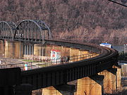
- North – HazelwoodHazelwood (Pittsburgh)Hazelwood is a neighborhood of Pittsburgh, Pennsylvania in the United States. It is represented on by Douglas Shields. It is bordered by Greenfield and Oakland on the north, Squirrel Hill and Glen Hazel on the east, and the Monongahela River on the south and west...
(a Pittsburgh neighborhood) via Glenwood BridgeGlenwood BridgeThe Glenwood Bridge is a cantilever bridge in Pittsburgh, Pennsylvania, which carries Pennsylvania Route 885 over the Monongahela River. It started construction on June 3, 1958 and was completed in 1966 to replace an old decayed unsafe iron bridge built in 1894 which carried Pittsburgh Railways...
across the Monongahela RiverMonongahela RiverThe Monongahela River is a river on the Allegheny Plateau in north-central West Virginia and southwestern Pennsylvania in the United States... - North east – HomesteadHomestead, PennsylvaniaHomestead is a borough in Allegheny County, Pennsylvania, USA, in the "Mon Valley," southeast of downtown Pittsburgh and directly across the river from the city limit line. The borough is known for the Homestead Strike of 1892, an important event in the history of labor relations in the United...
(an Allegheny county boroughBorough (Pennsylvania)In the U.S. Commonwealth of Pennsylvania, a borough is a self-governing municipal entity that is usually smaller than a city. There are 958 boroughs in Pennsylvania. All municipalities in Pennsylvania are classified as either cities, boroughs, or townships...
) - South east – MunhallMunhall, PennsylvaniaMunhall is a borough in Allegheny County, Pennsylvania, on the west bank of the Monongahela River, south of the confluence of the Monongahela and the Allegheny rivers where the Ohio River begins. It abuts the borough of Homestead. A large part of the Homestead Works of the Carnegie Steel Company...
(an Allegheny county boroughBorough (Pennsylvania)In the U.S. Commonwealth of Pennsylvania, a borough is a self-governing municipal entity that is usually smaller than a city. There are 958 boroughs in Pennsylvania. All municipalities in Pennsylvania are classified as either cities, boroughs, or townships...
) - South west – New Homestead (a Pittsburgh neighborhood)
- West – HaysHays (Pittsburgh)Hays is a neighborhood in the 31st Ward of southeastern Pittsburgh, Pennsylvania. It is represented on by the representative of . It occupies ZIP codes 15227, 15207, and 15236. It is named after James H...
(a Pittsburgh neighborhood)
Attractions
In 2000, Continental Realestate Companies opened The WaterfrontThe Waterfront
The Waterfront is a super-regional open air shopping mall spanning the three boroughs of Homestead, West Homestead and Munhall near Pittsburgh. The shopping mall sits on land once occupied by U.S. Steel's Homestead Steel Works plant, which closed in 1987. It has a gross leasable area of in "The...
. This large "LifeStyle" shopping center was built on the former site of the US Steel Works. Most of the structures associated with the steel mills on this site were demolished during construction. Still standing in the Waterfront development are some of the brick stacks from the Homestead Steel Works. In addition, near the river is a former mill structure known as the Pump House which was restored by the developer.
Sandcastle Waterpark
Sandcastle Waterpark
Sandcastle is a water park located in the Pittsburgh suburb of West Homestead. The park is located on a piece of land along the banks of the Monongahela River. Sandcastle is owned by Parques Reunidos, who purchased Kennywood Entertainment. The company runs its original sister parks, Kennywood,...
is a waterpark that has 14 water slides and 3 speed slides and the newest addition the Blue Tooba Looba.
Demographics
As of the censusCensus
A census is the procedure of systematically acquiring and recording information about the members of a given population. It is a regularly occurring and official count of a particular population. The term is used mostly in connection with national population and housing censuses; other common...
of 2000, there were 2,197 people, 956 households, and 623 families residing in the borough. The population density
Population density
Population density is a measurement of population per unit area or unit volume. It is frequently applied to living organisms, and particularly to humans...
was 2,408.9 people per square mile (932.2/km²). There were 1,106 housing units at an average density of 1,212.7 per square mile (469.3/km²). The racial makeup of the borough was 89.53% White, 8.83% African American, 0.18% Native American, 0.55% Asian, 0.05% from other races
Race (United States Census)
Race and ethnicity in the United States Census, as defined by the Federal Office of Management and Budget and the United States Census Bureau, are self-identification data items in which residents choose the race or races with which they most closely identify, and indicate whether or not they are...
, and 0.86% from two or more races. Hispanic or Latino of any race were 0.55% of the population.
There were 956 households out of which 22.9% had children under the age of 18 living with them, 47.3% were married couples
Marriage
Marriage is a social union or legal contract between people that creates kinship. It is an institution in which interpersonal relationships, usually intimate and sexual, are acknowledged in a variety of ways, depending on the culture or subculture in which it is found...
living together, 12.9% had a female householder with no husband present, and 34.8% were non-families. 30.4% of all households were made up of individuals and 13.2% had someone living alone who was 65 years of age or older. The average household size was 2.30 and the average family size was 2.87.
In the borough the population was spread out with 21.0% under the age of 18, 5.1% from 18 to 24, 25.4% from 25 to 44, 24.9% from 45 to 64, and 23.6% who were 65 years of age or older. The median age was 44 years. For every 100 females there were 88.6 males. For every 100 females age 18 and over, there were 89.2 males.
The median income for a household in the borough was $33,309, and the median income for a family was $44,338. Males had a median income of $35,033 versus $27,700 for females. The per capita income
Per capita income
Per capita income or income per person is a measure of mean income within an economic aggregate, such as a country or city. It is calculated by taking a measure of all sources of income in the aggregate and dividing it by the total population...
for the borough was $17,327. About 9.2% of families and 13.7% of the population were below the poverty line, including 20.6% of those under age 18 and 5.5% of those age 65 or over.