

West College Corner, Indiana
Encyclopedia
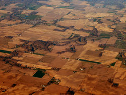
West College Corner, also known as just College Corner, is a town in Union Township, Union County
, Indiana
about five miles northwest of Oxford, Ohio
. The population was 634 at the 2000 census. The town is bordered on the east by the state line with Ohio
. Across it is the town of College Corner, Ohio
. The town's public school is bisected by the state line and is operated jointly with the Ohio authorities. It owes its name to the Ohio town, which was in the northwestern corner of the "College Township
", the survey township
designated by the Ohio General Assembly
as the site of the state college that became Miami University
. This survey township was later organized as a civil township
, Oxford Township
.
According to the United States Census Bureau
, the town has a total area of 0.3 square mile (0.776996433 km²), all of it land.
of 2000, there were 634 people, 242 households, and 164 families residing in the town. The population density
was 2,410.4 people per square mile (941.5/km²). There were 272 housing units at an average density of 1,034.1 per square mile (403.9/km²). The racial makeup of the town was 98.26% White, 0.63% Native American, 0.16% from other races
, and 0.95% from two or more races. Hispanic or Latino of any race were 0.16% of the population.
 There were 242 households out of which 37.2% had children under the age of 18 living with them, 52.1% were married couples
living together, 10.7% had a female householder with no husband present, and 32.2% were non-families. 28.1% of all households were made up of individuals and 11.6% had someone living alone who was 65 years of age or older. The average household size was 2.62 and the average family size was 3.25.
In the town the population was spread out with 31.7% under the age of 18, 7.1% from 18 to 24, 32.3% from 25 to 44, 19.6% from 45 to 64, and 9.3% who were 65 years of age or older. The median age was 32 years. For every 100 females there were 98.7 males. For every 100 females age 18 and over, there were 94.2 males.
The median income for a household in the town was $34,625, and the median income for a family was $37,083. Males had a median income of $28,472 versus $21,250 for females. The per capita income
for the town was $13,528. About 14.0% of families and 16.1% of the population were below the poverty line, including 22.5% of those under age 18 and 14.6% of those age 65 or over.
Union County, Indiana
As of the census of 2000, there were 7,349 people, 2,793 households, and 2,072 families residing in the county. The population density was 46 people per square mile . There were 3,077 housing units at an average density of 19 per square mile...
, Indiana
Indiana
Indiana is a US state, admitted to the United States as the 19th on December 11, 1816. It is located in the Midwestern United States and Great Lakes Region. With 6,483,802 residents, the state is ranked 15th in population and 16th in population density. Indiana is ranked 38th in land area and is...
about five miles northwest of Oxford, Ohio
Oxford, Ohio
Oxford is a city in northwestern Butler County, Ohio, United States, in the southwestern portion of the state. It lies in Oxford Township, originally called the College Township. The population was 21,943 at the 2000 census. This college town was founded as a home for Miami University. Oxford...
. The population was 634 at the 2000 census. The town is bordered on the east by the state line with Ohio
Ohio
Ohio is a Midwestern state in the United States. The 34th largest state by area in the U.S.,it is the 7th‑most populous with over 11.5 million residents, containing several major American cities and seven metropolitan areas with populations of 500,000 or more.The state's capital is Columbus...
. Across it is the town of College Corner, Ohio
College Corner, Ohio
College Corner is a village in the southwestern part of the U.S. state of Ohio in Butler and Preble Counties, five miles northwest of Oxford. It was settled in 1811 and takes its name from its position in the northwestern corner of the "College Township", the survey township designated the previous...
. The town's public school is bisected by the state line and is operated jointly with the Ohio authorities. It owes its name to the Ohio town, which was in the northwestern corner of the "College Township
College Township
The "College Township" was the full survey township located in the northwest corner of Butler County, Ohio, now corresponding to the civil township of Oxford, designated by the Ohio General Assembly to be the site of the state university now called Miami University...
", the survey township
Survey township
Survey township, sometimes called Congressional township, as used by the United States Public Land Survey System, refers to a square unit of land, that is nominally six miles on a side...
designated by the Ohio General Assembly
Ohio General Assembly
The Ohio General Assembly is the state legislature of the U.S. state of Ohio. It consists of the 99-member Ohio House of Representatives and the 33-member Ohio Senate...
as the site of the state college that became Miami University
Miami University
Miami University is a coeducational public research university located in Oxford, Ohio, United States. Founded in 1809, it is the 10th oldest public university in the United States and the second oldest university in Ohio, founded four years after Ohio University. In its 2012 edition, U.S...
. This survey township was later organized as a civil township
Civil township
A civil township is a widely used unit of local government in the United States, subordinate to, and geographic divisions of, a county. Specific responsibilities and the degree of autonomy vary based on each state. Civil townships are distinct from survey townships, but in states that have both,...
, Oxford Township
Oxford Township, Butler County, Ohio
Oxford Township, also known as the College Township, is one of thirteen townships in the county and is located in the northwestern corner of Butler County, Ohio, United States, where it meets Preble County, Ohio, and Union County, Indiana. The city of Oxford and Miami University are located here. ...
.
Geography
West College Corner is located at 39°34′10"N 84°49′3"W (39.569451, -84.817497).According to the United States Census Bureau
United States Census Bureau
The United States Census Bureau is the government agency that is responsible for the United States Census. It also gathers other national demographic and economic data...
, the town has a total area of 0.3 square mile (0.776996433 km²), all of it land.
Demographics
As of the censusCensus
A census is the procedure of systematically acquiring and recording information about the members of a given population. It is a regularly occurring and official count of a particular population. The term is used mostly in connection with national population and housing censuses; other common...
of 2000, there were 634 people, 242 households, and 164 families residing in the town. The population density
Population density
Population density is a measurement of population per unit area or unit volume. It is frequently applied to living organisms, and particularly to humans...
was 2,410.4 people per square mile (941.5/km²). There were 272 housing units at an average density of 1,034.1 per square mile (403.9/km²). The racial makeup of the town was 98.26% White, 0.63% Native American, 0.16% from other races
Race (United States Census)
Race and ethnicity in the United States Census, as defined by the Federal Office of Management and Budget and the United States Census Bureau, are self-identification data items in which residents choose the race or races with which they most closely identify, and indicate whether or not they are...
, and 0.95% from two or more races. Hispanic or Latino of any race were 0.16% of the population.
Marriage
Marriage is a social union or legal contract between people that creates kinship. It is an institution in which interpersonal relationships, usually intimate and sexual, are acknowledged in a variety of ways, depending on the culture or subculture in which it is found...
living together, 10.7% had a female householder with no husband present, and 32.2% were non-families. 28.1% of all households were made up of individuals and 11.6% had someone living alone who was 65 years of age or older. The average household size was 2.62 and the average family size was 3.25.
In the town the population was spread out with 31.7% under the age of 18, 7.1% from 18 to 24, 32.3% from 25 to 44, 19.6% from 45 to 64, and 9.3% who were 65 years of age or older. The median age was 32 years. For every 100 females there were 98.7 males. For every 100 females age 18 and over, there were 94.2 males.
The median income for a household in the town was $34,625, and the median income for a family was $37,083. Males had a median income of $28,472 versus $21,250 for females. The per capita income
Per capita income
Per capita income or income per person is a measure of mean income within an economic aggregate, such as a country or city. It is calculated by taking a measure of all sources of income in the aggregate and dividing it by the total population...
for the town was $13,528. About 14.0% of families and 16.1% of the population were below the poverty line, including 22.5% of those under age 18 and 14.6% of those age 65 or over.