

Waves, North Carolina
Encyclopedia
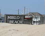
Waves is an unincorporated community in Dare County, North Carolina
, USA. It is on Hatteras Island
, part of North Carolina's Outer Banks
. Waves, along with Rodanthe
and Salvo
, are part of the settlement of Chicamacomico.
The residents of Waves are governed by the Dare County Board of Commissioners
. Waves is part of District 4, along with Avon
, Buxton
, Frisco
, Hatteras
, Rodanthe
and Salvo
.
and Salvo
— a part of the larger settlement of Chicamacomico. Waves was known as "South Rodanthe" until 1939. In this approximate location a low sandy promontory known as Cape Kenrick is shown on colonial era maps associated with Wimble Shoals just offshore.
has also recently opened a full service branch in Waves. The Bank of the Commonwealth is based in Norfolk, Virginia and was established in 1971.
Dare County, North Carolina
-National protected areas:* Alligator River National Wildlife Refuge * Cape Hatteras National Seashore * Fort Raleigh National Historic Site* Pea Island National Wildlife Refuge* Wright Brothers National Memorial-Demographics:...
, USA. It is on Hatteras Island
Hatteras Island
Hatteras Island is a barrier island located off the North Carolina coast. Dividing the Atlantic Ocean and the Pamlico Sound, it runs parallel to the coast, forming a bend at Cape Hatteras. It is part of North Carolina's Outer Banks and includes the towns of Rodanthe, Waves, Salvo, Avon, Buxton,...
, part of North Carolina's Outer Banks
Outer Banks
The Outer Banks is a 200-mile long string of narrow barrier islands off the coast of North Carolina, beginning in the southeastern corner of Virginia Beach on the east coast of the United States....
. Waves, along with Rodanthe
Rodanthe, North Carolina
Rodanthe is an unincorporated community located in Dare County, North Carolina, on Hatteras Island, part of North Carolina's Outer Banks. Rodanthe, along with Waves and Salvo, are part of the settlement of Chicamacomico...
and Salvo
Salvo, North Carolina
Salvo is an unincorporated community located in Dare County, North Carolina, on Hatteras Island, part of North Carolina's Outer Banks. Originally part of the settlement of Chicamacomico, Salvo was originally known as Clarks or Clarksville.The name "Salvo" allegedly stems from the American Civil...
, are part of the settlement of Chicamacomico.
The residents of Waves are governed by the Dare County Board of Commissioners
Dare County Board of Commissioners
The Dare County Board of Commissioners is the governing body of Dare County, North Carolina. It runs in the manner of a county commission. It has seven seats held by elected officials called County Commissioners. The Commissioners are elected at large in countywide elections and serve four-year...
. Waves is part of District 4, along with Avon
Avon, North Carolina
Avon is a a census-designated place in Dare County in the State of North Carolina in the United States of America. It is located at latitude 35°21'7" North, longitude 75°30'39" West. The village is south of Salvo and north of Buxton on Hatteras Island...
, Buxton
Buxton, North Carolina
Buxton is an unincorporated community of nearly 1,500 people on Hatteras Island near Cape Hatteras. It is located in Dare County in the U.S. state of North Carolina. North Carolina Highway 12 links the community to other Outer Banks communities such as Avon, Frisco, and Hatteras...
, Frisco
Frisco, North Carolina
Frisco is a small unincorporated community on the barrier island of Hatteras Island, between the villages of Buxton and Hatteras. It is located in Dare County, North Carolina, USA, and was previously named Trent, or Trent Woods, but received a new name with the coming of the post office in 1898...
, Hatteras
Hatteras, North Carolina
Hatteras is an unincorporated community in Dare County, North Carolina, United States, on the Outer Banks island of Hatteras. North Carolina Highway 12 passes through the community linking it to Frisco and Ocracoke . It is south of the famous Cape Hatteras and the Cape Hatteras Lighthouse in Buxton...
, Rodanthe
Rodanthe, North Carolina
Rodanthe is an unincorporated community located in Dare County, North Carolina, on Hatteras Island, part of North Carolina's Outer Banks. Rodanthe, along with Waves and Salvo, are part of the settlement of Chicamacomico...
and Salvo
Salvo, North Carolina
Salvo is an unincorporated community located in Dare County, North Carolina, on Hatteras Island, part of North Carolina's Outer Banks. Originally part of the settlement of Chicamacomico, Salvo was originally known as Clarks or Clarksville.The name "Salvo" allegedly stems from the American Civil...
.
History
Waves originally formed — along with neighboring RodantheRodanthe, North Carolina
Rodanthe is an unincorporated community located in Dare County, North Carolina, on Hatteras Island, part of North Carolina's Outer Banks. Rodanthe, along with Waves and Salvo, are part of the settlement of Chicamacomico...
and Salvo
Salvo, North Carolina
Salvo is an unincorporated community located in Dare County, North Carolina, on Hatteras Island, part of North Carolina's Outer Banks. Originally part of the settlement of Chicamacomico, Salvo was originally known as Clarks or Clarksville.The name "Salvo" allegedly stems from the American Civil...
— a part of the larger settlement of Chicamacomico. Waves was known as "South Rodanthe" until 1939. In this approximate location a low sandy promontory known as Cape Kenrick is shown on colonial era maps associated with Wimble Shoals just offshore.
Boundaries
The northern border of Waves is generally considered to be the ditch that runs under Highway 12 just south of Resort Rodanthe Drive. The southern border, separating Waves and Salvo, is more ambiguous. Long-time residents indicate various "official lines" separating the two. Formerly Rodanthe, Waves and Salvo were each served by their own post office. Today a single post office, located in Salvo, serves the entire community and the former lines that separated the communities have become blurred.Economy
The Waves area of Chicamacomico is dominated by campgrounds both large and small as well as numerous rental houses. The Bank of the CommonwealthBank of the Commonwealth
The name Bank of the Commonwealth represents any of the following:* Bank of the Commonwealth, a former financial institution in Detroit, Michigan, acquired by Comerica in 1983...
has also recently opened a full service branch in Waves. The Bank of the Commonwealth is based in Norfolk, Virginia and was established in 1971.