

Washington State Route 433
Encyclopedia
State Route 433 is a 0.94 miles (1.5 km) long state highway
located entirely in Cowlitz County
, Washington, United States. The highway begins midway across the Columbia River
on the National Register of Historic Places
listed Lewis and Clark Bridge and travels north to SR 432
in Longview
. Prior to the 1964 state highway renumbering
the highway was part of Primary State Highway 12. Between 1964 and 1972, the highway's designation was changed from State Route 833 to the current SR 433.
, intersecting Port Way again, and gaining one lane in each direction for a total of four lanes before the highway terminates at an intersection with SR 432 and Industrial Way. The highway has a posted speed limit of 35 miles per hour (15.6 m/s) for its entire length. Oregon Way continues after the end of SR 433 into downtown Longview and SR 4.
Every year the Washington State Department of Transportation
(WSDOT) conducts a series of surveys on its highways in the state to measure traffic volume. This is expressed in terms of average annual daily traffic (AADT), which is a measure of traffic volume for any average day of the year. In 2009, WSDOT calculated 20,000 vehicles use the highway, with 12 percent of that traffic being trucks. The entire highway is listed on both the WSDOT List of Highways of Statewide Significance, which marks this portion of the highway as critical to connecting major communities in the state, and the National Highway System
, a system of roads that are important to the nation's economy, defense and mobility.
SR 433 and the Lewis and Clark Bridge form part of the Seattle to Portland Bicycle Classic
, serving as the link between Washington and Oregon on the 202 mi (325.1 km) long bicycle race held annually.
the highway was part of Primary State Highway 12. Sometime between the renumbering and 1972 the highway was renumbered from SR 833, a branch of U.S. Route 830
(US 830), to the current SR 433, a branch of SR 4, which replaced US 830 through the area. Until 1992 the highway continued north to Tennant Way, however highway was truncated to Industrial Way.
.
{| class=wikitable
!Location
!Mile
!Destinations
!Notes
|-
|Columbia River
|0.00–0.54
|colspan=2|Lewis and Clark Bridge
|-
|Longview
|0.94
|
|To I-5
via SR 432
State highway
State highway, state road or state route can refer to one of three related concepts, two of them related to a state or provincial government in a country that is divided into states or provinces :#A...
located entirely in Cowlitz County
Cowlitz County, Washington
Cowlitz County is a county located in the U.S. state of Washington. As of the 2010 census its population was 102,410. It forms the Longview, Washington, Metropolitan Statistical Area which encompasses all of Cowlitz County. The county seat is at Kelso, and its largest city is Longview...
, Washington, United States. The highway begins midway across the Columbia River
Columbia River
The Columbia River is the largest river in the Pacific Northwest region of North America. The river rises in the Rocky Mountains of British Columbia, Canada, flows northwest and then south into the U.S. state of Washington, then turns west to form most of the border between Washington and the state...
on the National Register of Historic Places
National Register of Historic Places
The National Register of Historic Places is the United States government's official list of districts, sites, buildings, structures, and objects deemed worthy of preservation...
listed Lewis and Clark Bridge and travels north to SR 432
Washington State Route 432
State Route 432 is a spur route of SR 4 beginning west of the cities of Kelso and Longview, Washington. Beginning at SR 4, SR 432 travels east on Mt Solo Road. As it enters the industrial area of Longview, the road changes to Industrial Way. After the junction of SR 433 and Lewis and Clark Bridge...
in Longview
Longview, Washington
Longview is a city in Cowlitz County, Washington, United States. It is the principal city of the "Longview, Washington Metropolitan Statistical Area", which encompasses all of Cowlitz County. Longview's population was 36,648 at the time of the 2010 census and is the largest city in Cowlitz County...
. Prior to the 1964 state highway renumbering
1964 state highway renumbering (Washington)
In 1963, a law was passed authorizing a new numbering for sign routes. In 1970 the legislative definitions were changed to use the sign route numbers but renamed state routes...
the highway was part of Primary State Highway 12. Between 1964 and 1972, the highway's designation was changed from State Route 833 to the current SR 433.
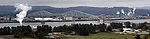
Route description
SR 433 enters Washington and Cowlitz county on the National Register of Historic Places listed Lewis and Clark Bridge over the Columbia River. The highway travels northwest along the bridge for 0.54 mi (0.8690436 km) before dropping into the city and Port of Longview, intersecting the access road to the Port, Port Way. The highway continues north, paralleling railroad tracks belonging to the Columbia and Cowlitz RailwayColumbia and Cowlitz Railway
The Columbia and Cowlitz Railway , is a wholly owned subsidiary of Weyerhaeuser Company, and is headquartered in Longview, Washington; the railroad serves an route from the Weyerhaeuser Company mill in Longview to the junction just outside the city limits of Kelso...
, intersecting Port Way again, and gaining one lane in each direction for a total of four lanes before the highway terminates at an intersection with SR 432 and Industrial Way. The highway has a posted speed limit of 35 miles per hour (15.6 m/s) for its entire length. Oregon Way continues after the end of SR 433 into downtown Longview and SR 4.
Every year the Washington State Department of Transportation
Washington State Department of Transportation
The Washington State Department of Transportation , was established in 1905. The agency, led by a Secretary and overseen by the Governor, is a Washington governmental agency that constructs, maintains, and regulates the use of the state's transportation infrastructure...
(WSDOT) conducts a series of surveys on its highways in the state to measure traffic volume. This is expressed in terms of average annual daily traffic (AADT), which is a measure of traffic volume for any average day of the year. In 2009, WSDOT calculated 20,000 vehicles use the highway, with 12 percent of that traffic being trucks. The entire highway is listed on both the WSDOT List of Highways of Statewide Significance, which marks this portion of the highway as critical to connecting major communities in the state, and the National Highway System
National Highway System (United States)
The National Highway System is a network of strategic highways within the United States, including the Interstate Highway System and other roads serving major airports, ports, rail or truck terminals, railway stations, pipeline terminals and other strategic transport facilities.Individual states...
, a system of roads that are important to the nation's economy, defense and mobility.
SR 433 and the Lewis and Clark Bridge form part of the Seattle to Portland Bicycle Classic
Seattle to Portland Bicycle Classic
The Seattle to Portland Bicycle Classic, or STP, is an annual one- and two-day supported bicycle ride from Seattle, Washington to Portland, Oregon in the United States. The STP "is considered one of the 10 biggest recreational bicycle rides in the country, drawing riders from across the nation and...
, serving as the link between Washington and Oregon on the 202 mi (325.1 km) long bicycle race held annually.
History
Before the 1964 state highway renumbering1964 state highway renumbering (Washington)
In 1963, a law was passed authorizing a new numbering for sign routes. In 1970 the legislative definitions were changed to use the sign route numbers but renamed state routes...
the highway was part of Primary State Highway 12. Sometime between the renumbering and 1972 the highway was renumbered from SR 833, a branch of U.S. Route 830
U.S. Route 830
U.S. Route 830, , was a U.S. Highway which ran between a junction with U.S. Route 97 near the city of Maryhill, Washington and a junction with U.S. Route 101 near Ilwaco, Washington...
(US 830), to the current SR 433, a branch of SR 4, which replaced US 830 through the area. Until 1992 the highway continued north to Tennant Way, however highway was truncated to Industrial Way.
Major intersections
The entire route is located in Cowlitz CountyCowlitz County, Washington
Cowlitz County is a county located in the U.S. state of Washington. As of the 2010 census its population was 102,410. It forms the Longview, Washington, Metropolitan Statistical Area which encompasses all of Cowlitz County. The county seat is at Kelso, and its largest city is Longview...
.
{| class=wikitable
!Location
!Mile
!Destinations
!Notes
|-
|Columbia River
Columbia River
The Columbia River is the largest river in the Pacific Northwest region of North America. The river rises in the Rocky Mountains of British Columbia, Canada, flows northwest and then south into the U.S. state of Washington, then turns west to form most of the border between Washington and the state...
|0.00–0.54
|colspan=2|
|-
|Longview
|0.94
|
|To I-5
Interstate 5 in Washington
Interstate 5 in Washington is a highway in the U.S. state of Washington that extends from its border with Oregon to its border with Canada...
via SR 432