
Warren, Indiana
Encyclopedia
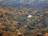
Warren is a town in Salamonie Township
, Huntington County
, Indiana
, United States
. The population of Warren at the 2010 census was 1,239.
. The town lies just southeast of Interstate 69
between exits 73 and 78.
According to the United States Census Bureau
, the town has a total area of 0.9 square miles (2.3 km²), all of it land.
of 2000, there were 1,272 people, 507 households, and 354 families residing in the town. The population density
was 1,395.1 people per square mile (539.7/km²). There were 558 housing units at an average density of 612.0 per square mile (236.8/km²). The racial makeup of the town was 98.82% White, 0.31% African American, 0.16% Native American, 0.08% Asian, 0.39% from other races
, and 0.24% from two or more races. Hispanic or Latino of any race were 0.79% of the population.
There were 507 households out of which 36.3% had children under the age of 18 living with them, 58.6% were married couples
living together, 7.9% had a female householder with no husband present, and 30.0% were non-families. 25.8% of all households were made up of individuals and 11.4% had someone living alone who was 65 years of age or older. The average household size was 2.51 and the average family size was 3.03.
In the town the population was spread out with 28.4% under the age of 18, 6.4% from 18 to 24, 28.6% from 25 to 44, 21.7% from 45 to 64, and 14.9% who were 65 years of age or older. The median age was 37 years. For every 100 females there were 92.4 males. For every 100 females age 18 and over, there were 90.2 males.
The median income for a household in the town was $38,550, and the median income for a family was $41,917. Males had a median income of $33,229 versus $21,821 for females. The per capita income
for the town was $17,145. About 2.0% of families and 3.1% of the population were below the poverty line, including 2.3% of those under age 18 and 8.1% of those age 65 or over.
, in 1966. Warren Elementary School operated in the old high school building for many years, its basketball team having adopted the old high school's nickname; "Lightning 5." However, the school was eventually closed and the nickname retired. The building served as the Knight Civic Center until the name was changed to it's current name the "Knight Bergman Center".
nearby.
Salamonie Township, Huntington County, Indiana
Salamonie Township is one of twelve townships in Huntington County, Indiana, USA. As of the 2000 census, its population was 2,529.-Geography:Salamonie Township covers an area of ; of this, or 0.12 percent is water...
, Huntington County
Huntington County, Indiana
Huntington County is a county located in the U.S. state of Indiana. The county seat and lone city is Huntington. According to Census 2010, the population was 37,124.-Geography:...
, Indiana
Indiana
Indiana is a US state, admitted to the United States as the 19th on December 11, 1816. It is located in the Midwestern United States and Great Lakes Region. With 6,483,802 residents, the state is ranked 15th in population and 16th in population density. Indiana is ranked 38th in land area and is...
, United States
United States
The United States of America is a federal constitutional republic comprising fifty states and a federal district...
. The population of Warren at the 2010 census was 1,239.
Geography
Warren is located at 40°41′6"N 85°25′24"W (40.685112, -85.423446), along the Salamonie RiverSalamonie River
The Salamonie River is a tributary of the Wabash River, long, in eastern Indiana in the United States. Via the Wabash and Ohio rivers, it is part of the watershed of the Mississippi River...
. The town lies just southeast of Interstate 69
Interstate 69
Interstate 69 is an Interstate Highway in the United States. It exists in two parts: a completed highway from Indianapolis, Indiana, northeast to the Canadian border in Port Huron, Michigan, and a mostly proposed extension southwest to the Mexican border in Texas...
between exits 73 and 78.
According to the United States Census Bureau
United States Census Bureau
The United States Census Bureau is the government agency that is responsible for the United States Census. It also gathers other national demographic and economic data...
, the town has a total area of 0.9 square miles (2.3 km²), all of it land.
Demographics
As of the censusCensus
A census is the procedure of systematically acquiring and recording information about the members of a given population. It is a regularly occurring and official count of a particular population. The term is used mostly in connection with national population and housing censuses; other common...
of 2000, there were 1,272 people, 507 households, and 354 families residing in the town. The population density
Population density
Population density is a measurement of population per unit area or unit volume. It is frequently applied to living organisms, and particularly to humans...
was 1,395.1 people per square mile (539.7/km²). There were 558 housing units at an average density of 612.0 per square mile (236.8/km²). The racial makeup of the town was 98.82% White, 0.31% African American, 0.16% Native American, 0.08% Asian, 0.39% from other races
Race (United States Census)
Race and ethnicity in the United States Census, as defined by the Federal Office of Management and Budget and the United States Census Bureau, are self-identification data items in which residents choose the race or races with which they most closely identify, and indicate whether or not they are...
, and 0.24% from two or more races. Hispanic or Latino of any race were 0.79% of the population.
There were 507 households out of which 36.3% had children under the age of 18 living with them, 58.6% were married couples
Marriage
Marriage is a social union or legal contract between people that creates kinship. It is an institution in which interpersonal relationships, usually intimate and sexual, are acknowledged in a variety of ways, depending on the culture or subculture in which it is found...
living together, 7.9% had a female householder with no husband present, and 30.0% were non-families. 25.8% of all households were made up of individuals and 11.4% had someone living alone who was 65 years of age or older. The average household size was 2.51 and the average family size was 3.03.
In the town the population was spread out with 28.4% under the age of 18, 6.4% from 18 to 24, 28.6% from 25 to 44, 21.7% from 45 to 64, and 14.9% who were 65 years of age or older. The median age was 37 years. For every 100 females there were 92.4 males. For every 100 females age 18 and over, there were 90.2 males.
The median income for a household in the town was $38,550, and the median income for a family was $41,917. Males had a median income of $33,229 versus $21,821 for females. The per capita income
Per capita income
Per capita income or income per person is a measure of mean income within an economic aggregate, such as a country or city. It is calculated by taking a measure of all sources of income in the aggregate and dividing it by the total population...
for the town was $17,145. About 2.0% of families and 3.1% of the population were below the poverty line, including 2.3% of those under age 18 and 8.1% of those age 65 or over.
Education
The Huntington County Community School Corporation operates Salamonie School, a K-5 school which is the only remaining school in Warren. The former Salamonie Township High School was consolidated into Huntington County Community High School, now known as Huntington North High SchoolHuntington North High School
Huntington North High School is a large public secondary school serving all of Huntington County, Indiana. Enrollment is approximately 2,000 students. The school is operated by the Huntington County Community School Corporation and is located at 450 MacGahan Street in Huntington, Indiana...
, in 1966. Warren Elementary School operated in the old high school building for many years, its basketball team having adopted the old high school's nickname; "Lightning 5." However, the school was eventually closed and the nickname retired. The building served as the Knight Civic Center until the name was changed to it's current name the "Knight Bergman Center".
History
Warren, originally known as "Jonesboro," had its beginning in 1837 when Samuel Jones offered lots for sale in the area. The name was changed due to there being another town of JonesboroJonesboro, Indiana
Jonesboro is a city in Grant County, Indiana, United States, located along the Mississinewa River opposite Gas City. The population was 1,887 at the 2000 census.-Geography:Jonesboro is located at ....
nearby.
Transportation
Important highways in Warren:-
 State Road 5Indiana State Road 5State Road 5 is a north–south road that runs through northeast Indiana. Its southern terminus is at SR 22 in Upland, and the northern terminus is at SR 120 just north of Shipshewana. The largest city along its path is Huntington...
 -
 State Road 218Indiana State Road 218Indiana State Road 218 exists in two different sections in the central part of the U.S. state of Indiana, on either side of Mississinewa Lake. The road covers a total distance of about 91 miles; the ends of the two sections are separated by about 14 miles...
Points of interest
- Heritage Pointe
- Pulse Opera House
- Knight Civic Center
- USS Salamonie Museum
- Salamonie Valley Museum