
.gif)
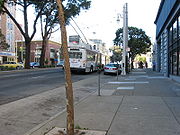
Van Ness Avenue (San Francisco)
Encyclopedia
California
California is a state located on the West Coast of the United States. It is by far the most populous U.S. state, and the third-largest by land area...
, running from Market St north to the Bay. Originally named Marlette Street, the street was renamed Van Ness Avenue in honor of the city's seventh mayor
Mayor of San Francisco
The Mayor of the City and County of San Francisco is the head of the executive branch of San Francisco's city and county government. The mayor has the duty to enforce city laws, and the power to either approve or veto bills passed by the San Francisco Board of Supervisors, the legislative branch....
, James Van Ness
James Van Ness
James Van Ness was the seventh mayor of San Francisco, USA from 1855 to 1856.He was the son of Dutch-American Vermont Governor Cornelius Van Ness and father-in-law of future San Francisco mayor Frank McCoppin. Prior to being mayor, he had been a lawyer in the U.S. South and then a San Francisco...
. Van Ness Avenue begins at Market Street
Market Street (San Francisco)
Market Street is an important thoroughfare in San Francisco, California. It begins at The Embarcadero in front of the Ferry Building at the northeastern edge of the city and runs southwest through downtown, passing the Civic Center and the Castro District, to the intersection with Corbett Avenue in...
near the Civic Center, and extends north to end at McDowell Avenue at Fort Mason
Fort Mason
Fort Mason, once known as San Francisco Port of Embarkation, US Army, in San Francisco, California, is a former United States Army post located in the northern Marina District, alongside San Francisco Bay. Fort Mason served as an Army post for more than 100 years, initially as a coastal defense...
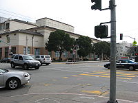
. Of the more striking landmarks along the route are the San Francisco City Hall
San Francisco City Hall
San Francisco City Hall, re-opened in 1915, in its open space area in the city's Civic Center, is a Beaux-Arts monument to the City Beautiful movement that epitomized the high-minded American Renaissance of the 1880s to 1917. The structure's dome is the fifth largest in the world...
, the War Memorial Opera House
War Memorial Opera House (San Francisco)
The War Memorial Opera House in San Francisco, California is located on the western side of Van Ness Avenue across from the rear facade of City Hall. It is part of the San Francisco War Memorial and Performing Arts Center...
, and Louise M. Davies Symphony Hall
Louise M. Davies Symphony Hall
Louise M. Davies Symphony Hall, the concert hall component of the San Francisco War Memorial and Performing Arts Center, was built in 1980 at a cost of US$28 million to give the San Francisco Symphony a permanent home. The hall has a seating capacity of 2743 persons...
.
South Van Ness Avenue is the newer extension of Van Ness south of Market Street, continuing through the city's South of Market and Mission districts to end at Cesar Chavez Street.
The route is designated US 101 from the Central Freeway
Central Freeway
The Central Freeway is a roughly one-mile elevated freeway in San Francisco, California, United States, connecting the Bayshore/James Lick Freeway with the Hayes Valley neighborhood. Most of the freeway is part of US 101, which exits at Mission Street on the way to the Golden Gate Bridge...
at the convergence of South Van Ness, Howard Street, and 13th Street, north to Lombard Street
Lombard Street (San Francisco)
Lombard Street is an east–west street in San Francisco, California. It is famous for having a steep, one-block section that consists of eight tight hairpin turns.-Route description:...
.
History
Originally a quiet residential neighborhood of mansions, the street was used as a firebreakFirebreak
A firebreak is a gap in vegetation or other combustible material that acts as a barrier to slow or stop the progress of a bushfire or wildfire. A firebreak may occur naturally where there is a lack of vegetation or "fuel", such as a river, lake or canyon...
by the U.S. Army during the 1906 earthquake and fire
1906 San Francisco earthquake
The San Francisco earthquake of 1906 was a major earthquake that struck San Francisco, California, and the coast of Northern California at 5:12 a.m. on Wednesday, April 18, 1906. The most widely accepted estimate for the magnitude of the earthquake is a moment magnitude of 7.9; however, other...
that destroyed most of San Francisco. Many of the buildings were dynamited along the street by soldiers in an ultimately successful attempt to keep the firestorm from spreading west to the entire city. Following the quake, Van Ness served as the temporary commercial center and main thoroughfare of San Francisco, as it ultimately evolved into a busy commercial district in its own right, attracting many car dealerships that exist to this day as the majority of the city's car and scooter dealerships line the street. It still remains a generally upscale area with large and grand apartment buildings, restaurants, and movie theaters.
Major intersections
The entire route is within the borders of the City and County of San Francisco.| Destinations | Notes |
|---|---|
| Cesar Chavez (Army Street) | |
| South end of US 101 overlap; interchange | |
| North end of US 101 overlap | |
| McDowell Avenue |