

Union Turnpike (New York)
Encyclopedia
Queens
Queens is the easternmost of the five boroughs of New York City. The largest borough in area and the second-largest in population, it is coextensive with Queens County, an administrative division of New York state, in the United States....
in New York City
New York City
New York is the most populous city in the United States and the center of the New York Metropolitan Area, one of the most populous metropolitan areas in the world. New York exerts a significant impact upon global commerce, finance, media, art, fashion, research, technology, education, and...
. It runs from Myrtle Avenue
Myrtle Avenue (New York City)
Myrtle Avenue in New York City is a street that runs from Flatbush Avenue Extension in Downtown Brooklyn to Jamaica Avenue in Richmond Hill, Queens.-In Queens:...
in Glendale
Glendale, Queens
Glendale is a neighborhood in the west-central portion of the borough of Queens in New York City. It is bounded by Cooper Avenue to the north, Woodhaven Boulevard to the east, Myrtle Avenue to the south and Fresh Pond Road to the West...
to Marcus Avenue in North New Hyde Park
North New Hyde Park, New York
North New Hyde Park is a census-designated place in Nassau County, New York, United States. The population was 14,899 at the 2010 census.-Geography:North New Hyde Park is located at ....
, about a mile into Nassau County, New York
Nassau County, New York
Nassau County is a suburban county on Long Island, east of New York City in the U.S. state of New York, within the New York Metropolitan Area. As of the 2010 census, the population was 1,339,532...
. Initially designed as a toll road, it takes a straight-arrow path from Kew Gardens Hills
Kew Gardens Hills, Queens
Kew Gardens Hills, also sometimes incorrectly referred to as Kew Garden Hills, is a one-square mile sub-neighborhood of Flushing in the New York City borough of Queens. The western border is Flushing Meadows-Corona Park, on the north is Jewel Avenue, on the south is Union Turnpike and to the east...
towards Glen Oaks
Glen Oaks, Queens
Glen Oaks is a neighborhood in the easternmost portion of the New York City Borough of Queens. The neighborhood is part of Queens Community Board 13.-Location:...
and Floral Park
Floral Park, Queens
Floral Park is a neighborhood in the New York City borough of Queens. It is adjacent to the Village of Floral Park, which is in Nassau County. It may be distinguished from the latter by the use of the designation "North Floral Park". The neighborhood is part of Queens Community Board 13.Union...
on the Queens-Nassau border. At the time, Union Turnpike traveled through relatively undeveloped areas, serving as a border between the towns of Flushing
Flushing, Queens
Flushing, founded in 1645, is a neighborhood in the north central part of the City of New York borough of Queens, east of Manhattan.Flushing was one of the first Dutch settlements on Long Island. Today, it is one of the largest and most diverse neighborhoods in New York City...
and Jamaica
Jamaica, Queens
Jamaica is a neighborhood in the borough of Queens in New York City, New York, United States. It was settled under Dutch rule in 1656 in New Netherland as Rustdorp. Under British rule, the Village of Jamaica became the center of the "Town of Jamaica"...
. Though both towns were absorbed into New York City in 1898, the division is evident today in the addresses. Buildings on the north side generally begin with a 113- ZIP code
ZIP Code
ZIP codes are a system of postal codes used by the United States Postal Service since 1963. The term ZIP, an acronym for Zone Improvement Plan, is properly written in capital letters and was chosen to suggest that the mail travels more efficiently, and therefore more quickly, when senders use the...
, indicating Flushing, and buildings to the south begin with a 114-. An exception is a section of zip code 11426 (Bellerose
Bellerose, Queens
Bellerose, also called Bellerose Manor, is a neighborhood on the eastern edge of the New York City borough of Queens, near the border with Nassau County. It is sometimes referred to as Bellerose Manor, to distinguish it from the adjacent Bellerose Village and Bellerose Terrace in Nassau County,...
) that extends north across the Turnpike west of Little Neck Parkway and in Glendale where Forest Park, a few blocks to the south, marks the border between the old towns.
Union Turnpike from New Hyde Park to Woodhaven memorializes the Union Racetrack that was once a famous attraction for residents in Queens.
Prior to the construction of Grand Central Parkway
Grand Central Parkway
The Grand Central Parkway is a parkway that stretches from the RFK-Triborough Bridge in New York City to Nassau County on Long Island. At the Queens-Nassau border, it becomes the Northern State Parkway, which runs across the northern part of Long Island through Nassau County and into Suffolk...
in the 1930s, Union Turnpike was heavily used, and developed businesses throughout its length. Among the landmarks found along the turnpike are Forest Park
Forest Park (Queens)
Forest Park is a park in the New York City borough of Queens. It has an area of 538 acres . The park is operated and maintained by the New York City Department of Parks and Recreation.-History:...
, Queens Borough Hall
Queens Borough Hall
Queens Borough Hall is a public building in the Kew Gardens neighborhood of the Queens borough of New York City which houses the Office of the Queens Borough President and other city offices and court space. It is located in the Kew Gardens municipal stretch bounded by Queens Boulevard and Union...
, St. John's University
St. John's University (New York City)
St. John's University is a private, Roman Catholic, coeducational university located in New York City, United States. Founded by the Congregation of the Mission in 1870, the school was originally located in the borough of Brooklyn in the neighborhood of Bedford–Stuyvesant...
, and Creedmoor Psychiatric Center
Creedmoor Psychiatric Center
Creedmoor Psychiatric Center is a psychiatric hospital in Queens Village, Queens, New York, United States that provides inpatient, outpatient and residential services for severely mentally ill patients...
. The turnpike crosses into Nassau County at the city's easternmost point on Langdale Street, two blocks past the city's highest-numbered street (271st Street). North of the turnpike at this point is Glen Oaks
Glen Oaks, Queens
Glen Oaks is a neighborhood in the easternmost portion of the New York City Borough of Queens. The neighborhood is part of Queens Community Board 13.-Location:...
and south of it is Floral Park
Floral Park, Queens
Floral Park is a neighborhood in the New York City borough of Queens. It is adjacent to the Village of Floral Park, which is in Nassau County. It may be distinguished from the latter by the use of the designation "North Floral Park". The neighborhood is part of Queens Community Board 13.Union...
, both sharing the same ZIP code (11004). It then enters the hamlet of North New Hyde Park.
With the exception of a section in Glendale
Glendale, Queens
Glendale is a neighborhood in the west-central portion of the borough of Queens in New York City. It is bounded by Cooper Avenue to the north, Woodhaven Boulevard to the east, Myrtle Avenue to the south and Fresh Pond Road to the West...
, most of Union Turnpike consists of four traffic lanes divided by a narrow concrete median. The Glendale section contains a wide mall with trees, and in Kew Gardens, the turnpike flanks the Jackie Robinson Parkway
Jackie Robinson Parkway
The Jackie Robinson Parkway is a parkway in the New York City boroughs of Brooklyn and Queens. The western terminus of the parkway is at Jamaica Avenue in the Brooklyn neighborhood of East New York. It runs through Highland Park, along the north side of Ridgewood Reservoir, and through Forest Park...
crossing over the Main Line
Main Line (Long Island Rail Road)
The Main Line is a rail line owned and operated by the Long Island Rail Road in the U.S. state of New York. It begins in Long Island City and runs along the middle of Long Island about 95 miles to Greenport...
of the Long Island Rail Road, before dipping below Queens Boulevard
Queens Boulevard
Queens Boulevard is a major thoroughfare in the New York City boroughs of Manhattan and Queens connecting communities from Midtown Manhattan to Jamaica...
. Though it appears to be a service road for the parkway, it does not function as such. There is no direct access to the parkway, though there is partial access to the Grand Central Parkway
Grand Central Parkway
The Grand Central Parkway is a parkway that stretches from the RFK-Triborough Bridge in New York City to Nassau County on Long Island. At the Queens-Nassau border, it becomes the Northern State Parkway, which runs across the northern part of Long Island through Nassau County and into Suffolk...
). This section has its own full diamond interchange with Queens Boulevard
Queens Boulevard
Queens Boulevard is a major thoroughfare in the New York City boroughs of Manhattan and Queens connecting communities from Midtown Manhattan to Jamaica...
.
Between Queens Boulevard in Kew Gardens and the city line, the Q46 bus line travels along Union Turnpike. The QM1, QM5, QM6, QM7, and QM8 express routes also run along this section. The Q23 terminates on Union Turnpike near Woodhaven Boulevard in Forest Hills.
Route Description
Starting from Myrtle Avenue in Glendale, Union Turnpike goes through Glendale and crosses Woodhaven Boulevard. It continues as the northern boundary of Forest Park to an intersection with Metropolitan Avenue. Just east of here Union Turnpike crosses over the Jackie Robinson Parkway near Exit 6 (Metropolitan Avenue). It serves as a service road to the parkway, but there is no access to or from the parkway to Union Turnpike. It passes through Kew Gardens.Soon Union Turnpike and the parkway go under a long tunnel. On top is Queens Boulevard (New York State Highway 25). There is a full diamond interchange with from Union Turnpike, but no access from the parkway. Just after Queens Boulevard, the parkway ends at an interchange with the Van Wyck Expressway (Interstate 678
Interstate 678
Interstate 678 is a north–south auxiliary Interstate Highway that extends for through two boroughs of New York City. The route begins at John F. Kennedy International Airport on Jamaica Bay and travels north through Queens and across the East River to the Bronx, where it ends at...
) and the Grand Central Parkway (Exits 7 and 8 on the Jackie Robinson, Exit 13 on the Grand Central, and Exit 10 on the Van Wyck. From Union Turnpike there is partial access to the Grand Central, and none to the Van Wyck). Union Turnpike eastbound goes on a bridge over the Grand Central Parkway to meet with Union Turnpike westbound on the other side at an intersection with the Grand Central Parkway's service roads just east of the intersection, and the road becomes a four-lane divided road. It continues through Kew Gardens, crossing Main Street, Parsons Boulevard, and 164 street. It then passes St. John's University (New York), crosses Utopia Parkway, goes through Jamaica Estates, crosses 188 Street, and enters Cunningham Park
Cunningham Park
Cunningham Park is a park in the New York City borough of Queens. The park lies between the Grand Central Parkway to the south and the Long Island Expressway, and is bifurcated by the Clearview Expressway...
at an intersection with Francis Lewis Boulevard. Just after Francis Lewis Boulevard, it shares a full diamond interchange with I-295, the Clearview Expressway (Exit 2 on the Clearview).
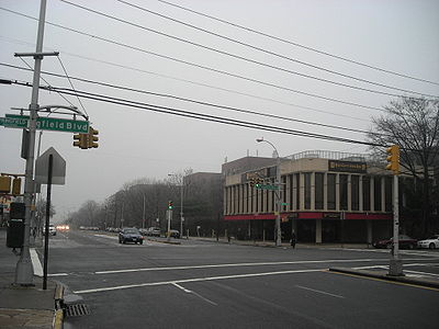
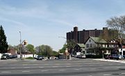
It then crosses Hollis Court Boulevard before leaving the park. It passes through Hollis Hills, crossing Bell Boulevard and Springfield Boulevard. Just after Springfield Boulevard is a full interchange with the Grand Central Parkway (along the Grand Central, Exit 22 eastbound, and exit 23 westbound). Past the Grand Central it becomes the southern boundary of Alley Pond Park until it intersects with Winchester Boulevard. It passes the Creedmoor Psychiatric Center, and then shares a full interchange with the Cross Island Parkway (Exit 28B on the Cross Island), and crosses Commonwealth Boulevard just after the interchange. Past here, it crosses Little Neck Parkway in Bellerose, and then passes through Glen Oaks. It crosses the highest numbered street in New York City, 271 Street, and then passes the city's easternmost point, at Langdale Street. Just past here Union Turnpike enters Nassau County, and then intersects Lakeville Road. It passes a shopping center in Lake Success, crosses New Hyde Park Road, and ends a block east at Marcus Avenue.
The section of Union Turnpike between Springfield Boulevard to Marcus Avenue was New York State Highway 25C from the mid-1930s to 1970.