
Ugo, Akita
Encyclopedia
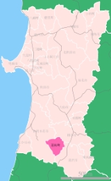
is a town
located in Ogachi District
, Akita
, Japan
.
As of 2011, the town has an estimated population
of 16,476 and a density
of 71.4 persons per km². The total area is 230.75 km².
was realigned into two provinces: Ugo
, which contained some of the northern parts of Yamagata and nearly all of Akita prefectures; and Uzen
, which contained the majority of Yamagata Prefecture.
Buses are also available from Yuzawa to Ugo. Simply go to the bus stop in front of Yuzawa Station and take the bus headed to Motonishi Shogakkou (元西小学校) which will pass through Miwa, and Nishimonai before continuing to Motonishi. (Cost is about 700yen to Nishimonai from Yuzawa.) There are also limited buses from Nishimonai to Sendou. However, these run only a few times a day.
It began as a harvest dance in Nishimonai in about 1280. In 1601 the lord of Nishimonai burned his castle after a defeat and the people danced among the ruins to remember their lord. These two dances were merged in the late 18th century to form the dance's last incarnation which(despite attempts to stop it in the early 20th century)continues to this day. It is the biggest festival of the year, drawing people from all over Tohoku, and the country at large
The week before the festival all of the shops on the Bon Odori street open up and display traditional patchwork kimono, hats and masks.
The shops and food stands open at around 5. The dance begins as the sun goes down and continues until about 11.
is the cultural and economic hub of the town and is home to most of the residents. Nishimonai is also home to the majority of restaurants, shops, drinking establishments, and some small parks. Every August the town's most famous festival the Bon Odori is held on the streets of Nishimonai. is the second largest district in Ugo and is home to one or two small soba shops. It also houses Miwa Suga Jinjya, the oldest and most important shrine in town. Mostly a residential area, although there are some shops, and some sights to see. is, much like all of Ugo, heavy with farms. However, it is also the home of Arcadia park as well as the only onsen in Ugo., , and are all pretty much exclusively residential and farming areas, however there are some sights to see like secluded shrines and temples, agricultural co-ops, and lots and lots of rice fields.
Towns of Japan
A town is a local administrative unit in Japan. It is a local public body along with prefecture , city , and village...
located in Ogachi District
Ogachi District, Akita
is a district located in Akita, Japan.In 2003, the district had an estimated population of 44,129. On March 22, 2005, three towns formerly in Ogachi District merged into the city of Yuzawa....
, Akita
Akita Prefecture
is a prefecture of Japan located in the Tōhoku Region of northern Honshu, the main island of Japan. The capital is the city of Akita.- History :The area of Akita has been created from the ancient provinces of Dewa and Mutsu....
, Japan
Japan
Japan is an island nation in East Asia. Located in the Pacific Ocean, it lies to the east of the Sea of Japan, China, North Korea, South Korea and Russia, stretching from the Sea of Okhotsk in the north to the East China Sea and Taiwan in the south...
.
As of 2011, the town has an estimated population
Population
A population is all the organisms that both belong to the same group or species and live in the same geographical area. The area that is used to define a sexual population is such that inter-breeding is possible between any pair within the area and more probable than cross-breeding with individuals...
of 16,476 and a density
Population density
Population density is a measurement of population per unit area or unit volume. It is frequently applied to living organisms, and particularly to humans...
of 71.4 persons per km². The total area is 230.75 km².
History
During Japan's Meiji era the former Dewa ProvinceDewa Province
is an old province of Japan, comprising modern-day Yamagata Prefecture and Akita Prefecture, except for the city of Kazuno and the town of Kosaka. It was sometimes called .-Historical record:...
was realigned into two provinces: Ugo
Ugo Province
is an old province of Japan in the area of Akita Prefecture and some parts of Yamagata Prefecture. It was sometimes called , with Uzen Province.-Districts:*Akita *Akumi *Hiraka *Kawabe *Ogachi *Semboku *Yamamoto...
, which contained some of the northern parts of Yamagata and nearly all of Akita prefectures; and Uzen
Uzen Province
is an old province of Japan in the area of Yamagata Prefecture. It was sometimes called , with Ugo Province.This province was in the Tōhoku region of Honshū island. It was the place where the Mogami clan was established.-References:...
, which contained the majority of Yamagata Prefecture.
Geography
The town is located on the , which is bordered by the to the west and the to the east.Access
There is no train station or expressway interchange within the city limits. From Daisen/Senboku/Yokote, you can take the expressway to Yuzawa, and then a right onto R398 will take you straight in. Or you can take 13 down and save yourself a few hundred yen. If you're coming from Yurihonjo you can enjoy mountains roads the whole way there. Take 7 to 107 for quite a while then right onto 398 at the statue of a man made with old tires, which will take you right into Nishimonai. From Akita City you can take the expressway, go through Honjo, or take 13 the whole way down.(expressway recommended)Buses are also available from Yuzawa to Ugo. Simply go to the bus stop in front of Yuzawa Station and take the bus headed to Motonishi Shogakkou (元西小学校) which will pass through Miwa, and Nishimonai before continuing to Motonishi. (Cost is about 700yen to Nishimonai from Yuzawa.) There are also limited buses from Nishimonai to Sendou. However, these run only a few times a day.
Nishimonai Bon Odori
The is held every year from August 16–18. It is a symbolic dance to show proper respect and gratefulness to ones deceased ancestors. It is ranked as one of the top 3 bon dances in Japan.It began as a harvest dance in Nishimonai in about 1280. In 1601 the lord of Nishimonai burned his castle after a defeat and the people danced among the ruins to remember their lord. These two dances were merged in the late 18th century to form the dance's last incarnation which(despite attempts to stop it in the early 20th century)continues to this day. It is the biggest festival of the year, drawing people from all over Tohoku, and the country at large
The week before the festival all of the shops on the Bon Odori street open up and display traditional patchwork kimono, hats and masks.
The shops and food stands open at around 5. The dance begins as the sun goes down and continues until about 11.
Yukitopia
The annual takes place on the last Saturday and Sunday of January. A horse drawn carriage follows set course through Nishimonai, Motonishi, and all the way up the Nana Magari mountain road, crossing into Tashiro. The road is lined with small lanterns made from snow.Areas
Ugo is divided into seven distinct areas:is the cultural and economic hub of the town and is home to most of the residents. Nishimonai is also home to the majority of restaurants, shops, drinking establishments, and some small parks. Every August the town's most famous festival the Bon Odori is held on the streets of Nishimonai. is the second largest district in Ugo and is home to one or two small soba shops. It also houses Miwa Suga Jinjya, the oldest and most important shrine in town. Mostly a residential area, although there are some shops, and some sights to see. is, much like all of Ugo, heavy with farms. However, it is also the home of Arcadia park as well as the only onsen in Ugo., , and are all pretty much exclusively residential and farming areas, however there are some sights to see like secluded shrines and temples, agricultural co-ops, and lots and lots of rice fields.
Places of worship
: Oldest and most important shrine in Ugo. The main Building of this shrine was built in the Muromachi era with several others having been added over the following 400 years. Like most shrines in Ugo this shrine is surrounded by many cedar trees.- A 15 minute car ride and a 25 minute hike over a well worn mountain trail with many wooden stairs will bring you to the shrine at the top of Ugo's tiny Mt. Taihei. The shrine provides a sweeping view of southern Akita from Yuzawa all the way to Daisen. Especially recommended in Fall.
- Located next to the Nishimonai post office, this is Nishimonai's main shrine. It is located in the center of a stand of tall cedars.
Attractions
: A seriously windy mountain path that leads over the branch of the Dewa mountains that cuts across the western third of Ugo. It leads from Motonishi into Tashiro, and is a popular challenge for cyclists. There are multiple areas to stop and take in the natural beauty as well as the local spring water known for extending life -- .- The oldest house in Akita prefecture. The main part of the house was built in the first half of the 17th century. The gate house being finished by 1733.
- A beautiful park complex Located in Nishimonai and Niinari. The is a small golf course with driving range (which doubles as a ski slope in the winter,) lots of picnic and party area, and beautiful pond, as well as the Toshitoland spa and restaurant building.