
.gif)
U.S. Route 50 Business (Salisbury, Maryland)
Encyclopedia
U.S. Route 50 Business is a business route
of U.S. Route 50
in the U.S. state
of Maryland
. The highway runs 6.88 miles (11.1 km) between US 50 on the northwest side of Salisbury
and US 50 on the east side of Salisbury, the county seat
of Wicomico County
. US 50 Business is a four- to six-lane divided highway within and on either side of the central business district
of Salisbury, where the highway intersects MD 349
, US 13 Business
, and MD 346
. US 50 Business west of MD 349 is a mid 1950s upgrade of the original highway entering Salisbury from the northwest. The business route between MD 349 and MD 346 was a relocation of US 50 from Main Street built in the early 1960s. East of MD 346, US 50 Business is part of the relocation of US 50 between Salisbury and Berlin
completed in the mid 1960s. US 50 Business was designated when the US 50 portion of the Salisbury Bypass was completed in 2002.
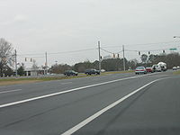 US 50 Business begins at a partial interchange with US 50, with ramps from US 50 east to US 50 Business east and US 50 Business west to US 50 west. One lane of westbound US 50 Business continues beyond the ramp to an intersection with Stanton Avenue, a service road for residences detached from US 50 when the interchange was built. The movements missing from the interchange are completed via Naylor Mill Road just to the east of the partial interchange. US 50 Business heads southeast toward downtown Salisbury as a four-lane divided highway. After passing American Legion Road, the business route enters the city limits of Salisbury and its name changes to Salisbury Parkway. At the intersection with MD 349 (Nanticoke Road) and Isabella Street, US 50 Business turns east, expands to six lanes, becomes a partially controlled access
highway, and parallels Main Street, the original alignment of US 50. After crossing the North Prong of the Wicomico River
on a drawbridge, the business route intersects Division Street, the original alignment of US 13. The highway drops to four lanes as ramps to Baptist Street heading eastbound and from Broad Street heading westbound leave the highway; these streets are used to access US 13 Business (Salisbury Boulevard). US 50 Business expands to six lanes again after passing under US 13 Business and the Delmarva Secondary track of Norfolk Southern Railway
. The business route returns to four lanes after the intersection with MD 346 (Main Street), which is the original alignment of US 50. The median expands as US 50 Business passes commercial and industrial properties. Shortly after the intersection with Tilghman Road, the business route reaches its eastern terminus at a partial cloverleaf interchange with the Salisbury Bypass, which features US 13 and US 50 west. The divided highway continues east as US 50 (Ocean Gateway) toward Ocean City
.
along its present course from the northwest to Isabella Street. The highway then followed Main Street to downtown Salisbury. The highway followed Broad Street to Church Street, which the road followed east toward Parsonsburg
. This highway was one of the original state roads designated for improvement by the Maryland State Roads Commission
(SRC) in 1909. The state roads from Hebron to the western limit of Salisbury and from the eastern limit of Salisbury to Parsonsburg were both completed in 1914. The SRC directed two major changes on Main Street in the mid 1920s. First, the SRC took over maintenance of the drawbridge over the North Prong of the Wicomico River in 1924 and completed its replacement in 1928. While Main Street is no longer a state highway, MDSHA continues to maintain the Main Street drawbridge, which was reconstructed in 1980 and is designated as unsigned
MD 991. Secondly, the SRC extended Main Street east from downtown along its present course east and then northeast to Church Street in 1926. US 213 was designated as the main east–west highway through Salisbury in 1927. US 213 was moved from Church Street to Main Street around 1940. US 50 replaced US 213 through Salisbury in 1949.
US 50 through Salisbury was upgraded in three portions in the 1950s and 1960s. US 50 west of Isabella Street was expanded to a four-lane divided highway northwest to Naylor Mill Road in 1954. Planning for what became Salisbury Parkway between Isabella Street and Main Street east of downtown began after World War II, when right-of-way estimates were made on routes along Isabella Street and Church Street. By 1956, right-of-way purchases and condemnation of buildings had begun; the highway was completed by 1964. US 50 east of Main Street was relocated in 1965 when the four-lane expressway from there to Berlin was completed.
While the US 13 portion of the Salisbury Bypass was completed in 1981, construction on the extension west to US 50 to allow that highway to bypass downtown Salisbury did not begin until May 2000. The US 50 portion of the bypass was completed in October 2002; US 50 Business was assigned to the highway through Salisbury at the same time.
in Wicomico County
.
{| class=wikitable
!Mile
!Destinations
!Notes
|-
|0.00
|, Bay Bridge
|Western terminus of US 50 Business and Salisbury Bypass; eastbound exit and westbound entrance from US 50
|-
|0.60
|Naylor Mill Road east to
|
|-
|2.52
| / Isabella Street east – Quantico
, Nanticoke
|
|-
|3.34
|Division Street
|Original alignment of US 13
|-
|3.62
|
|Eastbound exit and westbound entrance
|-
|4.39
| / Main Street west – Parsonsburg
|Old alignment of US 50
|-
|rowspan=2|6.88
| – Cambridge
, Dover
, Norfolk
|rowspan=2|Eastern terminus of US 50 Business; partial cloverleaf interchange
|-
|
Business route
A business route in the United States and Canada is a short special route connected to a parent numbered highway at its beginning, then routed through the central business district of a nearby city or town, and finally reconnecting with the same parent numbered highway again at its...
of U.S. Route 50
U.S. Route 50 in Maryland
U.S. Route 50 is a major east–west route of the U.S. Highway system, stretching just over from Ocean City, Maryland on the Atlantic Ocean to West Sacramento, California. In the U.S. state of Maryland, US 50 exists in two sections. The longer of these serves as a major route connecting...
in the U.S. state
U.S. state
A U.S. state is any one of the 50 federated states of the United States of America that share sovereignty with the federal government. Because of this shared sovereignty, an American is a citizen both of the federal entity and of his or her state of domicile. Four states use the official title of...
of Maryland
Maryland
Maryland is a U.S. state located in the Mid Atlantic region of the United States, bordering Virginia, West Virginia, and the District of Columbia to its south and west; Pennsylvania to its north; and Delaware to its east...
. The highway runs 6.88 miles (11.1 km) between US 50 on the northwest side of Salisbury
Salisbury, Maryland
-Demographics:Salisbury is the principal city of the Salisbury-Ocean Pines CSA, a Combined Statistical Area that includes the Salisbury metropolitan area and the Ocean Pines micropolitan area , which had a combined population of 176,657 at the 2010 census.As of the census of 2000, there were...
and US 50 on the east side of Salisbury, the county seat
County seat
A county seat is an administrative center, or seat of government, for a county or civil parish. The term is primarily used in the United States....
of Wicomico County
Wicomico County, Maryland
As of the census of 2010, there were 98,733 people, 37,220 households, and 24,172 families residing in the county. The population density was 261.7 people per square mile . There were 41,192 housing units at an average density of 109.2 per square mile...
. US 50 Business is a four- to six-lane divided highway within and on either side of the central business district
Central business district
A central business district is the commercial and often geographic heart of a city. In North America this part of a city is commonly referred to as "downtown" or "city center"...
of Salisbury, where the highway intersects MD 349
Maryland Route 349
Maryland Route 349 is a state highway in the U.S. state of Maryland. Known as Nanticoke Road, the state highway runs from a dead end in Nanticoke east to U.S. Route 50 Business in Salisbury. The first segment of MD 349 was constructed by 1910 west of Salisbury...
, US 13 Business
U.S. Route 13 Business (Salisbury, Maryland)
U.S. Route 13 Business is a business route of U.S. Route 13 in the U.S. state of Maryland. The highway runs between US 13 south of Fruitland and US 13 and US 50 on the north side of Salisbury...
, and MD 346
Maryland Route 346
Maryland Route 346 is a state highway in the U.S. state of Maryland. The state highway runs from U.S. Route 50 Business in Salisbury east to US 50 in Berlin...
. US 50 Business west of MD 349 is a mid 1950s upgrade of the original highway entering Salisbury from the northwest. The business route between MD 349 and MD 346 was a relocation of US 50 from Main Street built in the early 1960s. East of MD 346, US 50 Business is part of the relocation of US 50 between Salisbury and Berlin
Berlin, Maryland
Berlin is a town in Worcester County, Maryland, United States. The population was 3,491 at the 2000 census.-History:The town of Berlin had its start around the 1790s, part of the Burley Plantation, a land grant dating back to 1677...
completed in the mid 1960s. US 50 Business was designated when the US 50 portion of the Salisbury Bypass was completed in 2002.
Route description
Limited-access road
A limited-access road known by various terms worldwide, including limited-access highway, dual-carriageway and expressway, is a highway or arterial road for high-speed traffic which has many or most characteristics of a controlled-access highway , including limited or no access to adjacent...
highway, and parallels Main Street, the original alignment of US 50. After crossing the North Prong of the Wicomico River
Wicomico River (Maryland eastern shore)
The Wicomico River is a tributary of the Chesapeake Bay on the eastern shore of Maryland. It drains an area of low marshlands and farming country in the middle Delmarva Peninsula. The name "Wicomico" derives from the words wicko mekee, meaning "a place where houses are built," apparently...
on a drawbridge, the business route intersects Division Street, the original alignment of US 13. The highway drops to four lanes as ramps to Baptist Street heading eastbound and from Broad Street heading westbound leave the highway; these streets are used to access US 13 Business (Salisbury Boulevard). US 50 Business expands to six lanes again after passing under US 13 Business and the Delmarva Secondary track of Norfolk Southern Railway
Norfolk Southern Railway
The Norfolk Southern Railway is a Class I railroad in the United States, owned by the Norfolk Southern Corporation. With headquarters in Norfolk, Virginia, the company operates 21,500 route miles in 22 eastern states, the District of Columbia and the province of Ontario, Canada...
. The business route returns to four lanes after the intersection with MD 346 (Main Street), which is the original alignment of US 50. The median expands as US 50 Business passes commercial and industrial properties. Shortly after the intersection with Tilghman Road, the business route reaches its eastern terminus at a partial cloverleaf interchange with the Salisbury Bypass, which features US 13 and US 50 west. The divided highway continues east as US 50 (Ocean Gateway) toward Ocean City
Ocean City, Maryland
Ocean City, sometimes known as OC, or OCMD, is an Atlantic Ocean resort town in Worcester County, Maryland, United States. Ocean City is widely known in the Mid-Atlantic region of the United States and is a frequent destination for vacationers in that area...
.
History
The original east–west highway through Salisbury entered the city from HebronHebron, Maryland
Hebron is a town in Wicomico County, Maryland, United States. The population was 807 at the 2000 census. It is included in the Salisbury, Maryland Metropolitan Statistical Area.It is the hometown of pro wrestler Mark Hildreth.-Geography:...
along its present course from the northwest to Isabella Street. The highway then followed Main Street to downtown Salisbury. The highway followed Broad Street to Church Street, which the road followed east toward Parsonsburg
Parsonsburg, Maryland
Parsonsburg is an unincorporated community in Wicomico County, Maryland, United States.-References:...
. This highway was one of the original state roads designated for improvement by the Maryland State Roads Commission
Maryland State Highway Administration
The Maryland State Highway Administration is the state agency responsible for maintaining Maryland numbered highways outside of Baltimore City...
(SRC) in 1909. The state roads from Hebron to the western limit of Salisbury and from the eastern limit of Salisbury to Parsonsburg were both completed in 1914. The SRC directed two major changes on Main Street in the mid 1920s. First, the SRC took over maintenance of the drawbridge over the North Prong of the Wicomico River in 1924 and completed its replacement in 1928. While Main Street is no longer a state highway, MDSHA continues to maintain the Main Street drawbridge, which was reconstructed in 1980 and is designated as unsigned
Unsigned highway
An unsigned highway is a highway that has been assigned a route number, but does not bear conventional road markings that would normally be used to identify the route with that number...
MD 991. Secondly, the SRC extended Main Street east from downtown along its present course east and then northeast to Church Street in 1926. US 213 was designated as the main east–west highway through Salisbury in 1927. US 213 was moved from Church Street to Main Street around 1940. US 50 replaced US 213 through Salisbury in 1949.
US 50 through Salisbury was upgraded in three portions in the 1950s and 1960s. US 50 west of Isabella Street was expanded to a four-lane divided highway northwest to Naylor Mill Road in 1954. Planning for what became Salisbury Parkway between Isabella Street and Main Street east of downtown began after World War II, when right-of-way estimates were made on routes along Isabella Street and Church Street. By 1956, right-of-way purchases and condemnation of buildings had begun; the highway was completed by 1964. US 50 east of Main Street was relocated in 1965 when the four-lane expressway from there to Berlin was completed.
While the US 13 portion of the Salisbury Bypass was completed in 1981, construction on the extension west to US 50 to allow that highway to bypass downtown Salisbury did not begin until May 2000. The US 50 portion of the bypass was completed in October 2002; US 50 Business was assigned to the highway through Salisbury at the same time.
Junction list
The entire route is in SalisburySalisbury, Maryland
-Demographics:Salisbury is the principal city of the Salisbury-Ocean Pines CSA, a Combined Statistical Area that includes the Salisbury metropolitan area and the Ocean Pines micropolitan area , which had a combined population of 176,657 at the 2010 census.As of the census of 2000, there were...
in Wicomico County
Wicomico County, Maryland
As of the census of 2010, there were 98,733 people, 37,220 households, and 24,172 families residing in the county. The population density was 261.7 people per square mile . There were 41,192 housing units at an average density of 109.2 per square mile...
.
{| class=wikitable
!Mile
!Destinations
!Notes
|-
|0.00
|, Bay Bridge
Chesapeake Bay Bridge
The Chesapeake Bay Bridge is a major dual-span bridge in the U.S. state of Maryland. Spanning the Chesapeake Bay, it connects the state's rural Eastern Shore region with the more urban Western Shore. The original span opened in 1952 and, at the time, with a length of , it was the world's longest...
|Western terminus of US 50 Business and Salisbury Bypass; eastbound exit and westbound entrance from US 50
|-
|0.60
|Naylor Mill Road east to
|
|-
|2.52
| / Isabella Street east – Quantico
Quantico, Maryland
Quantico is an unincorporated community in Wicomico County, Maryland, United States, along the former stage route from Vienna to the port of Whitehaven on the Wicomico River. It consists of approximately 35 homes on the Quantico Creek. The community lies four miles from Hebron, Maryland along...
, Nanticoke
Nanticoke, Maryland
Nanticoke is an unincorporated community in Wicomico County, Maryland, United States.-References:...
|
|-
|3.34
|Division Street
|Original alignment of US 13
|-
|3.62
|
|Eastbound exit and westbound entrance
|-
|4.39
| / Main Street west – Parsonsburg
Parsonsburg, Maryland
Parsonsburg is an unincorporated community in Wicomico County, Maryland, United States.-References:...
|Old alignment of US 50
|-
|rowspan=2|6.88
| – Cambridge
Cambridge, Maryland
Cambridge is a city in Dorchester County, Maryland, United States. The population was 12,326 at the 2010 census. It is the county seat of Dorchester County and the county's largest municipality...
, Dover
Dover, Delaware
The city of Dover is the capital and second largest city in the U.S. state of Delaware. It is also the county seat of Kent County, and the principal city of the Dover, Delaware Metropolitan Statistical Area, which encompasses all of Kent County. It is located on the St. Jones River in the Delaware...
, Norfolk
Norfolk, Virginia
Norfolk is an independent city in the Commonwealth of Virginia in the United States. With a population of 242,803 as of the 2010 Census, it is Virginia's second-largest city behind neighboring Virginia Beach....
|rowspan=2|Eastern terminus of US 50 Business; partial cloverleaf interchange
|-
|