
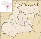
Três Ranchos
Encyclopedia
| Três Ranchos | |
|---|---|
| State | Goiás Goiás Goiás is a state of Brazil, located in the central part of the country. The name Goiás comes from the name of an indigenous community... |
| Coordinates: | 18°21′30"S 47°46′36"W |
| Area: | 282.0 km² |
| Population: | 2,862 (IBGE 2007) |
| Elevation: | 687m above sea level |
| Postcode (CEP): | 75985-000 |
| IBGE statistical microregion: | 017 Catalão Catalão Microregion The Catalão Microregion is a statistical microregion created by IBGE in south-eastern Goiás state, Brazil.*Population: 131.741 inhabitants *Cities: 11*Total Area: 15,238.60 km²... |
| Became a city: | 1953 |
| Mayor: | Nivaldo da Silva Aguiar (2005-2009) |
| Distance to Goiânia Goiânia -Climate:The city has a tropical wet and dry climate with an average temperature of . There's a wet season, from October to April, and a dry one, from May to September. Annual rainfall is around 1,520 mm.... : |
383 km. |
| Website: | none |

Town
A town is a human settlement larger than a village but smaller than a city. The size a settlement must be in order to be called a "town" varies considerably in different parts of the world, so that, for example, many American "small towns" seem to British people to be no more than villages, while...
and municipality
Municipality
A municipality is essentially an urban administrative division having corporate status and usually powers of self-government. It can also be used to mean the governing body of a municipality. A municipality is a general-purpose administrative subdivision, as opposed to a special-purpose district...
in south Goiás
Goiás
Goiás is a state of Brazil, located in the central part of the country. The name Goiás comes from the name of an indigenous community...
state, Brazil
Brazil
Brazil , officially the Federative Republic of Brazil , is the largest country in South America. It is the world's fifth largest country, both by geographical area and by population with over 192 million people...
.
Location
Três Ranchos is located in the statistical micro-region of CatalãoCatalão Microregion
The Catalão Microregion is a statistical microregion created by IBGE in south-eastern Goiás state, Brazil.*Population: 131.741 inhabitants *Cities: 11*Total Area: 15,238.60 km²...
See Citybrazil and is bordered by:
- North: OuvidorOuvidorOuvidor is a small town and municipality in southeast Goiás state, Brazil.-Location:Located 267 kilometers from the state capital, Goiânia, Ouvidor is connected by BR-352 / Bela Vista de Goiás / Cristianópolis / GO-020 / Pires do Rio / BR-352 / GO-330 / Ipameri / Catalão / GO-330 / BR-352...
- East: Paranaíba RiverParanaíba RiverThe Paranaíba River is a Brazilian river whose source lies in the state of Minas Gerais in the Mata da Corda mountains, municipality of Rio Paranaíba, at an altitude of 1,148 meters; on the other face of this mountain chain are the sources of the Abaeté river, tributary of the São Francisco River...
- South: CatalãoCatalãoCatalão is a small city and municipality located in the south of the state of Goiás, in Brazil. It is a large producer of grains, cattle, and phosphates and has a John Deere and Mitsubishi factory.-Demographics:*Population density: 17.85 inhab/km²...
and once again by the Paranaíba - West: CatalãoCatalãoCatalão is a small city and municipality located in the south of the state of Goiás, in Brazil. It is a large producer of grains, cattle, and phosphates and has a John Deere and Mitsubishi factory.-Demographics:*Population density: 17.85 inhab/km²...
.
Highway Connections
It is connected to the important city of CatalãoCatalão
Catalão is a small city and municipality located in the south of the state of Goiás, in Brazil. It is a large producer of grains, cattle, and phosphates and has a John Deere and Mitsubishi factory.-Demographics:*Population density: 17.85 inhab/km²...
by highway GO-230, passing through Ouvidor
Ouvidor
Ouvidor is a small town and municipality in southeast Goiás state, Brazil.-Location:Located 267 kilometers from the state capital, Goiânia, Ouvidor is connected by BR-352 / Bela Vista de Goiás / Cristianópolis / GO-020 / Pires do Rio / BR-352 / GO-330 / Ipameri / Catalão / GO-330 / BR-352...
. The distance to Catalão is 28 km.
The distance to Goiânia
Goiânia
-Climate:The city has a tropical wet and dry climate with an average temperature of . There's a wet season, from October to April, and a dry one, from May to September. Annual rainfall is around 1,520 mm....
is 383 km. Highway connections are made by BR-352 / Bela Vista de Goiás
Bela Vista de Goiás
Bela Vista de Goiás is a small city located in central Goiás state in Brazil.-Location:It is 45 kilometers from the state capital of Goiânia...
/ Cristianópolis
Cristianópolis
This article is about Cristianópolis, Goiás. For Cristianópolis, Mato Grosso see Cristianópolis, Mato GrossoCristianópolis is a small town and municipality in south-eastern Goiás state, Brazil.-Geographical Information:...
/ GO-020 / Pires do Rio
Pires do Rio
Pires do Rio is a small city and municipality in Goiás state, Brazil. It is a prosperous town and a major producer of poultry.-Location:It is located in the Pires do Rio Microregion. . It is located 144 kilometers from the state capital and is served by highways GO-020, 330 and 414, as well as...
/ BR-352 / GO-330 / Ipameri
Ipameri
Ipameri is a small city and municipality in southeastern Goiás state, in Brazil. The population was 23,114 in a total area of 4,368.6 km² . It is a major producer of soybeans, corn, and livestock.-Location and connections:...
/ Catalão
Catalão
Catalão is a small city and municipality located in the south of the state of Goiás, in Brazil. It is a large producer of grains, cattle, and phosphates and has a John Deere and Mitsubishi factory.-Demographics:*Population density: 17.85 inhab/km²...
/ GO-330 / BR-352. See Distancias Rodoviarias Sepin
There is also a small airport and two ferries that connect with the state of Minas Gerais
Minas Gerais
Minas Gerais is one of the 26 states of Brazil, of which it is the second most populous, the third richest, and the fourth largest in area. Minas Gerais is the Brazilian state with the largest number of Presidents of Brazil, the current one, Dilma Rousseff, being one of them. The capital is the...
crossing the artificial lake of Emborcação.
History
Três Ranchos began as a port in 1887 on the Paranaíba RiverParanaíba River
The Paranaíba River is a Brazilian river whose source lies in the state of Minas Gerais in the Mata da Corda mountains, municipality of Rio Paranaíba, at an altitude of 1,148 meters; on the other face of this mountain chain are the sources of the Abaeté river, tributary of the São Francisco River...
and as a place where diamonds were found. The name comes from three houses, really huts, that served as a resting place for the cattle drivers who passed through the region. With the railroad the settlement grew until it was raised to the category of district in Catalão
Catalão
Catalão is a small city and municipality located in the south of the state of Goiás, in Brazil. It is a large producer of grains, cattle, and phosphates and has a John Deere and Mitsubishi factory.-Demographics:*Population density: 17.85 inhab/km²...
in 1948. In 1953 it was dismembered becoming a municipality with the name Paranaíba de Goiás. Shortly after the old name Três Ranchos was restored.
Political Information
- Mayor: Nivaldo da Silva Aguiar (January 2005)
- City council: 09 members
- Eligible voters: 2,843 (December/2007)
Demographics
- Population density: 10.15 inhab/km² (2007)
- Urban population: 2,528 (2007)
- Rural population: 334 (2007)
- Population growth: a gain of about 1,000 people since 1980
The economy
The economy is based on tourism, subsistence agriculture, cattle raising, services, public administration, and small transformation industries.- Industrial units: 2 (2007)
- Commercial units: 44 (2007)
- Hotels: 3 (2007)
- Cattle herd: 13,700 head (2,400 milk cows) (2006)
- Poultry: 31,300 head (2006)
- Main crops: rice, beans, manioc, corn (200 hectares), and soybeans (500 hectares).
Agricultural data 2006
- Farms: 112
- Total area: 3,048 ha.
- Area of permanent crops: 25 ha.
- Area of perennial crops: 176 ha.
- Area of natural pasture: 2,497 ha.
- Area of woodland and forests: 222 ha.
- Persons dependent on farming: 270
- Farms with tractors: 4
- Number of tractors: 4
- Cattle herd: 13,000 head
Education (2006)
- Schools: 2
- Classrooms: 22
- Teachers: 39
- Students: 767
- Higher education: none
- Adult literacy rate: 90.2% (2000) (national average was 86.4%)
Health (2007)
- Hospitals: 0
- Hospital beds: 0
- Ambulatory clinics: 1
- Infant mortality rate: 14.32 (2000) (national average was 33.0)
Tourism
The Emborcação ReservoirEmborcação Dam
The Emborcação Dam, also known as Theodomiro Sampaio, is an embankment dam on the Paranaíba River near Araguari in Minas Gerais, Brazil. It was constructed for hydroelectric power production and flood control.-Background:...
, on the Paranaíba
Paranaíba River
The Paranaíba River is a Brazilian river whose source lies in the state of Minas Gerais in the Mata da Corda mountains, municipality of Rio Paranaíba, at an altitude of 1,148 meters; on the other face of this mountain chain are the sources of the Abaeté river, tributary of the São Francisco River...
is famous for its blue color and is called Lago Azul. There are several tourist structures on the lake islands and on the banks, which help the local economy. The lake has a surface of 440 km² and a maximum depth of 160 meters. It can be reached by taking highways BR-352, GO-330 and GO-208. The hydroelectric plant operated by Cemig is located near the dam, which is 30 kilometers from Três Ranchos. See Pousada3ranchos for information on the city (in Portuguese).
Climate
The climate is considered moist tropical with two well defined seasons: dry winter and rainy summer, with a maximum temperature between 18°C and 23°C. After the formation of the lake, according to data, the days have become hotter with the maximum going higher than 30°C.Municipal Human Development Index
Human Development Index
The Human Development Index is a composite statistic used to rank countries by level of "human development" and separate "very high human development", "high human development", "medium human development", and "low human development" countries...
- MHDI: 0.787
- State ranking: 17 (out of 242 municipalities in 2000)
- National ranking: 873 (out of 5,507 municipalities in 2000) See Frigoletto.com
See also
- List of municipalities in Goiás
- Catalão MicroregionCatalão MicroregionThe Catalão Microregion is a statistical microregion created by IBGE in south-eastern Goiás state, Brazil.*Population: 131.741 inhabitants *Cities: 11*Total Area: 15,238.60 km²...
- Microregions of Goiás