
Transportation in Aruba
Encyclopedia
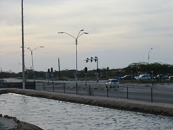
Taxis, buses, and personal automobiles are the most common ways to travel in Aruba
. The majority of the roads are paved, but toward the interior of the island the roads are less commonly paved. Coastal areas most often feature paved roads. With a total of 800 km of road, 287 km are unpaved.
 Arubus is the government-owned bus company with some 29 buses in service. Mini-buses are also common. The main Arubus station is located in downtown Oranjestad
.
Despite Aruba's location
near Curaçao
and Venezuela
, boat crossings are not generally available. Private boaters can make the journey, but there is no public transport via the sea. Travelers may choose to take short plane flights from the Queen Beatrix International Airport
.
There are three ports or harbors on the island: Barcadera, Oranjestad
, and San Nicolas
. The Aruba Ports Authority operates the ports in Barcadera and Oranjestad, while the Valero Aruba Refining Company operates the third port. Barcadera and San Nicolaas are mainly industrial and oil ports.
When you arrive at the Queen Beatrix airport, most of the major rental cars companies are across the driveway, including Hertz, Avis and Alamo. Local rental car companies are also available. Arubans drive on the right side of the road, so that an American tourist will have little problem adjusting to the driving pattern.
Aruba has no railways. There were, historically, two industrial narrow-gauge railways; but they no longer exist.
Aruba
Aruba is a 33 km-long island of the Lesser Antilles in the southern Caribbean Sea, located 27 km north of the coast of Venezuela and 130 km east of Guajira Peninsula...
. The majority of the roads are paved, but toward the interior of the island the roads are less commonly paved. Coastal areas most often feature paved roads. With a total of 800 km of road, 287 km are unpaved.
Oranjestad, Aruba
Oranjestad is the capital and largest city of Aruba, which is in the Caribbean north of Venezuela. Oranjestad is located on the southern coast near the western end of the island country...
.
Despite Aruba's location
Geography of Aruba
Aruba is a small Caribbean island about the size of Washington, D.C., located 25 km north of the coast of Venezuela and 68 km northwest of Curaçao, the largest island of the Kingdom of the Netherlands. Aruba’s terrain is mostly flat with a few hills. There is little in the way of vegetation or...
near Curaçao
Curaçao
Curaçao is an island in the southern Caribbean Sea, off the Venezuelan coast. The Country of Curaçao , which includes the main island plus the small, uninhabited island of Klein Curaçao , is a constituent country of the Kingdom of the Netherlands...
and Venezuela
Venezuela
Venezuela , officially called the Bolivarian Republic of Venezuela , is a tropical country on the northern coast of South America. It borders Colombia to the west, Guyana to the east, and Brazil to the south...
, boat crossings are not generally available. Private boaters can make the journey, but there is no public transport via the sea. Travelers may choose to take short plane flights from the Queen Beatrix International Airport
Queen Beatrix International Airport
Queen Beatrix International Airport , in Oranjestad, Aruba, is an aviation facility. It has flight services to the United States, most countries in the Caribbean, the northern coastal countries of South America, Canada and some parts of Europe, notably the Netherlands...
.
There are three ports or harbors on the island: Barcadera, Oranjestad
Oranjestad, Aruba
Oranjestad is the capital and largest city of Aruba, which is in the Caribbean north of Venezuela. Oranjestad is located on the southern coast near the western end of the island country...
, and San Nicolas
San Nicolas, Aruba
San Nicolaas is southeast of Oranjestad, and is Aruba's second largest city. As of 2008 it has a population of 18,126, most who originate from the British Caribbean. Known as the island's Sunrise Side, San Nicolaas was once a bustling company town, when Lago Oil and Transport operated its oil...
. The Aruba Ports Authority operates the ports in Barcadera and Oranjestad, while the Valero Aruba Refining Company operates the third port. Barcadera and San Nicolaas are mainly industrial and oil ports.
When you arrive at the Queen Beatrix airport, most of the major rental cars companies are across the driveway, including Hertz, Avis and Alamo. Local rental car companies are also available. Arubans drive on the right side of the road, so that an American tourist will have little problem adjusting to the driving pattern.
Aruba has no railways. There were, historically, two industrial narrow-gauge railways; but they no longer exist.