
Terezópolis de Goiás
Encyclopedia
| Terezópolis de Goiás | |
|---|---|
| State | Goiás Goiás Goiás is a state of Brazil, located in the central part of the country. The name Goiás comes from the name of an indigenous community... |
| Area: | 106.9 km² |
| Population: | 5,620 (IBGE 2007) |
| Elevation: | 828m above sea level |
| Postcode (CEP): | 75985-000 |
| IBGE statistical microregion: | 010 Goiânia Microregion Goiânia Microregion The Goiânia Microregion is a region in central Goiás state, Brazil. It includes 17 municipalities with a population of 2,032,305 in a total area of 6,848.00 km².... |
| Became a city: | 1993 |
| Distance to Goiânia Goiânia -Climate:The city has a tropical wet and dry climate with an average temperature of . There's a wet season, from October to April, and a dry one, from May to September. Annual rainfall is around 1,520 mm.... : |
28 km. |
| Website: | none |
Town
A town is a human settlement larger than a village but smaller than a city. The size a settlement must be in order to be called a "town" varies considerably in different parts of the world, so that, for example, many American "small towns" seem to British people to be no more than villages, while...
and municipality
Municipality
A municipality is essentially an urban administrative division having corporate status and usually powers of self-government. It can also be used to mean the governing body of a municipality. A municipality is a general-purpose administrative subdivision, as opposed to a special-purpose district...
in central Goiás
Goiás
Goiás is a state of Brazil, located in the central part of the country. The name Goiás comes from the name of an indigenous community...
state, Brazil
Brazil
Brazil , officially the Federative Republic of Brazil , is the largest country in South America. It is the world's fifth largest country, both by geographical area and by population with over 192 million people...
.
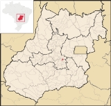
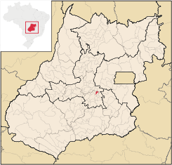
Location
Terezópolis is located in the Goiânia MicroregionGoiânia Microregion
The Goiânia Microregion is a region in central Goiás state, Brazil. It includes 17 municipalities with a population of 2,032,305 in a total area of 6,848.00 km²....
, 28 kilometers northeast of the capital, Goiânia
Goiânia
-Climate:The city has a tropical wet and dry climate with an average temperature of . There's a wet season, from October to April, and a dry one, from May to September. Annual rainfall is around 1,520 mm....
. Neighboring municipalities are:
- north: AnápolisAnápolisAnápolis is the third largest city in the State of Goiás in Brazil. It lies in the center of a rich agricultural region and has become a leader in food processing and pharmaceutical plants.-Location and population:...
- south and east: GoianápolisGoianápolisGoianápolis is a small town and municipality in central Goiás state, Brazil. It had a population of 11,159 in a total area of 162.38 km²...
- west: NerópolisNerópolisNerópolis is a small city and municipality in central Goiás state, Brazil.-Location:The municipality is part of the metropolitan region of Goiânia, which is 42 kilometers to the west. It is nationally known as the city of garlic and sweets...
History
Terezópolis began in 1948 with the building of the important highway, BR-153, which connects the south with BelemBelem
Belem or Belém may refer to:* Belém, capital city of the Brazilian state of Pará* Belem , a three-masted barque from France* Belém, Alagoas, a municipality located in the Brazilian state of Alagoas...
. The town was the site of several stands along the road selling fruit, vegetables, local sweets and cheeses. Until 1992 it was called Santa Tereza and was a district of Goianápolis
Goianápolis
Goianápolis is a small town and municipality in central Goiás state, Brazil. It had a population of 11,159 in a total area of 162.38 km²...
.
Climate
The average annual temperature is 22ºC with two well defined seasons: dry and rainy. The rainy season occurs in the months of November to March. The average annual rainfall is 1,300 milliliters and the relative humidity of the air is 50% to 70%.Political Information
- Mayor: Uilton Pereira dos Santos (January 2005)
- City council: 09 members
- Eligible voters: 4,195 (12/2006)
Demographic Information
- Population density: 52.54 inhab/km² (2007)
- Urban population: 4,909 (2007)
- Rural population: 711 (2007)
- Population growth: a gain of about 1,600 people since 1996
Economic Information
The economy is based on subsistence agriculture, cattle raising, services, public administration, and small transformation industries.Due to the proximity to the urban population of Goiânia
Goiânia
-Climate:The city has a tropical wet and dry climate with an average temperature of . There's a wet season, from October to April, and a dry one, from May to September. Annual rainfall is around 1,520 mm....
, Terezópolis has several small factories. One of them, Saty, produces ketchup and other products using the available tomatoes produced in nearby Goianápolis
Goianápolis
Goianápolis is a small town and municipality in central Goiás state, Brazil. It had a population of 11,159 in a total area of 162.38 km²...
.
- Industrial units: 10 (2007)
- Commercial units: 39 (2007)
- Cattle herd: 11,000 head
- Main crops: oranges (110 hectares), lemons, tangerines, rice, beans, manioc, corn (250 hectares), and soybeans.
Education (2006)
- Schools: 7
- Classrooms: 33
- Teachers: 70
- Students: 1,751
- Higher education: none
- Adult literacy rate: 82.4% (2000) (national average was 86.4%)
Health (2007)
- Hospitals: 0
- Hospital beds: 0
- Ambulatory clinics: 1
- Infant mortality rate: 27.70 (2000) (national average was 33.0)
Municipal Human Development IndexHuman Development IndexThe Human Development Index is a composite statistic used to rank countries by level of "human development" and separate "very high human development", "high human development", "medium human development", and "low human development" countries...
- MHDI: 0.707
- State ranking: 202 (out of 242 municipalities)
- National ranking: 2,875 (out of 5,507 municipalities)
For the complete list see Frigoletto.com