
Talisker Conservation Park
Encyclopedia
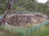
Talisker Conservation Park is located on the south-western area of the Fleurieu Peninsula
, South Australia
. It is close to the town of Cape Jervis and adjacent to Deep Creek Conservation Park
. The park has an area of 212ha.
Fleurieu Peninsula
The Fleurieu Peninsula is a peninsula located south of Adelaide in South Australia, Australia. It was named after the French explorer and hydrographer Charles Pierre Claret de Fleurieu by the French explorer Nicolas Baudin as he mapped the south coast of Australia in 1802.Towns of interest in the...
, South Australia
South Australia
South Australia is a state of Australia in the southern central part of the country. It covers some of the most arid parts of the continent; with a total land area of , it is the fourth largest of Australia's six states and two territories.South Australia shares borders with all of the mainland...
. It is close to the town of Cape Jervis and adjacent to Deep Creek Conservation Park
Deep Creek Conservation Park
Deep Creek Conservation Park is 45 square kilometres of natural Australian bush land located at the southern end of Fleurieu Peninsula in South Australia, 11 km east of Cape Jervis. It has spectacular cliffs fronting the Southern Ocean. The total of 18 km of coastline include views across...
. The park has an area of 212ha.