

Summerset Trail
Encyclopedia
Rail trail
A rail trail is the conversion of a disused railway easement into a multi-use path, typically for walking, cycling and sometimes horse riding. The characteristics of former tracks—flat, long, frequently running through historical areas—are appealing for various development. The term sometimes also...
in Warren County in south-central Iowa
Iowa
Iowa is a state located in the Midwestern United States, an area often referred to as the "American Heartland". It derives its name from the Ioway people, one of the many American Indian tribes that occupied the state at the time of European exploration. Iowa was a part of the French colony of New...
in the United States
United States
The United States of America is a federal constitutional republic comprising fifty states and a federal district...
.
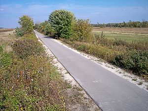
The trail is 11.1 miles (17.9 km) long and is paved with asphalt
Asphalt concrete
Asphalt concrete is a composite material commonly used in construction projects such as road surfaces, airports and parking lots. It consists of asphalt and mineral aggregate mixed together, then laid down in layers and compacted...
. It follows the route of an abandoned rail line between the cities of Carlisle
Carlisle, Iowa
Carlisle is a city in Warren and Polk counties in the U.S. state of Iowa. The population was 3,497 at the 2000 census. The city is part of the Des Moines–West Des Moines Metropolitan Statistical Area....
at its northeastern end and Indianola
Indianola, Iowa
As of the census of 2000, there were 12,998 people, 4,748 households, and 3,261 families residing in the city. The population density was 1,414.7 people per square mile . There were 4,981 housing units at an average density of 542.1 per square mile...
at the southwest. The trail passes remnants of prairie
Prairie
Prairies are considered part of the temperate grasslands, savannas, and shrublands biome by ecologists, based on similar temperate climates, moderate rainfall, and grasses, herbs, and shrubs, rather than trees, as the dominant vegetation type...
, wetland
Wetland
A wetland is an area of land whose soil is saturated with water either permanently or seasonally. Wetlands are categorised by their characteristic vegetation, which is adapted to these unique soil conditions....
s along the Middle River
Middle River (Iowa)
The Middle River is a tributary of the Des Moines River in south-central Iowa in the United States. It is long and drains an area of . Via the Des Moines River, it is part of the watershed of the Mississippi River....
southwest of Carlisle, and woodlands north of Indianola.
The Facilities
TrailheadTrailhead
A trailhead is the point at which a trail begins, where the trail is often intended for hiking, biking, horseback riding, or off-road vehicles...
s are at Carlisle and Indianola, and at the trail's midpoint at Banner Lakes at Summerset State Park. The Carlisle trailhead consists of a parking lot and a small Portable toilet
Portable toilet
Portable toilet are simple portable enclosures containing a chemical toilet which are typically used as a temporary toilet for construction sites and large gatherings and events. Most of the portable toilets have black open-front-U-shaped toilet seat with cover...
. The trailhead at Banner Lakes at Summerset State Park is located at the end of Elk Horn St. (which is accessible from Highway 65-69). There is a pit toilet facility in the parking lot of the Banner Lakes Trailhead, and the trail can also be accessed through the park loop road. In Indianola, the trailhead is located at the 300 block of East 5th street, at the junction of the Summerset trail and the 1.6 miles (2.6 km) long McVay Trail which ends at Pickard Park in Indianola.