

Subaqueous soil
Encyclopedia
The study of subaqueous soils is a relatively new field in Pedology
Pedology
Pedology may refer to:*Pedology *Pedology *Pediatrics...
or soil science. The concept that sediments in shallow water environments undergo soil forming processes, are capable of supporting rooted plants (such as Eelgrass), and meet the definition of soil according to the criteria defined in Soil Taxonomy
USDA soil taxonomy
USDA Soil Taxonomy developed by United States Department of Agriculture and the National Cooperative Soil Survey provides an elaborate classification of soil types according to several parameters and in several levels: Order, Suborder, Great Group, Subgroup, Family, and Series.- Example of...
has been moving soil scientists into a new frontier of soil survey – mapping subaqueous soils.
The National Cooperative Soil Survey
National Cooperative Soil Survey
The National Cooperative Soil Survey in the United States is a nation-wide partnership of federal, regional, state, and local agencies and institutions...
(NCSS) is a nationwide partnership of Federal, regional, State, and local agencies and institutions. This partnership works together to cooperatively investigate, inventory, document, classify, and interpret soils and to disseminate, publish, and promote the use of information about the soils of the United States and its trust territories. The activities of the NCSS are carried out on National, regional, and State levels.
The USDA
United States Department of Agriculture
The United States Department of Agriculture is the United States federal executive department responsible for developing and executing U.S. federal government policy on farming, agriculture, and food...
, Natural Resources Conservation Service
Natural Resources Conservation Service
The Natural Resources Conservation Service , formerly known as the Soil Conservation Service , is an agency of the United States Department of Agriculture that provides technical assistance to farmers and other private landowners and managers.Its name was changed in 1994 during the Presidency of...
(NRCS) is the lead federal agency for the mapping and interpretations of the nation’s soil resource and the extension of soil survey technology to global applications.
Subaqueous and Submerged Soils
As the name implies, subaqueous and submerged soils are soils that occur under water (both fresh and salt water). The depth range of the water column where these soils may be found is not known, an arbitrary depth of 2.5 meters below the surface has been set for soil survey inventory but some states have extended this depth to 5 m (NAVD 88). The difference between subaqueous and submerged soils is that submerged soils formed in an upland environment then became submerged as a result of rising water tables, flooding events (such as a Beaver Dam), or sea level rise. Subaqueous soils formed under a continuous water column (such as in an estuaryEstuary
An estuary is a partly enclosed coastal body of water with one or more rivers or streams flowing into it, and with a free connection to the open sea....
), although their sediments may have originated from an upland area such as a dune.
Although proposals to include permanently submersed sediments as soil have been put forth since the mid 1800’s, it was not until the early 1990’s that the concept of subaqueous soils was developed in the U.S. The pioneer in U.S. subaqueous soils is the late George Demas
George Demas
George Demas was an American pedologist whose pioneering studies of subaqueous soil contributed to the understanding of soil formation and the expansion of the concept of soil. USDA soil taxonomy was revised as a result....
, a soil scientist working for the National Cooperative Soil Survey in the Chesapeake Bay region of Maryland. George observed that subaqueous areas met the definition of soil by being able to support rooted plant growth (such as Eelgrass
Zostera
Zostera is a small genus of widely distributed seagrass, commonly called marine eelgrass or simply eelgrass . The genus Zostera contains sixteen species.-Ecology:Zostera is found on sandy substrates or in estuaries submerged or partially floating...
) and had formed soil horizons. Further study revealed that these submersed sediments underwent other soil forming (pedogenic) processes including additions, losses, and transformations of energy and matter.
Significance of Subaqueous Soils
A major limitation to science-based management of shallow water habitats has been a lack of definitive information on the properties and spatial distribution of subaqueous soils. In part, this lack of information has stemmed from an inadequate paradigm for subaqueous soils, which has not considered them “soils” at all, but rather as “sediments”. During the decade it has been demonstrated that these “sediments” would be better understood as “soils” and that the sedimentary paradigm should give way to a pedological paradigm.An advantage of using the pedological approach to study shallow water habitat is that soils are studied as a collection of horizons that are linked vertically with depth and horizontally across the subaqueous landscape. These horizons are studied and characterized by examining a combination of properties and characteristics, instead of, say, a single component or parameter. In this manner, subaqueous soil can be characterized as ecological map units and provide a site-based system to identify the geomorphic settings that represent the subaqueous landscape. The following are some advantages of a subaqueous soil approach to shallow water classification:
- Sediment characteristics presented to a greater depth (2 m), rather than a bottom-type classification (such as mud bottom or rocky bottom).
- Provides a comprehensive classification scheme (Soil Taxonomy, Soil Survey Manual) for shallow water sediments.
- Could provide a major or missing data set for submersed aquatic vegetation (SAV) restoration, estuarine protection, planning and management.
Subaqueous Soil Survey
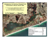
Several States throughout the U.S. have begun the process of mapping and inventorying subaqueous soils. States with subaqueous soils are responsible for determining the activity in their State related to subaqueous soil mapping.How are subaqueous soils mapped?
Traditional terrestrial soil mapping is conducted by a field soil scientist trained to understand the interaction of soil forming processes and soil-landscape relations. Mapping soil involves mostly field work with the soil mapper traversing the landscape and digging many holes to observe and classify the soil. Subaqueous soil mapping is performed in much the same way, except the mapper is in water. Instead of topographic maps to provide landscape position, subaqueous soil mapping uses bathymetric maps to identify landscapes and landforms (a glossary of subaqueous landforms is available at: Glossary of Subaqueous Soil Landscape Terms). Shovels are replaced with augers and special tools, such as peat corers and vibracore, to obtain the soil samples.Uses of Subaqueous Soil Mapping
A major use of traditional soils surveys is to provide interpretation for various land uses and environmental planning. Interpretations for subaqueous soils are currently being developed for a variety of uses. As more areas are surveyed and more data collected a wide array of soil interpretations are expected.External Subaqueous Soil Links
Subaqueous Soil Information Page from Nesoil.comThe Mapping Partnership for Coastal Soils and Sediment (Rhode Island)
Proposed Amendments to Soil Taxonomy to Accommodate Subaqueous Soils
Presentations Made at the National Workshop for Subaqueous Soils
Watch a News Segment about Subaqueous Soils