

Sierra City, California
Encyclopedia
Sierra City is a census-designated place
in Sierra County
, California
, United States
. The elevation of Sierra City is 5407 feet (1,648.1 m), and the town is situated in the canyon of the North Yuba River on California State Route 49
, twelve miles northeast of the county seat of Sierra County, Downieville
. A sheer rock peak known as the Sierra Buttes (Latitude: 39.59351, Longitude: -120.64105), 7,818 feet high, is just 1.6 miles from Sierra City and towers over the town. The population was 221 at the 2010 census.
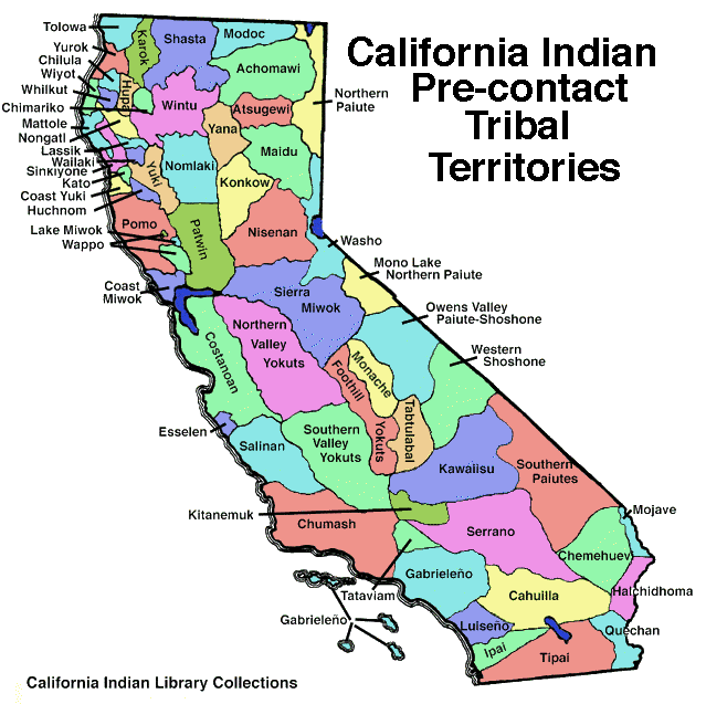
, only Native Americans had ventured into the area, which lies northwest of Lake Tahoe on the western slope of the Sierra Nevada, and which lay between areas inhabited by Maidu
, Nisenan
, and Washo peoples (Pre-Contact Tribal Map). The area is now part of the Tahoe National Forest
.
A settlement was established in 1850 by Philo A. Haven and Joseph Zumwalt, who were also involved with the settling of Downieville (Sinnott). In the Winter of 1852-53, however, an avalanche of snow destroyed the settlement, which was not rebuilt for several years. Ferdinand, Gustav, and Christian Reis purchased several mining claims near the Sierra Buttes and began to resettle Sierra City, which had a peak population of 3,000 during the decade after gold was discovered in California (1849).
Numerous hard-rock gold mines were developed on both sides of the North Yuba River
Canyon near Sierra City. These include the Colombo Mine, the Kentucky Mine, the Keystone Mine, the Monumental Mine, the Sierra Buttes Mine, and the William Tell Mine. A nugget weighing over 1,500 troy ounces was found in the Monumental Mine in 1960, and in 1869, a nugget weighing over 1,800 troy ounces was found there (see external link 2). Placer mining was also practiced and continues today on the banks of the North Yuba. On February 10, 1963, Alec M. Ostrom of Sierra City discovered a nugget weighing 8 troy ounces while placer mining (Sinnott.)
Company occupied in the 19th century, and the Masonic Lodge, both of which sit on the town's main street, which is Highway 49. The town hall, a log structure, was built after World War II, and a new post office, dedicated in 1969, features stone work in which antique mining implements, including an ore-car, are embedded. The Bigelow House, a Victorian structure, is situated near the town's southwestern limits. The cemetery contains gravestones dating back to the 1860s.
is quite nearby. The nearest public school is 12 miles away in Downieville.
, the CDP covers an area of 2.2 square miles (5.6 km²), 99.99% of it land and 0.01% of it water.
was 102.8 people per square mile (39.7/km²). The racial makeup of Sierra City was 200 (90.5%) White, 0 (0.0%) African American, 2 (0.9%) Native American, 3 (1.4%) Asian, 0 (0.0%) Pacific Islander, 12 (5.4%) from other races
, and 4 (1.8%) from two or more races. Hispanic or Latino of any race were 21 persons (9.5%).
The Census reported that 221 people (100% of the population) lived in households, 0 (0%) lived in non-institutionalized group quarters, and 0 (0%) were institutionalized.
There were 113 households, out of which 14 (12.4%) had children under the age of 18 living in them, 54 (47.8%) were opposite-sex married couples
living together, 8 (7.1%) had a female householder with no husband present, 7 (6.2%) had a male householder with no wife present. There were 12 (10.6%) unmarried opposite-sex partnerships
, and 0 (0%) same-sex married couples or partnerships. 34 households (30.1%) were made up of individuals and 15 (13.3%) had someone living alone who was 65 years of age or older. The average household size was 1.96. There were 69 families
(61.1% of all households); the average family size was 2.35.
The population was spread out with 16 people (7.2%) under the age of 18, 14 people (6.3%) aged 18 to 24, 30 people (13.6%) aged 25 to 44, 104 people (47.1%) aged 45 to 64, and 57 people (25.8%) who were 65 years of age or older. The median age was 56.6 years. For every 100 females there were 102.8 males. For every 100 females age 18 and over, there were 101.0 males.
There were 280 housing units at an average density of 130.2 per square mile (50.3/km²), of which 87 (77.0%) were owner-occupied, and 26 (23.0%) were occupied by renters. The homeowner vacancy rate was 1.1%; the rental vacancy rate was 21.2%. 170 people (76.9% of the population) lived in owner-occupied housing units and 51 people (23.1%) lived in rental housing units.
Census-designated place
A census-designated place is a concentration of population identified by the United States Census Bureau for statistical purposes. CDPs are delineated for each decennial census as the statistical counterparts of incorporated places such as cities, towns and villages...
in Sierra County
Sierra County, California
Sierra County is a county located in the Sierra Nevada of the U.S. state of California, northeast of Sacramento on the border with Nevada. As of the 2010 census the population was 3,240, down from 3,555 at the 2000 census. The county seat is Downieville....
, California
California
California is a state located on the West Coast of the United States. It is by far the most populous U.S. state, and the third-largest by land area...
, United States
United States
The United States of America is a federal constitutional republic comprising fifty states and a federal district...
. The elevation of Sierra City is 5407 feet (1,648.1 m), and the town is situated in the canyon of the North Yuba River on California State Route 49
California State Route 49
State Route 49 is a north–south state highway in the U.S. state of California that passes through many historic mining communities of the 1849 California gold rush. Highway 49 is numbered after the "49ers", the waves of immigrants who swept into the area looking for gold, and a portion of it...
, twelve miles northeast of the county seat of Sierra County, Downieville
Downieville, California
Downieville is a census-designated place in and the county seat of Sierra County, California, United States. Downieville sits at an elevation of...
. A sheer rock peak known as the Sierra Buttes (Latitude: 39.59351, Longitude: -120.64105), 7,818 feet high, is just 1.6 miles from Sierra City and towers over the town. The population was 221 at the 2010 census.
History
Before the California Gold RushCalifornia Gold Rush
The California Gold Rush began on January 24, 1848, when gold was found by James W. Marshall at Sutter's Mill in Coloma, California. The first to hear confirmed information of the gold rush were the people in Oregon, the Sandwich Islands , and Latin America, who were the first to start flocking to...
, only Native Americans had ventured into the area, which lies northwest of Lake Tahoe on the western slope of the Sierra Nevada, and which lay between areas inhabited by Maidu
Maidu
The Maidu are a group of Native Americans who live in Northern California. They reside in the central Sierra Nevada, in the drainage area of the Feather and American Rivers...
, Nisenan
Nisenan
The Nisenan, also known as the Southern Maidu and Valley Maidu, are one of many native groups of the Central Valley. The name Nisenan, derives from the ablative plural pronoun nisena·n, "from among us"...
, and Washo peoples (Pre-Contact Tribal Map). The area is now part of the Tahoe National Forest
Tahoe National Forest
Tahoe National Forest is a U.S. National Forest located in the state of California, northwest of Lake Tahoe. It includes the peak of Sierra Buttes, near Sierra City, which has views of Mount Lassen and Mount Shasta. It is located in parts of six counties. In descending order of forestland area...
.
A settlement was established in 1850 by Philo A. Haven and Joseph Zumwalt, who were also involved with the settling of Downieville (Sinnott). In the Winter of 1852-53, however, an avalanche of snow destroyed the settlement, which was not rebuilt for several years. Ferdinand, Gustav, and Christian Reis purchased several mining claims near the Sierra Buttes and began to resettle Sierra City, which had a peak population of 3,000 during the decade after gold was discovered in California (1849).
Numerous hard-rock gold mines were developed on both sides of the North Yuba River
North Yuba River
The North Yuba River is the main tributary of the Yuba River in northern California in the United States. The river is about long and drains from the Sierra Nevada westwards towards the foothills between the mountains and the Sacramento Valley.It rises on the Sierra Crest about northwest of...
Canyon near Sierra City. These include the Colombo Mine, the Kentucky Mine, the Keystone Mine, the Monumental Mine, the Sierra Buttes Mine, and the William Tell Mine. A nugget weighing over 1,500 troy ounces was found in the Monumental Mine in 1960, and in 1869, a nugget weighing over 1,800 troy ounces was found there (see external link 2). Placer mining was also practiced and continues today on the banks of the North Yuba. On February 10, 1963, Alec M. Ostrom of Sierra City discovered a nugget weighing 8 troy ounces while placer mining (Sinnott.)
Historic Buildings
Historic buildings that remain in Sierra City include the two-story brick Busch Building, which the Wells FargoWells Fargo
Wells Fargo & Company is an American multinational diversified financial services company with operations around the world. Wells Fargo is the fourth largest bank in the U.S. by assets and the largest bank by market capitalization. Wells Fargo is the second largest bank in deposits, home...
Company occupied in the 19th century, and the Masonic Lodge, both of which sit on the town's main street, which is Highway 49. The town hall, a log structure, was built after World War II, and a new post office, dedicated in 1969, features stone work in which antique mining implements, including an ore-car, are embedded. The Bigelow House, a Victorian structure, is situated near the town's southwestern limits. The cemetery contains gravestones dating back to the 1860s.
Recent Times
Today the town-limits signs list Sierra City's population as 225. The main industry is tourism. None of the nearby hard-rock mines are in operation, but the Kentucky mine just outside the town limits, now houses a mining museum. In the summer months, fishing in the North Yuba and its tributaries and in nearby alpine lakes is popular, as is mountain-biking, placer-mining, and hiking. The Pacific Crest TrailPacific Crest Trail
The Pacific Crest Trail is a long-distance mountain hiking and equestrian trail on the Western Seaboard of the United States. The southern terminus is at the California border with Mexico...
is quite nearby. The nearest public school is 12 miles away in Downieville.
Geography
According to the United States Census BureauUnited States Census Bureau
The United States Census Bureau is the government agency that is responsible for the United States Census. It also gathers other national demographic and economic data...
, the CDP covers an area of 2.2 square miles (5.6 km²), 99.99% of it land and 0.01% of it water.
Demographics
The 2010 United States Census reported that Sierra City had a population of 221. The population densityPopulation density
Population density is a measurement of population per unit area or unit volume. It is frequently applied to living organisms, and particularly to humans...
was 102.8 people per square mile (39.7/km²). The racial makeup of Sierra City was 200 (90.5%) White, 0 (0.0%) African American, 2 (0.9%) Native American, 3 (1.4%) Asian, 0 (0.0%) Pacific Islander, 12 (5.4%) from other races
Race (United States Census)
Race and ethnicity in the United States Census, as defined by the Federal Office of Management and Budget and the United States Census Bureau, are self-identification data items in which residents choose the race or races with which they most closely identify, and indicate whether or not they are...
, and 4 (1.8%) from two or more races. Hispanic or Latino of any race were 21 persons (9.5%).
The Census reported that 221 people (100% of the population) lived in households, 0 (0%) lived in non-institutionalized group quarters, and 0 (0%) were institutionalized.
There were 113 households, out of which 14 (12.4%) had children under the age of 18 living in them, 54 (47.8%) were opposite-sex married couples
Marriage
Marriage is a social union or legal contract between people that creates kinship. It is an institution in which interpersonal relationships, usually intimate and sexual, are acknowledged in a variety of ways, depending on the culture or subculture in which it is found...
living together, 8 (7.1%) had a female householder with no husband present, 7 (6.2%) had a male householder with no wife present. There were 12 (10.6%) unmarried opposite-sex partnerships
POSSLQ
POSSLQ is an abbreviation for "Persons of Opposite Sex Sharing Living Quarters," a term coined in the late 1970s by the United States Census Bureau as part of an effort to more accurately gauge the prevalence of cohabitation in American households....
, and 0 (0%) same-sex married couples or partnerships. 34 households (30.1%) were made up of individuals and 15 (13.3%) had someone living alone who was 65 years of age or older. The average household size was 1.96. There were 69 families
Family (U.S. Census)
A family or family household is defined by the United States Census Bureau for statistical purposes as "a householder and one or more other people related to the householder by birth, marriage, or adoption. They do not include same-sex married couples even if the marriage was performed in a state...
(61.1% of all households); the average family size was 2.35.
The population was spread out with 16 people (7.2%) under the age of 18, 14 people (6.3%) aged 18 to 24, 30 people (13.6%) aged 25 to 44, 104 people (47.1%) aged 45 to 64, and 57 people (25.8%) who were 65 years of age or older. The median age was 56.6 years. For every 100 females there were 102.8 males. For every 100 females age 18 and over, there were 101.0 males.
There were 280 housing units at an average density of 130.2 per square mile (50.3/km²), of which 87 (77.0%) were owner-occupied, and 26 (23.0%) were occupied by renters. The homeowner vacancy rate was 1.1%; the rental vacancy rate was 21.2%. 170 people (76.9% of the population) lived in owner-occupied housing units and 51 people (23.1%) lived in rental housing units.
Sources
- California-Indian Pre-Contact Tribal Areas Map, http://www.kstrom.net/isk/maps/ca/calprecontact.gif
- Kelly, Leslie A. Traveling California's Gold Rush Country. Falcon, 1997.
- Sinnott, James J. History of Sierra City and History of Goodyear's Bar [one volume], 1978.
- Sinnott, James J. History of Sierra County, 1977.