
Shire of Perenjori
Encyclopedia
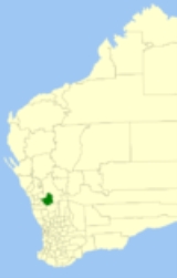
The Shire of Perenjori is a Local Government Area
in the Mid West region of Western Australia
, about 360 kilometres (224 mi) north of the state capital, Perth
. The Shire covers an area of 8313 square kilometres (3,210 sq mi), and its seat of government is the town of Perenjori
.
On 18 September 2009, it was announced that the Shires of Perenjori, Mingenew
, Morawa
and Three Springs
intend to amalgamate. A formal agreement was signed five days later. The resulting entity would have a 2006 census population of 2,487 and an area of 16426 square kilometres (6,342.1 sq mi).
road board. On 27 April 1928 it split into the Perenjori and Morawa Road Districts. On 1 July 1961, Morawa became a Shire under the Local Government Act 1960.
Local Government Areas of Western Australia
The Australian state of Western Australia is divided into 141 local government areas...
in the Mid West region of Western Australia
Western Australia
Western Australia is a state of Australia, occupying the entire western third of the Australian continent. It is bounded by the Indian Ocean to the north and west, the Great Australian Bight and Indian Ocean to the south, the Northern Territory to the north-east and South Australia to the south-east...
, about 360 kilometres (224 mi) north of the state capital, Perth
Perth, Western Australia
Perth is the capital and largest city of the Australian state of Western Australia and the fourth most populous city in Australia. The Perth metropolitan area has an estimated population of almost 1,700,000....
. The Shire covers an area of 8313 square kilometres (3,210 sq mi), and its seat of government is the town of Perenjori
Perenjori, Western Australia
Perenjori is a townsite in the northern agricultural region, 348 km north of Perth and 39 km south-east of Morawa. It is located on the Wongan Hills to Mullewa railway line which was opened in 1915. Perenjori was approved as the name of a siding in April 1913, and later that year the...
.
On 18 September 2009, it was announced that the Shires of Perenjori, Mingenew
Shire of Mingenew
The Shire of Mingenew is a Local Government Area in the Mid West region of Western Australia, about southeast of the city of Geraldton and about north of the state capital, Perth. The Shire covers an area of , and its seat of government is the town of Mingenew.On 18 September 2009, it was...
, Morawa
Shire of Morawa
The Shire of Morawa is a Local Government Area in the Mid West region of Western Australia, about east-southeast of the city of Geraldton and about north of the state capital, Perth. The Shire covers an area of , and its seat of government is the town of Morawa.On 18 September 2009, it was...
and Three Springs
Shire of Three Springs
The Shire of Three Springs is a Local Government Area in the Mid West region of Western Australia, about north of the state capital, Perth. The Shire covers an area of , and its seat of government is the town of Three Springs....
intend to amalgamate. A formal agreement was signed five days later. The resulting entity would have a 2006 census population of 2,487 and an area of 16426 square kilometres (6,342.1 sq mi).
History
On 2 June 1916, the Perenjori-Morawa Road District was proclaimed on land previously managed by the Upper IrwinShire of Mingenew
The Shire of Mingenew is a Local Government Area in the Mid West region of Western Australia, about southeast of the city of Geraldton and about north of the state capital, Perth. The Shire covers an area of , and its seat of government is the town of Mingenew.On 18 September 2009, it was...
road board. On 27 April 1928 it split into the Perenjori and Morawa Road Districts. On 1 July 1961, Morawa became a Shire under the Local Government Act 1960.
Wards
The shire is divided into 5 wards:- Perenjori Ward (3 councillors)
- Caron Ward (1 councillor)
- Latham/Caron Ward (2 councillors)
- Bowgada Ward (2 councillors)
- Maya Ward (1 councillor)
Towns and localities
- PerenjoriPerenjori, Western AustraliaPerenjori is a townsite in the northern agricultural region, 348 km north of Perth and 39 km south-east of Morawa. It is located on the Wongan Hills to Mullewa railway line which was opened in 1915. Perenjori was approved as the name of a siding in April 1913, and later that year the...
- BowgadaBowgada, Western AustraliaBowgada is a small town in Western Australia located on the Mullewa Wubin Road north of Perth in the Mid West RegionThe townsite was gazetted as Chubble in 1913 but changed to Bowgada in 1914...
- BunjilBunjil, Western AustraliaBunjil is a small town in Western Australia located on the Mullewa Wubin Road north of Perth in the Mid West RegionThe townsite was gazetted in 1914, after being initially established as a railway siding in 1913 to allow transport of crops and stock. The name is Indigenous Australian in origin but...
- CaronCaron, Western AustraliaCaron is a small town located on the Mullewa-Wubin Road in the Mid West region of Western Australia. It is situated between the towns of Perenjori and Dalwallinu.The town is named after the nearby Caron Spring which is located about to the west...
- LathamLatham, Western AustraliaLatham is a small town in the Wheatbelt region of Western Australia.The town is named after a large granite rock, Latham Rock, that is located close to the townsite...
- MayaMaya, Western AustraliaMaya is a small town in the Mid West region of Western Australia.The town's name is a result of the shortening of the Indigenous Australian word for a nearby spring, Pocanmaya. The name was first recorded by surveyors in 1876....
- RothsayRothsay, Western AustraliaRothsay is an abandoned town in the Mid West region of Western Australia. It is situated between the towns of Dalwallinu and Mount MagnetA prospector named George Woodley discovered gold in the area in 1894 and initially the area was known as Woodley's Find.Within a year all of the leases had been...
- Warriedar
Population
| Year | Population |
|---|---|
| 1933 | 1,275 |
| 1947 | 956 |
| 1954 | 1,277 |
| 1961 | 1,311 |
| 1966 | 1,311 |
| 1971 | 1,204 |
| 1976 | 1,167 |
| 1981 | 1,005 |
| 1986 | 823 |
| 1991 | 772 |
| 1996 | 684 |
| 2001 | 600 |
| 2006 | 528 |