
Shire of Mukinbudin
Encyclopedia
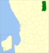
The Shire of Mukinbudin is a Local Government Area
in the Wheatbelt region of Western Australia
, about 80 kilometres (50 mi) north of Merredin
and about 300 kilometres (186 mi) east of the state capital, Perth
. The Shire covers an area of 3437 square kilometres (1,327 sq mi), and its seat of government is the town of Mukinbudin
.
On 1 July 1961, it became a Shire under the Local Government Act 1960.
Local Government Areas of Western Australia
The Australian state of Western Australia is divided into 141 local government areas...
in the Wheatbelt region of Western Australia
Western Australia
Western Australia is a state of Australia, occupying the entire western third of the Australian continent. It is bounded by the Indian Ocean to the north and west, the Great Australian Bight and Indian Ocean to the south, the Northern Territory to the north-east and South Australia to the south-east...
, about 80 kilometres (50 mi) north of Merredin
Merredin, Western Australia
-Economy:The agricultural land around Merredin produces 40% of Western Australia’s wheat quota. As a focal point for the region, Merredin’s local bulk handling co-operative receives and processes in excess of a million tonnes of grain every year...
and about 300 kilometres (186 mi) east of the state capital, Perth
Perth, Western Australia
Perth is the capital and largest city of the Australian state of Western Australia and the fourth most populous city in Australia. The Perth metropolitan area has an estimated population of almost 1,700,000....
. The Shire covers an area of 3437 square kilometres (1,327 sq mi), and its seat of government is the town of Mukinbudin
Mukinbudin, Western Australia
Mukinbudin is a town located in the North Eastern Wheatbelt region of Western Australia, approximately east of Perth and north of Merredin near Lake Campion. It is the main town in the Shire of Mukinbudin...
.
History
Initially, Mukinbudin was governed by the Merredin Road District. In 1921, the Nungarin Road District was gazetted, and on 1 November 1933 Mukinbudin, which had grown considerably in the intervening years, was gazetted separately. Its first election was held on 18 November 1933, and Thomas Basil Conway was elected its inaugural chairman at its first meeting.On 1 July 1961, it became a Shire under the Local Government Act 1960.
Wards
The shire has been divided into 4 wards.- Town Ward (5 councillors)
- Bonnie Rock Ward (2 councillors)
- Wilgoyne Ward (1 councillor)
- Wattoning Ward (1 councillor)
Towns and localities
- MukinbudinMukinbudin, Western AustraliaMukinbudin is a town located in the North Eastern Wheatbelt region of Western Australia, approximately east of Perth and north of Merredin near Lake Campion. It is the main town in the Shire of Mukinbudin...
- Barbalin
- Bonnie RockBonnie Rock, Western AustraliaBonnie Rock is a small town in the Wheatbelt region of Western Australia.The town was once the terminus of the railway to Beacon.The name of the town originated from a rock formation that is situated close to the town that was named by a sandalwood cutter. The townsite was gazetted in 1932.-...
- Dandanning
- Elachbutting
- Lake Brown
- Wattoning
- Wilgoyne