
.gif)
Seven Mile River (East Brookfield River)
Encyclopedia
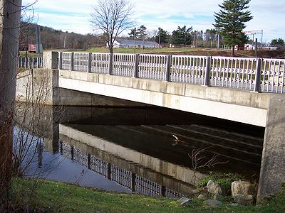
The Seven Mile River or Sevenmile River is a 9.6 miles (15.4 km) stream in central Massachusetts
. It heads at Browning Pond
, at the Oakham
and Spencer
border, and travels south through Spencer, following a short distance from State Route 31
(North Spencer Road). It crosses under Route 31 the highway becomes Pleasant Street, then continues south along Old Meadow Road and under State Route 9
near the junction of State Route 49
. It then parallels Route 9 to its south until it joins the East Brookfield River
between Lake Lashaway
and Quaboag Pond
.
. The reservoir was part of Spencer's wire drawing industry and fed the Lower Wire Village Mill, which made card wire. This mill originally belonged to the Prouty Brothers. When sold to Richard Sugden, he improved it by building the Sugden Reservoir on the top of Turkey Hill. The new company's name became Wickwire-Spencer. It remained until after World War II.
Massachusetts
The Commonwealth of Massachusetts is a state in the New England region of the northeastern United States of America. It is bordered by Rhode Island and Connecticut to the south, New York to the west, and Vermont and New Hampshire to the north; at its east lies the Atlantic Ocean. As of the 2010...
. It heads at Browning Pond
Browning Pond
Browning Pond is located in Oakham and Spencer, Massachusetts. This great pond forms the headwaters of the Seven Mile River. It is part of the Chicopee River Watershed.-Information:...
, at the Oakham
Oakham, Massachusetts
Oakham is a town in Worcester County, Massachusetts, United States. The population was 1,902 at the 2010 census.- History :Oakham was first settled in 1749 and was officially incorporated in 1762...
and Spencer
Spencer, Massachusetts
Spencer is a town in Worcester County, Massachusetts, United States. The population was 11,688 at the 2010 census.For geographic and demographic information on the census-designated place Spencer, please see the article Spencer , Massachusetts....
border, and travels south through Spencer, following a short distance from State Route 31
Route 31 (Massachusetts)
-Route description:It begins at the Connecticut border in Dudley, where a short unnumbered local road changes to MA-31. Through Dudley and Charlton, it is known as Dresser Hill Road. Dresser Hill road winds over Dresser Hill, with several moderately steep grades and some tight corners.In Charlton,...
(North Spencer Road). It crosses under Route 31 the highway becomes Pleasant Street, then continues south along Old Meadow Road and under State Route 9
Route 9 (Massachusetts)
Route 9 is a major east–west state highway in Massachusetts. Along with U.S. Route 20, Route 2 and the Massachusetts Turnpike, Route 9 is one of the major east-west routes of Massachusetts, and like the others its eastern terminus is in Boston...
near the junction of State Route 49
Route 49 (Massachusetts)
Route 49 is a north-south highway located in Worcester County, Massachusetts. For most of its length, the route is known as the Podunk Pike, named for the section of East Brookfield that it passes through. In Spencer and East Brookfield, the route is officially known as the Philip Quinn Memorial...
. It then parallels Route 9 to its south until it joins the East Brookfield River
East Brookfield River
The East Brookfield River is a river in Massachusetts that heads at Lake Lashaway in East Brookfield at an elevation of above sea level. It continues to Quaboag Pond, at an elevation of .-History:...
between Lake Lashaway
Lake Lashaway
Lake Lashaway is a pond located near the East Brookfield and North Brookfield, Massachusetts town line. The town line cuts the lake approximately in half. The lake lies just to the north of state Route 9 as it passes through East Brookfield.-Description:...
and Quaboag Pond
Quaboag Pond
Quaboag Pond is a pond located near the East Brookfield and Brookfield, Massachusetts. The pond lies about two miles south of state Route 9 as it passes through East Brookfield. Quaboag Pond was once named Podunk Pond.-Description:...
.
Information
The Seven Mile River drains Spencer and surrounding communities. Originally named for its length, modern mapping shows it to be nearly ten miles long. Its mouth is at an elevation of about 600 feet (182.9 m) above sea level, and its head is at about 745 feet (227.1 m). This 145 feet (44.2 m) fall was once used to provide waterpower for industry. There exists the remnants of several dams, two of which were taken out during a flood in the 1950s and never repaired. They remain as evidence of a forgone era when Spencer was a major manufacturing center. In addition to small local brooks and streams, the Seven Mile River is fed from Turkey Hill Brook north of town and Cranberry River to the south. This river is part of the Chicopee River Watershed.History
In the 1800s, the Seven Mile River furnished waterpower to industry in Spencer. There were many factories along this river. Now a sewage treatment plant stands alone. At the head of Turkey Hill Brook, a major tributary to the Seven Mile River is Sugden ReservoirSugden Reservoir
The Sugden Reservoir is a Massachusetts reservoir located in Spencer, Massachusetts. It forms the headwaters of Shaw Brook, which is a tributary to Turkey Hill Creek, a major tributary to the Seven Mile River...
. The reservoir was part of Spencer's wire drawing industry and fed the Lower Wire Village Mill, which made card wire. This mill originally belonged to the Prouty Brothers. When sold to Richard Sugden, he improved it by building the Sugden Reservoir on the top of Turkey Hill. The new company's name became Wickwire-Spencer. It remained until after World War II.