

Serra da Saudade
Encyclopedia
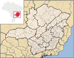
Minas Gerais
Minas Gerais is one of the 26 states of Brazil, of which it is the second most populous, the third richest, and the fourth largest in area. Minas Gerais is the Brazilian state with the largest number of Presidents of Brazil, the current one, Dilma Rousseff, being one of them. The capital is the...
. Its population as of 2007 was 863 people living in a total area of 3.36 km² (1.3 sq mi), making it the smallest municipality of Brazil
Brazil
Brazil , officially the Federative Republic of Brazil , is the largest country in South America. It is the world's fifth largest country, both by geographical area and by population with over 192 million people...
. The population density is 256.84/km2 (668.99/square mile). The city belongs to the meso-region of Central Mineira and to the micro-region of Bom Despacho
Bom Despacho, Minas Gerais
Bom Despacho is a Brazilian municipality located in the west of the state of Minas Gerais. Its population as of 2007 was 22,260 people living in a total area of 1,202 km². The city belongs to the meso-region of Central Mineira and to the micro-region of Bom Despacho...
. It became a municipality in 1962.
Location
The city center of Serra da Saudade is located at an elevation of 738 meters in a mountainous area of the Sierra da Saudade. Neighboring municipalities are: Quartel GeralQuartel Geral
Quartel Geral is a Brazilian municipality located in the center of the state of Minas Gerais. Its population as of 2007 was 3,200 people living in a total area of 556 km². The city belongs to the meso-region of Central Mineira and to the micro-region of Bom Despacho...
(N), Dores do Indaiá
Dores do Indaiá
Dores do Indaiá is a Brazilian municipality located in the center of the state of Minas Gerais. Its population as of 2007 was 13,996 people living in a total area of 1,110 km². The city belongs to the meso-region of Central Mineira and to the micro-region of Bom Despacho...
(E), Estrela do Indaiá
Estrela do Indaiá
Estrela do Indaiá is a Brazilian municipality located in the center of the state of Minas Gerais. Its population as of 2007 was 3,651 people living in a total area of 635 km². The city belongs to the meso-region of Central Mineira and to the micro-region of Bom Despacho...
(S), and São Gotardo
São Gotardo
São Gotardo is a Brazilian municipality located in the northwest of the state of Minas Gerais. Its population as of 2007 was 30,757 people and its land area is 854 km2. The city belongs to the mesoregion of Triângulo Mineiro e Alto Paranaíba and to the microregion of Patos de Minas...
(W).
Distances
- Belo HorizonteBelo HorizonteBelo Horizonte is the capital of and largest city in the state of Minas Gerais, located in the southeastern region of Brazil. It is the third largest metropolitan area in the country...
: 273 km - LuzLuz, Minas GeraisLuz is a Brazilian municipality located in the West part of the state of Minas Gerais. Luz is located between the city of Araxa and the capital city of the state of Minas Gerais, Belo Horizonte. Its population as of 2007 was 17,173 people living in a total area of 1,171 km²...
: 54 km south on MG-235, then MG-176 - Dores do IndaiáDores do IndaiáDores do Indaiá is a Brazilian municipality located in the center of the state of Minas Gerais. Its population as of 2007 was 13,996 people living in a total area of 1,110 km². The city belongs to the meso-region of Central Mineira and to the micro-region of Bom Despacho...
: 19 km southeast on dirt road (2002) - Estrela do IndaiáEstrela do IndaiáEstrela do Indaiá is a Brazilian municipality located in the center of the state of Minas Gerais. Its population as of 2007 was 3,651 people living in a total area of 635 km². The city belongs to the meso-region of Central Mineira and to the micro-region of Bom Despacho...
: 17 km south on MG-235
Economic Activities
Services and agriculture are the most important economic activities. The GDP in 2005 was approximately R$7 million, with 4 million coming from services. There were 113 rural producers on 19,000 hectares of land. 25 farms had tractors (2006). Approximately 250 persons were employed in agriculture. The main crops are coffee, beans and corn. There were 15,000 head of cattle (2006) of which 1,000 were dairy cattle.There were no banks(2007). In the vehicle fleet there were 124 automobiles, 4 trucks, 21 pickup trucks, 4 micro-buses, and 11 motorcycles. (2007).
Health and Education
In the health sector there was 1 public health clinic. (2005). Patients with more serious health conditions are transported to DivinópolisDivinópolis
Divinópolis is a city and municipality located in the centre-west of Minas Gerais state, Brazil. The estimated population in 2007 was 201,921 inhabitants. The total area of the municipality is 709 km² and the elevation is 712 metres. It is located at 120 km from state capital Belo Horizonte...
or Belo Horizonte
Belo Horizonte
Belo Horizonte is the capital of and largest city in the state of Minas Gerais, located in the southeastern region of Brazil. It is the third largest metropolitan area in the country...
. Educational needs of 170 students were met by 1 primary school and 1 pre-primary school. There was no middle school.
- Municipal Human Development IndexHuman Development IndexThe Human Development Index is a composite statistic used to rank countries by level of "human development" and separate "very high human development", "high human development", "medium human development", and "low human development" countries...
: 0.742 (2000) - State ranking: 348 out of 853 municipalities as of 2000
- National ranking: 2114 out of 5,138 municipalities as of 2000
- Literacy rate: 81%
- Life expectancy: 71 (average of males and females)
In 2000 the per capita monthly income of R$217.00 was below the state average of R$276.00 and below the national average of R$297.00. Poços de Caldas
Poços de Caldas
Poços de Caldas is a city and municipality in south-western Minas Gerais state, Brazil, in the microregion of the same name. Its estimated population in 2009 was 151,449 inhabitants...
had the highest per capita monthly income in 2000 with R$435.00. The lowest was Setubinha
Setubinha
Setubinha is a municipality in the northeast of the Brazilian state of Minas Gerais. As of 2007 the population was 10,834 in a total area of 536 km². The elevation is 729 metres. It is part of the IBGE statistical microregion of Teófilo Otoni...
with R$73.00.
The highest ranking municipality in Minas Gerais in 2000 was Poços de Caldas
Poços de Caldas
Poços de Caldas is a city and municipality in south-western Minas Gerais state, Brazil, in the microregion of the same name. Its estimated population in 2009 was 151,449 inhabitants...
with 0.841, while the lowest was Setubinha
Setubinha
Setubinha is a municipality in the northeast of the Brazilian state of Minas Gerais. As of 2007 the population was 10,834 in a total area of 536 km². The elevation is 729 metres. It is part of the IBGE statistical microregion of Teófilo Otoni...
with 0.568. Nationally the highest was São Caetano do Sul
São Caetano do Sul
São Caetano do Sul is a city in São Paulo state in Brazil, located in the Greater São Paulo Metropolitan Area. It is the city with the highest per capita income in Brazil and it also has the highest Human Development Index .-Geography:São Caetano do Sul is located on a plateau that is part of the...
in São Paulo with 0.919, while the lowest was Setubinha. In more recent statistics (considering 5,507 municipalities) Manari in the state of Pernambuco
Pernambuco
Pernambuco is a state of Brazil, located in the Northeast region of the country. To the north are the states of Paraíba and Ceará, to the west is Piauí, to the south are Alagoas and Bahia, and to the east is the Atlantic Ocean. There are about of beaches, some of the most beautiful in the...
has the lowest rating in the country—0,467—putting it in last place.
See also
- List of municipalities in Minas Gerais