

Dores do Indaiá
Encyclopedia
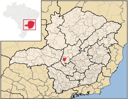
Minas Gerais
Minas Gerais is one of the 26 states of Brazil, of which it is the second most populous, the third richest, and the fourth largest in area. Minas Gerais is the Brazilian state with the largest number of Presidents of Brazil, the current one, Dilma Rousseff, being one of them. The capital is the...
. Its population as of 2007 was 13,996 people living in a total area of 1,110 km². The city belongs to the meso-region of Central Mineira and to the micro-region of Bom Despacho
Bom Despacho, Minas Gerais
Bom Despacho is a Brazilian municipality located in the west of the state of Minas Gerais. Its population as of 2007 was 22,260 people living in a total area of 1,202 km². The city belongs to the meso-region of Central Mineira and to the micro-region of Bom Despacho...
. It became a municipality in 1880.
Location
The city center of Dores do Indaiá is located at an elevation of 723 meters just off state highway MG-176, 8 km south of its junction with federal highway BR-262. Neighboring municipalities are: Quartel GeralQuartel Geral
Quartel Geral is a Brazilian municipality located in the center of the state of Minas Gerais. Its population as of 2007 was 3,200 people living in a total area of 556 km². The city belongs to the meso-region of Central Mineira and to the micro-region of Bom Despacho...
(N), Martinho Campos
Martinho Campos
Martinho Campos is a Brazilian municipality located in the center of the state of Minas Gerais. Its population as of 2007 was 12,165 people living in a total area of 1,060 km². The city belongs to the meso-region of Central Mineira and to the micro-region of Bom Despacho...
(E), Bom Despacho
Bom Despacho, Minas Gerais
Bom Despacho is a Brazilian municipality located in the west of the state of Minas Gerais. Its population as of 2007 was 22,260 people living in a total area of 1,202 km². The city belongs to the meso-region of Central Mineira and to the micro-region of Bom Despacho...
(SE), Luz
Luz, Minas Gerais
Luz is a Brazilian municipality located in the West part of the state of Minas Gerais. Luz is located between the city of Araxa and the capital city of the state of Minas Gerais, Belo Horizonte. Its population as of 2007 was 17,173 people living in a total area of 1,171 km²...
(S), Estrela do Indaiá
Estrela do Indaiá
Estrela do Indaiá is a Brazilian municipality located in the center of the state of Minas Gerais. Its population as of 2007 was 3,651 people living in a total area of 635 km². The city belongs to the meso-region of Central Mineira and to the micro-region of Bom Despacho...
and Serra da Saudade
Serra da Saudade
Serra da Saudade is a Brazilian municipality located in the center of the state of Minas Gerais. Its population as of 2007 was 863 people living in a total area of , making it the smallest municipality of Brazil. The population density is 256.84/km2 . The city belongs to the meso-region of Central...
(W).
Distances
- Belo HorizonteBelo HorizonteBelo Horizonte is the capital of and largest city in the state of Minas Gerais, located in the southeastern region of Brazil. It is the third largest metropolitan area in the country...
: 255 km - Bom DespachoBom Despacho, Minas GeraisBom Despacho is a Brazilian municipality located in the west of the state of Minas Gerais. Its population as of 2007 was 22,260 people living in a total area of 1,202 km². The city belongs to the meso-region of Central Mineira and to the micro-region of Bom Despacho...
: 65 km - Serra da SaudadeSerra da SaudadeSerra da Saudade is a Brazilian municipality located in the center of the state of Minas Gerais. Its population as of 2007 was 863 people living in a total area of , making it the smallest municipality of Brazil. The population density is 256.84/km2 . The city belongs to the meso-region of Central...
: 19 km - Quartel GeralQuartel GeralQuartel Geral is a Brazilian municipality located in the center of the state of Minas Gerais. Its population as of 2007 was 3,200 people living in a total area of 556 km². The city belongs to the meso-region of Central Mineira and to the micro-region of Bom Despacho...
: 30 km
Economic activities
Services and agriculture are the most important economic activities. In 2005 there were 91 small transformation industries employing 362 workers and 401 retail units employing 831 workers. The GDP in 2005 was approximately R$89 million, with 54 million reais from services, 9 million reais from industry, and 19 million reais from agriculture. There were 577 rural producers on 98,000 hectares of land. 169 farms had tractors (2006). Approximately 1,200 persons were occupied in agriculture. The main crops are rice, sugarcane, manioc, beans and corn. There were 66,000 head of cattle, of which 10,000 were milk cows (2006).There were 6 banks: Banco do Brasil - Caixa Econômica Federal - Banco Itaú - Bradesco - Credindaiá - Coopcredi
(2007). In the vehicle fleet there were 2,290 automobiles, 180 trucks, 352 pickup trucks, 18 buses, and 556 motorcycles (2007).
Health and education
In the health sector there were 4 public health clinics and 1 hospital (A Santa Casa de Misericórdia Dr. Zacarias) with 42 beds. (2005). There are 4 private doctors. Patients with more serious health conditions are transported to DivinópolisDivinópolis
Divinópolis is a city and municipality located in the centre-west of Minas Gerais state, Brazil. The estimated population in 2007 was 201,921 inhabitants. The total area of the municipality is 709 km² and the elevation is 712 metres. It is located at 120 km from state capital Belo Horizonte...
or Belo Horizonte
Belo Horizonte
Belo Horizonte is the capital of and largest city in the state of Minas Gerais, located in the southeastern region of Brazil. It is the third largest metropolitan area in the country...
. Educational needs of 3,200 students were met by 7 primary schools, 2 middle schools, and 6 pre-primary schools.
- Municipal Human Development IndexHuman Development IndexThe Human Development Index is a composite statistic used to rank countries by level of "human development" and separate "very high human development", "high human development", "medium human development", and "low human development" countries...
: 0.752 (2000) - State ranking: 270 out of 853 municipalities as of 2000
- National ranking: 1836 out of 5,138 municipalities as of 2000
- Literacy rate: 86%
- Life expectancy: 70 (average of males and females)
In 2000 the per capita monthly income of R$239.00 was below the national average of R$297.00. Poços de Caldas
Poços de Caldas
Poços de Caldas is a city and municipality in south-western Minas Gerais state, Brazil, in the microregion of the same name. Its estimated population in 2009 was 151,449 inhabitants...
had the highest per capita monthly income in 2000 with R$435.00. The lowest was Setubinha
Setubinha
Setubinha is a municipality in the northeast of the Brazilian state of Minas Gerais. As of 2007 the population was 10,834 in a total area of 536 km². The elevation is 729 metres. It is part of the IBGE statistical microregion of Teófilo Otoni...
with R$73.00.
The highest ranking municipality in Minas Gerais in 2000 was Poços de Caldas
Poços de Caldas
Poços de Caldas is a city and municipality in south-western Minas Gerais state, Brazil, in the microregion of the same name. Its estimated population in 2009 was 151,449 inhabitants...
with 0.841, while the lowest was Setubinha
Setubinha
Setubinha is a municipality in the northeast of the Brazilian state of Minas Gerais. As of 2007 the population was 10,834 in a total area of 536 km². The elevation is 729 metres. It is part of the IBGE statistical microregion of Teófilo Otoni...
with 0.568. Nationally the highest was São Caetano do Sul
São Caetano do Sul
São Caetano do Sul is a city in São Paulo state in Brazil, located in the Greater São Paulo Metropolitan Area. It is the city with the highest per capita income in Brazil and it also has the highest Human Development Index .-Geography:São Caetano do Sul is located on a plateau that is part of the...
in São Paulo with 0.919, while the lowest was Setubinha. In more recent statistics (considering 5,507 municipalities) Manari in the state of Pernambuco
Pernambuco
Pernambuco is a state of Brazil, located in the Northeast region of the country. To the north are the states of Paraíba and Ceará, to the west is Piauí, to the south are Alagoas and Bahia, and to the east is the Atlantic Ocean. There are about of beaches, some of the most beautiful in the...
has the lowest rating in the country—0,467—putting it in last place.