
Sal Rei
Encyclopedia
Sal Rei is a city on the northwestern coast of the island of Boa Vista
in eastern Cape Verde
. Sal Rei is the island's main urban settlement, and the 18th largest community in Cape Verde after Cidade Velha. It is also the seat of the Boa Vista Municipality
. Sal Rei is the 3rd largest city in Cape Verde.
Sal Rei is linked with the highway serving Rabil and Norte
. Sal Rei has a port on the bay and has ferry routes to the islands of Santiago
(Praia
), Sal
(Santa Maria
) and Maio
(Vila do Maio
).
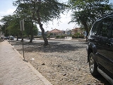
The street system is in a grid pattern. Hotels, restaurants, and bars make up the main industry of Sal Rei after agriculture and other businesses. Buildings surround the bay. The football/soccer team in town is Académica Sal-Rei.
of Sal Rei, which is mainly sandy and grassy, lies in the harbor. Mountains are to the north and northeast and further north are Ponta do Sol and Cabo Santa Maria. A plain covers much of the area around Sal as well as Praia da Chave
and serves a beach town. Land on Boa Vista is dry, rocky, and uncultivatived, with a few farms subsisting in the area around Sal Rei. Forests cover the northern part of the island, and the dry island desert dominates the rest of the area around Maio. A small saline marsh lies to the northwest.
The national park
of Pico d'Antônia which is Pico's fame is bounded to the west along its forests and its slopey valley. More mountains dominate the northeast and the central part are farmlands. The mountains including the view of Monte Batalha dominates the northeast.
Boa Vista, Cape Verde
Boa Vista is the easternmost island of Cape Verde. It is located in the Barlavento group of the archipelago. The island is known for marine turtles and traditional music, as well as its ultramarathon and its sand dunes and beaches...
in eastern Cape Verde
Cape Verde
The Republic of Cape Verde is an island country, spanning an archipelago of 10 islands located in the central Atlantic Ocean, 570 kilometres off the coast of Western Africa...
. Sal Rei is the island's main urban settlement, and the 18th largest community in Cape Verde after Cidade Velha. It is also the seat of the Boa Vista Municipality
Boa Vista, Cape Verde (municipality)
The whole island of Boa Vista makes up the Boa Vista Municipality.The municipality includes two parishes:*Santa Isabel*São João Baptista-Demography:-References:...
. Sal Rei is the 3rd largest city in Cape Verde.
Sal Rei is linked with the highway serving Rabil and Norte
Norte, Cape Verde
Norte is a village in the east-northeastern part of the island of Boa Vista. The village is around 35 km southeast of the island capital of Sal Rei and it is linked with the island's major road with Sal Rei and a remote road to Estância de Baixo and Morro Negro a few kilometres to the...
. Sal Rei has a port on the bay and has ferry routes to the islands of Santiago
Santiago, Cape Verde
Santiago , or Santiagu in Cape Verdean Creole, is the largest island of Cape Verde, its most important agricultural centre and home to half the nation’s population. At the time of Darwin's voyage it was called St. Jago....
(Praia
Praia
Praia , is the capital and largest city of Cape Verde, an island nation in the Atlantic Ocean west of Senegal. It lies on the southern coast of Santiago island in the Sotavento Islands group. It is the island's ferry port and is home to one of the nation’s four international airports...
), Sal
Sal, Cape Verde
Sal is an island in Cape Verde. It belongs to the northern group of islands, called Barlavento. The island is composed by a single administrative division, the Sal municipality. The island is home to Amílcar Cabral International Airport, the main airport of Cape Verde.- Geography :The island is...
(Santa Maria
Santa Maria, Cape Verde
Santa Maria is a fishing city situated in the southern part of the island municipality of Sal, Cape Verde. The city is the third largest in Cape Verde and is one of the few that it is larger than the municipal capital...
) and Maio
Maio, Cape Verde
Maio is the easternmost of the Sotavento islands of Cape Verde. Maio is located south of the islands of Boa Vista and east of Santiago. The island is also known for its large forest, which is unusual for Cape Verde.-Geography:The island covers an area of 269 km²...
(Vila do Maio
Vila do Maio
Vila do Maio, is a city in the southwestern part of the island of Maio in southeastern Cape Verde. It is the main urban settlement of the island, and also seat of the Maio Municipality....
).
The street system is in a grid pattern. Hotels, restaurants, and bars make up the main industry of Sal Rei after agriculture and other businesses. Buildings surround the bay. The football/soccer team in town is Académica Sal-Rei.
Geography
The small isletIslet
An islet is a very small island.- Types :As suggested by its origin as islette, an Old French diminutive of "isle", use of the term implies small size, but little attention is given to drawing an upper limit on its applicability....
of Sal Rei, which is mainly sandy and grassy, lies in the harbor. Mountains are to the north and northeast and further north are Ponta do Sol and Cabo Santa Maria. A plain covers much of the area around Sal as well as Praia da Chave
Praia da Chave
Praia de Chava is a point beach covering the western coastline of the island of Boa Vista in Cape Verde...
and serves a beach town. Land on Boa Vista is dry, rocky, and uncultivatived, with a few farms subsisting in the area around Sal Rei. Forests cover the northern part of the island, and the dry island desert dominates the rest of the area around Maio. A small saline marsh lies to the northwest.
The national park
National park
A national park is a reserve of natural, semi-natural, or developed land that a sovereign state declares or owns. Although individual nations designate their own national parks differently A national park is a reserve of natural, semi-natural, or developed land that a sovereign state declares or...
of Pico d'Antônia which is Pico's fame is bounded to the west along its forests and its slopey valley. More mountains dominate the northeast and the central part are farmlands. The mountains including the view of Monte Batalha dominates the northeast.