
.gif)
Route 88 (New Jersey)
Encyclopedia
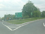
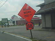
Route 88 is a state highway
in the northern part of Ocean County
, New Jersey
, United States
. It runs 10.02 mi (16.13 km) from an intersection with U.S. Route 9 and County Route 547
in Lakewood Township
to an intersection with Route 35 in Point Pleasant
. It is a two-lane undivided road that passes through mostly residential and commercial areas. The route intersects County Route 549
in Lakewood, Route 70 in Brick Township
at the former Laurelton Circle, and County Route 549 Spur in Point Pleasant. The road is mentioned in the lyrics of the 1973 song "Spirit in the Night
" by Bruce Springsteen
.
The route was built as a gravel county road in 1903 and became part of pre-1927 Route 4, a route that was to run from Absecon
to Rahway
, in 1916. U.S. Route 9 was designated along this stretch of road in 1926 when the U.S. Highway System was created. A year later, in 1927, this portion of pre-1927 Route 4 became a part of Route 35, a route that was to from Lakewood to South Amboy
. By the 1940s, U.S. Route 9 was moved off this road to follow its current alignment between Lakewood and South Amboy. In 1953, Route 35 was realigned to follow a portion of Route 37 between Point Pleasant and Seaside Heights
, and Route 88 was designated along the former alignment of Route 35 between Lakewood and Point Pleasant. The Laurelton Circle at Route 70, built in 1937, was replaced with the current intersection by the 1990s.
 Route 88 begins at an intersection with U.S. Route 9 and County Route 547
(Madison Avenue) in Lakewood Township
, and heads eastward on Main Street, a two-lane undivided road with a 25 mph (40.2 km/h) speed limit. The road heads through the commercial downtown before heading into wooded residential areas, where it becomes Ocean Avenue at the Pearl Street intersection before coming to a junction with County Route 20 (Clover Street). Past this intersection, the speed limit becomes 35 mph (56.3 km/h) and then 40 mph (64.4 km/h) as the route heads through a mix of residences and businesses with some rural woodland. Route 88 crosses County Route 623 (New Hampshire Avenue), where it heads through a commercial district, crossing County Route 549
(Lanes Mill Road/Chambers Bridge Road). A short distance later, the route passes under the Garden State Parkway
without an interchange before crossing the Metedeconk River
into Brick Township
. Here, the road heads through a mix of residential and commercial areas, intersecting County Route 64 (Jack Martin Boulevard), County Route 44 (Forge Pond Road), County Route 40 (West Princeton Avenue), and County Route 16 (Burrsville Road). It turns south and intersects County Route 40 (Olden Street) before crossing Route 70.
Past this intersection, Route 88 briefly splits into a one-way pair
. Here, the eastbound direction follows Princeton Avenue southeast before turning north onto Post Road, with County Route 630 continuing along Princeton Avenue, while westbound Route 88 follows Princeton Post Road. Past the one-way pair, the route continues northeast on 35 mph (56.3 km/h) Princeton Post Road, which passes by numerous businesses. Along this stretch of road Route 88 intersects several county routes, including County Route 64 again, County Route 42 (Van Zile Road), County Route 10 (Old Squan Road), and County Route 54 (Coolidge Road/Midstreams Road). The route heads into Point Pleasant
, where it intersects County Route 56 (Jordan Road) before crossing Beaver Dam Creek and becoming Sea Avenue. From here, the road continues through commercial areas, crossing County Route 632 (Bridge Avenue) before heading east and intersecting County Route 549 Spur (Herbertsville Road) and County Route 630 (Beaver Dam Road). After this intersection, Route 88 crosses the Point Pleasant Canal
(part of the Intracoastal Waterway
) on a lift bridge
before heading east through residential areas with some businesses. Here, the road intersects County Route 633 (Arnold Avenue)/County Route 10 (Johnson Avenue), County Route 6 (Rue Avenue), and County Route 604 (Bay Avenue). A short distance later, Route 88 ends at an intersection with Route 35 on the border of Point Pleasant and Point Pleasant Beach
.
 What is modern-day Route 88 was first built as a hard gravel county road back in 1903, the first such road in Ocean County. In 1916, this road was designated as a part of pre-1927 Route 4, a state road that was to run from Absecon
north to Rahway
. With the creation of the U.S. Highway System in 1926, U.S. Route 9 was also designated along this route, running concurrent with Route 4. In the 1927 New Jersey state highway renumbering
a year later, Route 35 replaced this portion of pre-1927 Route 4 as part of its route from Lakewood to South Amboy
. By the 1940s, U.S. Route 9 was moved off this portion of Route 35 to follow its current alignment along Route 4 between Lakewood and South Amboy. In the 1953 New Jersey state highway renumbering
, Route 35 was realigned to follow what was a part of Route 37 between Point Pleasant and Seaside Heights
, and Route 88 was designated along the former alignment of Route 35 between Lakewood and Point Pleasant. A traffic circle
called the Laurelton Circle, built in 1937, once existed at the intersection with Route 70; it was replaced with its current configuration by the 1990s.
Route 88 was referred to in the 1973 song "Spirit in the Night
" by Bruce Springsteen
on his debut album Greetings from Asbury Park, N.J.
.
State highway
State highway, state road or state route can refer to one of three related concepts, two of them related to a state or provincial government in a country that is divided into states or provinces :#A...
in the northern part of Ocean County
Ocean County, New Jersey
-Demographics:As of the census of 2000, there were 510,916 people, 200,402 households, and 137,876 families residing in the county. The population density was 803 people per square mile . There were 248,711 housing units at an average density of 151/km²...
, New Jersey
New Jersey
New Jersey is a state in the Northeastern and Middle Atlantic regions of the United States. , its population was 8,791,894. It is bordered on the north and east by the state of New York, on the southeast and south by the Atlantic Ocean, on the west by Pennsylvania and on the southwest by Delaware...
, United States
United States
The United States of America is a federal constitutional republic comprising fifty states and a federal district...
. It runs 10.02 mi (16.13 km) from an intersection with U.S. Route 9 and County Route 547
County Route 547 (New Jersey)
County Route 547, abbreviated CR 547, is a county highway in the U.S. state of New Jersey. The highway extends from Route 70 in Lakehurst to Broad Street in Eatontown...
in Lakewood Township
Lakewood Township, New Jersey
-Demographics:As of the census of 2000, there were 60,352 people, 19,876 households, and 13,356 families residing in the township. The population density was 2,431.8 people per square mile . There were 21,214 housing units at an average density of 854.8 per square mile...
to an intersection with Route 35 in Point Pleasant
Point Pleasant, New Jersey
Point Pleasant is a Borough in Ocean County, New Jersey, United States. As of the 2010 United States Census, the borough population was 18,392...
. It is a two-lane undivided road that passes through mostly residential and commercial areas. The route intersects County Route 549
County Route 549 (New Jersey)
County Route 549 is a county highway in the U.S. state of New Jersey. The highway extends from Main Street at County Route 527 in Toms River Township to County Route 547 at Monmouth CR 21 in Howell Township...
in Lakewood, Route 70 in Brick Township
Brick Township, New Jersey
-Transportation:The major county routes that pass through are CR 528, and CR 549 . Two state routes pass through: Route 70 and Route 88...
at the former Laurelton Circle, and County Route 549 Spur in Point Pleasant. The road is mentioned in the lyrics of the 1973 song "Spirit in the Night
Spirit in the Night
"Spirit in the Night" is a song written and originally recorded by New Jersey based singer/songwriter Bruce Springsteen for his debut album Greetings from Asbury Park, N.J. . It was also the second single released from the album...
" by Bruce Springsteen
Bruce Springsteen
Bruce Frederick Joseph Springsteen , nicknamed "The Boss," is an American singer-songwriter who records and tours with the E Street Band...
.
The route was built as a gravel county road in 1903 and became part of pre-1927 Route 4, a route that was to run from Absecon
Absecon, New Jersey
Absecon is a city in Atlantic County, New Jersey, United States. As of the 2010 United States Census, the city population was 8,411.What is now the City of Absecon was originally incorporated as a town by an Act of the New Jersey Legislature on February 29, 1872, from portions of Egg Harbor...
to Rahway
Rahway, New Jersey
Rahway is a city in southern Union County, New Jersey, United States. It is part of the New York metropolitan area, being 15 miles southwest of Manhattan and five miles west of Staten Island...
, in 1916. U.S. Route 9 was designated along this stretch of road in 1926 when the U.S. Highway System was created. A year later, in 1927, this portion of pre-1927 Route 4 became a part of Route 35, a route that was to from Lakewood to South Amboy
South Amboy, New Jersey
South Amboy is a city in Middlesex County, New Jersey, on the Raritan Bay. As of the 2000 United States Census, the city population was 7,913.South Amboy, and Perth Amboy across the Raritan River, are collectively referred to as The Amboys...
. By the 1940s, U.S. Route 9 was moved off this road to follow its current alignment between Lakewood and South Amboy. In 1953, Route 35 was realigned to follow a portion of Route 37 between Point Pleasant and Seaside Heights
Seaside Heights, New Jersey
Seaside Heights is a Borough in Ocean County, New Jersey, United States. As of the 2010 United States Census, the borough population was 2,887. Seaside Heights is situated on the Barnegat Peninsula, a long, narrow barrier peninsula that separates Barnegat Bay from the Atlantic Ocean...
, and Route 88 was designated along the former alignment of Route 35 between Lakewood and Point Pleasant. The Laurelton Circle at Route 70, built in 1937, was replaced with the current intersection by the 1990s.
Route description
County Route 547 (New Jersey)
County Route 547, abbreviated CR 547, is a county highway in the U.S. state of New Jersey. The highway extends from Route 70 in Lakehurst to Broad Street in Eatontown...
(Madison Avenue) in Lakewood Township
Lakewood Township, New Jersey
-Demographics:As of the census of 2000, there were 60,352 people, 19,876 households, and 13,356 families residing in the township. The population density was 2,431.8 people per square mile . There were 21,214 housing units at an average density of 854.8 per square mile...
, and heads eastward on Main Street, a two-lane undivided road with a 25 mph (40.2 km/h) speed limit. The road heads through the commercial downtown before heading into wooded residential areas, where it becomes Ocean Avenue at the Pearl Street intersection before coming to a junction with County Route 20 (Clover Street). Past this intersection, the speed limit becomes 35 mph (56.3 km/h) and then 40 mph (64.4 km/h) as the route heads through a mix of residences and businesses with some rural woodland. Route 88 crosses County Route 623 (New Hampshire Avenue), where it heads through a commercial district, crossing County Route 549
County Route 549 (New Jersey)
County Route 549 is a county highway in the U.S. state of New Jersey. The highway extends from Main Street at County Route 527 in Toms River Township to County Route 547 at Monmouth CR 21 in Howell Township...
(Lanes Mill Road/Chambers Bridge Road). A short distance later, the route passes under the Garden State Parkway
Garden State Parkway
The Garden State Parkway is a 172.4-mile limited-access toll parkway that stretches the length of New Jersey from the New York line at Montvale, New Jersey, to Cape May at New Jersey's southernmost tip. Its name refers to New Jersey's nickname, the "Garden State." Most New Jersey residents refer...
without an interchange before crossing the Metedeconk River
Metedeconk River
The Metedeconk River of southeastern New Jersey flows from its North Branch and its South Branch to their confluence at Forge Pond, where the river then widens and flows southeast for 6 miles/9.7 km into the Barnegat Bay...
into Brick Township
Brick Township, New Jersey
-Transportation:The major county routes that pass through are CR 528, and CR 549 . Two state routes pass through: Route 70 and Route 88...
. Here, the road heads through a mix of residential and commercial areas, intersecting County Route 64 (Jack Martin Boulevard), County Route 44 (Forge Pond Road), County Route 40 (West Princeton Avenue), and County Route 16 (Burrsville Road). It turns south and intersects County Route 40 (Olden Street) before crossing Route 70.
Past this intersection, Route 88 briefly splits into a one-way pair
One-way pair
A one-way pair, one-way couple, or just couplet is a pair of parallel, usually one-way streets that carry opposite directions of a signed route or major traffic flow, or sometimes opposite directions of a bus or streetcar route....
. Here, the eastbound direction follows Princeton Avenue southeast before turning north onto Post Road, with County Route 630 continuing along Princeton Avenue, while westbound Route 88 follows Princeton Post Road. Past the one-way pair, the route continues northeast on 35 mph (56.3 km/h) Princeton Post Road, which passes by numerous businesses. Along this stretch of road Route 88 intersects several county routes, including County Route 64 again, County Route 42 (Van Zile Road), County Route 10 (Old Squan Road), and County Route 54 (Coolidge Road/Midstreams Road). The route heads into Point Pleasant
Point Pleasant, New Jersey
Point Pleasant is a Borough in Ocean County, New Jersey, United States. As of the 2010 United States Census, the borough population was 18,392...
, where it intersects County Route 56 (Jordan Road) before crossing Beaver Dam Creek and becoming Sea Avenue. From here, the road continues through commercial areas, crossing County Route 632 (Bridge Avenue) before heading east and intersecting County Route 549 Spur (Herbertsville Road) and County Route 630 (Beaver Dam Road). After this intersection, Route 88 crosses the Point Pleasant Canal
Point Pleasant Canal
The Point Pleasant Canal is a canal in Point Pleasant, New Jersey. It was completed in late 1925 to connect the Manasquan Inlet and Manasquan River with Bay Head Harbor on the northern end of the Barnegat Bay...
(part of the Intracoastal Waterway
Intracoastal Waterway
The Intracoastal Waterway is a 3,000-mile waterway along the Atlantic and Gulf coasts of the United States. Some lengths consist of natural inlets, salt-water rivers, bays, and sounds; others are artificial canals...
) on a lift bridge
Lift bridge
A vertical-lift bridge or lift bridge is a type of movable bridge in which a span rises vertically while remaining parallel with the deck....
before heading east through residential areas with some businesses. Here, the road intersects County Route 633 (Arnold Avenue)/County Route 10 (Johnson Avenue), County Route 6 (Rue Avenue), and County Route 604 (Bay Avenue). A short distance later, Route 88 ends at an intersection with Route 35 on the border of Point Pleasant and Point Pleasant Beach
Point Pleasant Beach, New Jersey
Point Pleasant Beach is a Borough in Ocean County, New Jersey, United States. As of the 2010 United States Census, the borough population was 4,665....
.
History
Absecon, New Jersey
Absecon is a city in Atlantic County, New Jersey, United States. As of the 2010 United States Census, the city population was 8,411.What is now the City of Absecon was originally incorporated as a town by an Act of the New Jersey Legislature on February 29, 1872, from portions of Egg Harbor...
north to Rahway
Rahway, New Jersey
Rahway is a city in southern Union County, New Jersey, United States. It is part of the New York metropolitan area, being 15 miles southwest of Manhattan and five miles west of Staten Island...
. With the creation of the U.S. Highway System in 1926, U.S. Route 9 was also designated along this route, running concurrent with Route 4. In the 1927 New Jersey state highway renumbering
1927 New Jersey state highway renumbering
In 1927, New Jersey's state highways were renumbered. The old system, which had been defined in sequence by the legislature, was growing badly, as several routes shared the same number, and many unnumbered state highways had been defined...
a year later, Route 35 replaced this portion of pre-1927 Route 4 as part of its route from Lakewood to South Amboy
South Amboy, New Jersey
South Amboy is a city in Middlesex County, New Jersey, on the Raritan Bay. As of the 2000 United States Census, the city population was 7,913.South Amboy, and Perth Amboy across the Raritan River, are collectively referred to as The Amboys...
. By the 1940s, U.S. Route 9 was moved off this portion of Route 35 to follow its current alignment along Route 4 between Lakewood and South Amboy. In the 1953 New Jersey state highway renumbering
1953 New Jersey state highway renumbering
On January 1, 1953, the New Jersey Department of Transportation renumbered many of the State Routes. A few rules were followed in deciding what to renumber:...
, Route 35 was realigned to follow what was a part of Route 37 between Point Pleasant and Seaside Heights
Seaside Heights, New Jersey
Seaside Heights is a Borough in Ocean County, New Jersey, United States. As of the 2010 United States Census, the borough population was 2,887. Seaside Heights is situated on the Barnegat Peninsula, a long, narrow barrier peninsula that separates Barnegat Bay from the Atlantic Ocean...
, and Route 88 was designated along the former alignment of Route 35 between Lakewood and Point Pleasant. A traffic circle
Traffic circle
A traffic circle or rotary is a type of circular intersection in which traffic must travel in one direction around a central island. In some countries, traffic entering the circle has the right-of-way and drivers in the circle must yield. In many other countries, traffic entering the circle must...
called the Laurelton Circle, built in 1937, once existed at the intersection with Route 70; it was replaced with its current configuration by the 1990s.
Route 88 was referred to in the 1973 song "Spirit in the Night
Spirit in the Night
"Spirit in the Night" is a song written and originally recorded by New Jersey based singer/songwriter Bruce Springsteen for his debut album Greetings from Asbury Park, N.J. . It was also the second single released from the album...
" by Bruce Springsteen
Bruce Springsteen
Bruce Frederick Joseph Springsteen , nicknamed "The Boss," is an American singer-songwriter who records and tours with the E Street Band...
on his debut album Greetings from Asbury Park, N.J.
Greetings from Asbury Park, N.J.
Greetings from Asbury Park, N.J. is the first studio album by Bruce Springsteen, released in 1973. It only sold about 25,000 copies in the first year of its release, but had significant critical impact...
.