
.gif)
Route 3 (Rhode Island)
Encyclopedia
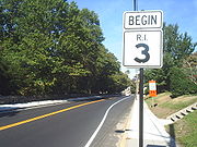
Route 3 is a state highway
in the U.S. state
of Rhode Island
.
 In 1922, the Westerly–Providence
road was assigned New England Interstate Highway 1A, as an alternate to New England Interstate Highway 1
. The road was only paved north of Nooseneck Hill. When NE 1 became US 1
in 1927, NE 1A became Route 1A (now assigned to a different route
).
The original NE 1A alignment differed from the current Route 3 alignment in the following places:
From there, the main road used Route 33 to where the Meshanticut Interchange is now, and then roughly Route 2 (though the exact route is unclear; it may have originally used Cranston Street into Westminster Street) to end concurrent
with US 1 and Route 2 in Providence
, possibly at Broad Street (former Route 117).
By 1939, the number had been changed to Route 3, and it was on its current alignment (though still extending north to Providence, via Route 2 and US 1
), and was fully paved with concrete
except for a bit in downtown Westerly (and along Route 2 and US 1 north of Route 12). Route 3 was part of a major through route, serving as a cutoff for US 1, along with Rhode Island–Connecticut Route 84. In fact, in 1947, Connecticut
proposed moving US 1 to this route, but RIDOT declined, wanting US 1 to continue through the shore towns. RIDOT offered US 1A as a compromise, but this was never signed. The old alignment through Washington to the Meshanticut Interchange site became Route 3A and later Route 33; by 1939 this was on its current alignment, bypassing Washington.
1952 and 1953 saw the building of a new high-speed relocation of Route 3 from Route 84 to north of Wyoming, where Route 3 left the New London Turnpike. This was built as a four-lane surface road, with interchanges at the Route 3/Route 84 split and Route 138
.
When the Huntington Expressway was built in 1959, Route 2 was moved onto it, leaving Route 3 as the only road on Reservoir Avenue north of the Expressway. Later the Expressway was designated Route 10, and Route 2 was moved back. At or after that time, Route 3 was truncated to Route 2.
In 1957 and 1958, the Kent County Freeway was built, splitting from Route 3 near Nooseneck Hill and heading east to Route 2. The original designation of this is unknown. However, the westernmost section carried Route 3, at least southbound, due to southbound access along the old road being cut off at the merge. This access was brought back in 1969 when the freeway extension was built to the south.
1959 also saw the assignment of the Interstate Highways, including I-95
along the Route 3 corridor. Route 84 and Route 3 were temporarily designated Route 95 from Connecticut to the beginning of the Kent County Freeway, which was I-95. Route 3 was moved back to the old alignment at the 1952–1953 relocation.
The southernmost several blocks in Westerly may have at one time used Canal Street and one of the diagonal streets to cut over to current Route 3.
State highway
State highway, state road or state route can refer to one of three related concepts, two of them related to a state or provincial government in a country that is divided into states or provinces :#A...
in the U.S. state
U.S. state
A U.S. state is any one of the 50 federated states of the United States of America that share sovereignty with the federal government. Because of this shared sovereignty, an American is a citizen both of the federal entity and of his or her state of domicile. Four states use the official title of...
of Rhode Island
Rhode Island
The state of Rhode Island and Providence Plantations, more commonly referred to as Rhode Island , is a state in the New England region of the United States. It is the smallest U.S. state by area...
.
Route
Route 3 takes the following route through the State:- Westerly: 2.7 miles (4.3 km); U.S. Route 1 to HopkintonHopkinton, Rhode IslandHopkinton is a town in Washington County, Rhode Island, United States. The population was 8,188 at the 2010 census.The villages of Ashaway and Hope Valley are located in Hopkinton.-Geography:Hopkinton is found at 41.461 N latitude and 71.778 W longitude...
town line- Grove Avenue, High Street and Ashaway Road
- HopkintonHopkinton, Rhode IslandHopkinton is a town in Washington County, Rhode Island, United States. The population was 8,188 at the 2010 census.The villages of Ashaway and Hope Valley are located in Hopkinton.-Geography:Hopkinton is found at 41.461 N latitude and 71.778 W longitude...
: 10.1 miles (16.3 km); Westerly city line to RichmondRichmond, Rhode IslandRichmond is a town in Washington County, Rhode Island, United States. The population was 7,708 at the 2010 census. The villages of Alton, Arcadia, Carolina, Hope Valley, Kenyon, Shannock, Usquepaug, Woodville, and Wyoming are located in Richmond.-History:The town of Richmond was originally part...
town line- Main Street
- RichmondRichmond, Rhode IslandRichmond is a town in Washington County, Rhode Island, United States. The population was 7,708 at the 2010 census. The villages of Alton, Arcadia, Carolina, Hope Valley, Kenyon, Shannock, Usquepaug, Woodville, and Wyoming are located in Richmond.-History:The town of Richmond was originally part...
: 3.7 miles (6 km); HopkintonHopkinton, Rhode IslandHopkinton is a town in Washington County, Rhode Island, United States. The population was 8,188 at the 2010 census.The villages of Ashaway and Hope Valley are located in Hopkinton.-Geography:Hopkinton is found at 41.461 N latitude and 71.778 W longitude...
town line to ExeterExeter, Rhode IslandExeter is a town in Washington County, Rhode Island, United States. Exeter extends east from the Connecticut border to the town of North Kingstown. It is bordered to the north by West Greenwich and East Greenwich, and to the south by Hopkinton, Richmond and South Kingstown. Exeter's postal code...
town line- Nooseneck Hill Road
- ExeterExeter, Rhode IslandExeter is a town in Washington County, Rhode Island, United States. Exeter extends east from the Connecticut border to the town of North Kingstown. It is bordered to the north by West Greenwich and East Greenwich, and to the south by Hopkinton, Richmond and South Kingstown. Exeter's postal code...
: 2.9 miles (4.7 km); RichmondRichmond, Rhode IslandRichmond is a town in Washington County, Rhode Island, United States. The population was 7,708 at the 2010 census. The villages of Alton, Arcadia, Carolina, Hope Valley, Kenyon, Shannock, Usquepaug, Woodville, and Wyoming are located in Richmond.-History:The town of Richmond was originally part...
town line to West GreenwichWest Greenwich, Rhode IslandWest Greenwich is a town in Kent County, Rhode Island, United States. The population was 6,135 at the 2010 census. West Greenwich was named for Greenwich, Kent, England...
town line- Nooseneck Hill Road
- West GreenwichWest Greenwich, Rhode IslandWest Greenwich is a town in Kent County, Rhode Island, United States. The population was 6,135 at the 2010 census. West Greenwich was named for Greenwich, Kent, England...
: 4.7 miles (7.6 km); ExeterExeter, Rhode IslandExeter is a town in Washington County, Rhode Island, United States. Exeter extends east from the Connecticut border to the town of North Kingstown. It is bordered to the north by West Greenwich and East Greenwich, and to the south by Hopkinton, Richmond and South Kingstown. Exeter's postal code...
town line to CoventryCoventry, Rhode IslandCoventry is a town in Kent County, Rhode Island, United States. The population was 35,014 at the 2010 census.-Geography:According to the United States Census Bureau, the town has a total area of . of it is land and of it is water...
town line
-
- Nooseneck Hill Road
- CoventryCoventry, Rhode IslandCoventry is a town in Kent County, Rhode Island, United States. The population was 35,014 at the 2010 census.-Geography:According to the United States Census Bureau, the town has a total area of . of it is land and of it is water...
: 4.6 miles (7.4 km); West GreenwichWest Greenwich, Rhode IslandWest Greenwich is a town in Kent County, Rhode Island, United States. The population was 6,135 at the 2010 census. West Greenwich was named for Greenwich, Kent, England...
town line to West WarwickWest Warwick, Rhode IslandWest Warwick is a town in Kent County, Rhode Island, United States. The population was 29,191 at the 2010 census.West Warwick was incorporated in 1913, making it the youngest town in the state. Prior to 1913, the town, situated on the western bank of the Pawtuxet River, was the population and...
town line- Nooseneck Hill Road and Tiogue Avenue
- West WarwickWest Warwick, Rhode IslandWest Warwick is a town in Kent County, Rhode Island, United States. The population was 29,191 at the 2010 census.West Warwick was incorporated in 1913, making it the youngest town in the state. Prior to 1913, the town, situated on the western bank of the Pawtuxet River, was the population and...
: 1.8 miles (2.9 km); CoventryCoventry, Rhode IslandCoventry is a town in Kent County, Rhode Island, United States. The population was 35,014 at the 2010 census.-Geography:According to the United States Census Bureau, the town has a total area of . of it is land and of it is water...
town line to Route 2Route 2 (Rhode Island)Route 2 is a state highway in the U.S. state of Rhode Island.-Route:Route 2 takes the following route through the State:*Charlestown: ; U.S...
- Tiogue Avenue, Main Street and Cowesett Avenue
History
Providence, Rhode Island
Providence is the capital and most populous city of Rhode Island and was one of the first cities established in the United States. Located in Providence County, it is the third largest city in the New England region...
road was assigned New England Interstate Highway 1A, as an alternate to New England Interstate Highway 1
U.S. Route 1 in Rhode Island
In the U.S. state of Rhode Island, U.S. Route 1 is a major north–south state highway through Providence. Staying close to the Atlantic Ocean and Narragansett Bay, it is a longer route than Interstate 95, and many portions are a four-lane divided highway....
. The road was only paved north of Nooseneck Hill. When NE 1 became US 1
U.S. Route 1 in Rhode Island
In the U.S. state of Rhode Island, U.S. Route 1 is a major north–south state highway through Providence. Staying close to the Atlantic Ocean and Narragansett Bay, it is a longer route than Interstate 95, and many portions are a four-lane divided highway....
in 1927, NE 1A became Route 1A (now assigned to a different route
Route 1A (Rhode Island)
Route 1A is a numbered state highway in Rhode Island, running in five sections.-Route:Route 1A follows U.S. 1 closely through South County. It can be separated into five sections:...
).
The original NE 1A alignment differed from the current Route 3 alignment in the following places:
- On a 1922 map, the main road appears to follow Route 3 out of downtown Westerly and then Potter Hill Road, and either Maxson Street and Route 3 or Laurel Street into AshawayAshaway, Rhode IslandAshaway is an unincorporated village and census-designated place in the town of Hopkinton in Washington County, Rhode Island, United States. The population was 1,537 at the 2000 census.-Geography:Ashaway is located at ....
. - Maxson Hill Road and Town House Road from Ashaway to HopkintonHopkinton, Rhode IslandHopkinton is a town in Washington County, Rhode Island, United States. The population was 8,188 at the 2010 census.The villages of Ashaway and Hope Valley are located in Hopkinton.-Geography:Hopkinton is found at 41.461 N latitude and 71.778 W longitude...
. - Bank Street, Arcadia Road, Route 165, Black Plain Road and Austin Road from Locustville to Austin. An old bridge still exists over a creek just north of Route 165, a bit east of the intersection with Arcadia Road.
- Weaver Hill Road and Kitts Corner Road north of Nooseneck Hill.
- Lake Drive and Mishnock Road, and then Maple Root Road and Route 118.
- South Main Street and Route 117 through Washington.
From there, the main road used Route 33 to where the Meshanticut Interchange is now, and then roughly Route 2 (though the exact route is unclear; it may have originally used Cranston Street into Westminster Street) to end concurrent
Concurrency (road)
A concurrency, overlap, or coincidence in a road network is an instance of one physical road bearing two or more different highway, motorway, or other route numbers...
with US 1 and Route 2 in Providence
Providence, Rhode Island
Providence is the capital and most populous city of Rhode Island and was one of the first cities established in the United States. Located in Providence County, it is the third largest city in the New England region...
, possibly at Broad Street (former Route 117).
By 1939, the number had been changed to Route 3, and it was on its current alignment (though still extending north to Providence, via Route 2 and US 1
U.S. Route 1 in Rhode Island
In the U.S. state of Rhode Island, U.S. Route 1 is a major north–south state highway through Providence. Staying close to the Atlantic Ocean and Narragansett Bay, it is a longer route than Interstate 95, and many portions are a four-lane divided highway....
), and was fully paved with concrete
Concrete
Concrete is a composite construction material, composed of cement and other cementitious materials such as fly ash and slag cement, aggregate , water and chemical admixtures.The word concrete comes from the Latin word...
except for a bit in downtown Westerly (and along Route 2 and US 1 north of Route 12). Route 3 was part of a major through route, serving as a cutoff for US 1, along with Rhode Island–Connecticut Route 84. In fact, in 1947, Connecticut
Connecticut
Connecticut is a state in the New England region of the northeastern United States. It is bordered by Rhode Island to the east, Massachusetts to the north, and the state of New York to the west and the south .Connecticut is named for the Connecticut River, the major U.S. river that approximately...
proposed moving US 1 to this route, but RIDOT declined, wanting US 1 to continue through the shore towns. RIDOT offered US 1A as a compromise, but this was never signed. The old alignment through Washington to the Meshanticut Interchange site became Route 3A and later Route 33; by 1939 this was on its current alignment, bypassing Washington.
1952 and 1953 saw the building of a new high-speed relocation of Route 3 from Route 84 to north of Wyoming, where Route 3 left the New London Turnpike. This was built as a four-lane surface road, with interchanges at the Route 3/Route 84 split and Route 138
Rhode Island Route 138
Route 138 is a numbered State Highway running in Rhode Island. It runs from the Connecticut state line to the Massachusetts state line and is the only state-numbered route that traverses the entire state.-Route description:...
.
When the Huntington Expressway was built in 1959, Route 2 was moved onto it, leaving Route 3 as the only road on Reservoir Avenue north of the Expressway. Later the Expressway was designated Route 10, and Route 2 was moved back. At or after that time, Route 3 was truncated to Route 2.
In 1957 and 1958, the Kent County Freeway was built, splitting from Route 3 near Nooseneck Hill and heading east to Route 2. The original designation of this is unknown. However, the westernmost section carried Route 3, at least southbound, due to southbound access along the old road being cut off at the merge. This access was brought back in 1969 when the freeway extension was built to the south.
1959 also saw the assignment of the Interstate Highways, including I-95
Interstate 95 in Rhode Island
Interstate 95, the main north–south Interstate Highway on the east coast of the United States, runs generally southwest-northeast through the U.S. state of Rhode Island. It runs from the border with Connecticut near Westerly through Warwick and Providence and to the Massachusetts state line...
along the Route 3 corridor. Route 84 and Route 3 were temporarily designated Route 95 from Connecticut to the beginning of the Kent County Freeway, which was I-95. Route 3 was moved back to the old alignment at the 1952–1953 relocation.
The southernmost several blocks in Westerly may have at one time used Canal Street and one of the diagonal streets to cut over to current Route 3.