

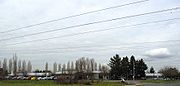
Rockcreek, Oregon
Encyclopedia
Rockcreek is a census-designated place
in Washington County, Oregon
, north of U.S. Route 26. It is named for the Rock Creek neighborhood in the area. As of the 2000 census, the CDP population was 9,404.
, with Cornelius Pass Road
dividing the two on the west and the Sunset Highway
as the dividing line on the south. According to the United States Census Bureau
, the CDP has a total area of 2 square miles (5.2 km²), none of which is covered with water.
and the Beaverton School District
. Fire protection is provided by Tualatin Valley Fire & Rescue, while law enforcement comes from the Washington County Sheriff. Rockcreek is with the Portland metropolitan area
's regional government, Metro
, while parks are provided by the Tualatin Hills Park & Recreation District
.
 As of the census
of 2000, there were 9,404 people, 3,501 households, and 2,559 families residing in the CDP. The population density
was 4,689.8 people per square mile (1,806.4/km²). There were 3,609 housing units at an average density of 1,799.8 per square mile (693.3/km²). The racial makeup of the CDP was 85.68% White, 0.84% African American, 0.47% Native American, 7.54% Asian, 0.28% Pacific Islander, 2.20% from other races
, and 3.00% from two or more races. Hispanic or Latino of any race were 4.58% of the population.
There were 3,501 households out of which 39.6% had children under the age of 18 living with them, 62.3% were married couples
living together, 7.8% had a female householder with no husband present, and 26.9% were non-families. 20.3% of all households were made up of individuals and 3.4% had someone living alone who was 65 years of age or older. The average household size was 2.69 and the average family size was 3.15.
In the CDP the population was spread out with 28.6% under the age of 18, 7.5% from 18 to 24, 31.5% from 25 to 44, 25.6% from 45 to 64, and 6.7% who were 65 years of age or older. The median age was 35 years. For every 100 females there were 102.5 males. For every 100 females age 18 and over, there were 100.9 males.
The median income for a household in the CDP was $63,958, and the median income for a family was $71,377. Males had a median income of $51,257 versus $34,591 for females. The per capita income
for the CDP was $30,102. About 4.2% of families and 6.5% of the population were below the poverty line, including 9.3% of those under age 18 and 2.0% of those age 65 or over.
Census-designated place
A census-designated place is a concentration of population identified by the United States Census Bureau for statistical purposes. CDPs are delineated for each decennial census as the statistical counterparts of incorporated places such as cities, towns and villages...
in Washington County, Oregon
Washington County, Oregon
- Major highways :* Interstate 5* Interstate 205* U.S. Route 26* Oregon Route 6* Oregon Route 8* Oregon Route 10* Oregon Route 47* Oregon Route 99W* Oregon Route 210* Oregon Route 217* Oregon Route 219-Demographics:...
, north of U.S. Route 26. It is named for the Rock Creek neighborhood in the area. As of the 2000 census, the CDP population was 9,404.
Geography
Rockcreek CDP is centered at 45°33′16"N 122°52′47"W (45.554391, -122.879787). The community is bordered on the south and west by HillsboroHillsboro, Oregon
Hillsboro is the fifth-largest city in the U.S. state of Oregon and is the county seat of Washington County. Lying in the Tualatin Valley on the west side of the Portland metropolitan area, the city is home to many high-technology companies, such as Intel, that compose what has become known as the...
, with Cornelius Pass Road
Cornelius Pass Road
Cornelius Pass Road is an arterial road over Cornelius Pass in the Tualatin Mountains west of Portland, Oregon, USA. Running north–south, the road stretches between U.S. Route 30 on the north and Oregon Route 8 on the south...
dividing the two on the west and the Sunset Highway
Sunset Highway (Oregon)
The Sunset Highway No. 47 , in the state of Oregon, is an official designation for the portion of U.S. Route 26 between its western terminus, south of Seaside, and the interchange with Interstate 405 in downtown Portland...
as the dividing line on the south. According to the United States Census Bureau
United States Census Bureau
The United States Census Bureau is the government agency that is responsible for the United States Census. It also gathers other national demographic and economic data...
, the CDP has a total area of 2 square miles (5.2 km²), none of which is covered with water.
Government
An unincorporated community, Rockcreek does not have a municipal government. Government services are provided by a variety of regional districts. The area lies within both the Hillsboro School DistrictHillsboro School District
The Hillsboro School District 1J is a unified school district located in Hillsboro, Oregon, United States. The district operates 26 elementary schools, four middle schools, and four high schools. Founded in 1851, the school district covers Hillsboro, Scholls, Reedville, North Plains, West Union,...
and the Beaverton School District
Beaverton School District
The Beaverton School District is a school district in suburban Beaverton and Portland, Oregon, United States. The Beaverton Elementary School District 48 was established in 1876, with other elementary districts later merged into the district. The elementary district was later merged with the high...
. Fire protection is provided by Tualatin Valley Fire & Rescue, while law enforcement comes from the Washington County Sheriff. Rockcreek is with the Portland metropolitan area
Portland metropolitan area
The Portland-Vancouver-Hillsboro, OR-WA Metropolitan Statistical Area , also known as the Portland metropolitan area or Greater Portland, is an urban area in the U.S. states of Oregon and Washington centered around the city of Portland, Oregon. The U.S...
's regional government, Metro
Metro (Oregon regional government)
Metro, formerly known as Metropolitan Service District, is the regional governmental agency for the Oregon portion of the Portland metropolitan area...
, while parks are provided by the Tualatin Hills Park & Recreation District
Tualatin Hills Park & Recreation District
Tualatin Hills Park & Recreation District is a special parks district located in the eastern part of Washington County in the U.S. state of Oregon. Created in 1955, the district covers all of the city of Beaverton and many of those communities surrounding Beaverton in the Portland metropolitan area...
.
Demographics
Census
A census is the procedure of systematically acquiring and recording information about the members of a given population. It is a regularly occurring and official count of a particular population. The term is used mostly in connection with national population and housing censuses; other common...
of 2000, there were 9,404 people, 3,501 households, and 2,559 families residing in the CDP. The population density
Population density
Population density is a measurement of population per unit area or unit volume. It is frequently applied to living organisms, and particularly to humans...
was 4,689.8 people per square mile (1,806.4/km²). There were 3,609 housing units at an average density of 1,799.8 per square mile (693.3/km²). The racial makeup of the CDP was 85.68% White, 0.84% African American, 0.47% Native American, 7.54% Asian, 0.28% Pacific Islander, 2.20% from other races
Race (United States Census)
Race and ethnicity in the United States Census, as defined by the Federal Office of Management and Budget and the United States Census Bureau, are self-identification data items in which residents choose the race or races with which they most closely identify, and indicate whether or not they are...
, and 3.00% from two or more races. Hispanic or Latino of any race were 4.58% of the population.
There were 3,501 households out of which 39.6% had children under the age of 18 living with them, 62.3% were married couples
Marriage
Marriage is a social union or legal contract between people that creates kinship. It is an institution in which interpersonal relationships, usually intimate and sexual, are acknowledged in a variety of ways, depending on the culture or subculture in which it is found...
living together, 7.8% had a female householder with no husband present, and 26.9% were non-families. 20.3% of all households were made up of individuals and 3.4% had someone living alone who was 65 years of age or older. The average household size was 2.69 and the average family size was 3.15.
In the CDP the population was spread out with 28.6% under the age of 18, 7.5% from 18 to 24, 31.5% from 25 to 44, 25.6% from 45 to 64, and 6.7% who were 65 years of age or older. The median age was 35 years. For every 100 females there were 102.5 males. For every 100 females age 18 and over, there were 100.9 males.
The median income for a household in the CDP was $63,958, and the median income for a family was $71,377. Males had a median income of $51,257 versus $34,591 for females. The per capita income
Per capita income
Per capita income or income per person is a measure of mean income within an economic aggregate, such as a country or city. It is calculated by taking a measure of all sources of income in the aggregate and dividing it by the total population...
for the CDP was $30,102. About 4.2% of families and 6.5% of the population were below the poverty line, including 9.3% of those under age 18 and 2.0% of those age 65 or over.
External links
- Rock Creek Tavern history from the McMenaminsMcMenaminsMcMenamins is a chain of nearly sixty brewpubs, microbreweries, music venues, historic hotels, and theater pubs. The chain is located mostly in the Portland metropolitan area, but has many other locations in Oregon and Washington...
website