

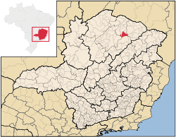
Riacho dos Machados
Encyclopedia
Minas Gerais
Minas Gerais is one of the 26 states of Brazil, of which it is the second most populous, the third richest, and the fourth largest in area. Minas Gerais is the Brazilian state with the largest number of Presidents of Brazil, the current one, Dilma Rousseff, being one of them. The capital is the...
, Brazil
Brazil
Brazil , officially the Federative Republic of Brazil , is the largest country in South America. It is the world's fifth largest country, both by geographical area and by population with over 192 million people...
. The population in 2007 was 9,392 in an area of 1,309 km². The elevation is 821 meters. It became a municipality in 1962. The postal code (CEP) is 39529-000.
Porteirinha is part of the statistical microregion of Janaúba
Janaúba
Janaúba is a municipality in the north of the Brazilian state of Minas Gerais. In 2007 the population was 65,387 in a total area of 2,189 km2. The elevation is 692 meters above sea level.-Location:...
. It is southeast of Janaúba on MG-120. The distance to Janauba is 66 km. Neighboring municipalities are: Porteirinha
Porteirinha
Porteirinha is a municipality in the northern region of Minas Gerais, Brazil. The population in 2007 was 36,864 in an area of 1,806 km². The elevation is 566 meters. It became a municipality in 1938. The postal code is 39520-000....
, Janaúba
Janaúba
Janaúba is a municipality in the north of the Brazilian state of Minas Gerais. In 2007 the population was 65,387 in a total area of 2,189 km2. The elevation is 692 meters above sea level.-Location:...
, Francisco Sá
Francisco Sá
Francisco Pedro Manuel Sá is a retired Argentine football defender.Sá holds the record for the most Copa Libertadores titles, he won six; 4 consecutive titles with Club Atlético Independiente between 1972 and 1975, and a further 2 with Boca Juniors in 1977 and 1978.Sá started his career with...
, Grão Mogol
Grão Mogol
Grão Mogol is a Brazilian municipality located in the north of the state of Minas Gerais. In 2007 the population was 14,954 in a total area of 3,890 km². The elevation is 829 meters. It became a municipality in 1840.-Location and Distances:...
, Rio Pardo de Minas
Rio Pardo de Minas
Rio Pardo de Minas is a municipality in the northeast of the Brazilian state of Minas Gerais. Its population in 2007 was 28,633 inhabitants in a total area of 3,119 km².-Important facts and Distances:...
, and Serranópolis de Minas
Serranópolis de Minas
Serranópolis de Minas is a municipality in the northern region of Minas Gerais, Brazil. The population in 2007 was 4,515 in an area of 553 km². The elevation is 555 meters. It became a municipality in 1997. The postal code is 39518-000....
. The distance to the state capital, Belo Horizonte
Belo Horizonte
Belo Horizonte is the capital of and largest city in the state of Minas Gerais, located in the southeastern region of Brazil. It is the third largest metropolitan area in the country...
, is 559 km.
The main economic activities are cattle raising (20,000 head in 2006) and farming with a large production of corn (4,350 ha.) and beans (2,890 ha.) and modest production of citrus fruits, cotton, and sorghum. In the urban area there were no financial institutions as of 2006. There were 197 automobiles, giving a ratio of about one automobile for every 46 inhabitants. The Gross Domestic Product was R$ 23,238,000 (2005) a year, which was mainly generated by services and agriculture. Health care was provided by 5 public health clinics. There were no private hospitals as of 2005.
Farm Data for 2006
- Producers: 1,193
- Area: 165,585 ha.
- Area planted in crops: 3,200 ha.
- Area of natural pasture: 17,878 ha.
- Area of woodland and forest: 134,455 ha.
- Persons occupied related to the producer: 3,829
- Salaried workers not related to the producer: 329
- Establishments with tractors: 24
- Number of tractors: 28
Municipal Human Development Index
Human Development Index
The Human Development Index is a composite statistic used to rank countries by level of "human development" and separate "very high human development", "high human development", "medium human development", and "low human development" countries...
Riacho dos Machados was in the bottom 100 of the poorest municipalities in Minas Gerais
- MHDI: .603 (2000)
- State ranking: 828 out of 853 municipalities as of 2000
- National ranking: 4,601 out of 5,138 municipalities as of 2000