
Raleigh Hills, Oregon
Encyclopedia
Raleigh Hills is a census-designated place
and neighborhood within the metropolitan area of Portland, Oregon
, in the United States
. It is located in the southwest hills in Washington County
, with Beaverton
to the west, West Slope
to the north, and Progress
and Garden Home to the south. As of the 2000 census, the census-designated place had a total population of 5,865.
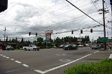
Raleigh Hills is located at the intersection of Oregon Routes 10 and 210.
line had a stop in Raleigh from 1914 until the line ceased operation in 1929. A Raleigh Hills branch of the Portland post office was opened in 1968.
According to the United States Census Bureau
, the neighborhood has a total area of four km² (1.5 sq mi), none of which is covered with water.
of 2000, there are 5865 people in the neighborhood, organized into 2586 households and 1561 families. The population density
is 3,829.5 people per square mile (1,480.1/km²). There are 2,786 housing units at an average density of 1,819.1/sq mi (703.1/km²). The racial makeup of the CDP is 90.08% White, 3.10% Asian, 0.99% African American, 0.31% Native American, 0.19% Pacific Islander, 3.34% from other races, and 1.99% from two or more races. 5.75% of the population are Hispanic or Latino of any race.
There are 2,586 households out of which 25.6% have children under the age of 18 living with them, 50.8% are married couples
living together, 6.3% have a female householder with no husband present, and 39.6% are non-families. 33.4% of all households are made up of individuals and 12.5% have someone living alone who is 65 years of age or older. The average household size is 2.26 and the average family size is 2.91.
In the neighborhood the population is spread out with 21.5% under the age of 18, 6.5% from 18 to 24, 25.6% from 25 to 44, 28.2% from 45 to 64, and 18.2% who are 65 years of age or older. The median age is 43 years. For every 100 females there are 95.3 males. For every 100 females age 18 and over, there are 90.4 males.
The median income for a household in the neighborhood is $60,714, and the median income for a family is $83,300. Males have a median income of $60,186 versus $34,769 for females. The per capita income
for the CDP is $37,839. 7.4% of the population and 5.0% of families are below the poverty line. Out of the total population, 11.7% of those under the age of 18 and 2.0% of those 65 and older are living below the poverty line.
Census-designated place
A census-designated place is a concentration of population identified by the United States Census Bureau for statistical purposes. CDPs are delineated for each decennial census as the statistical counterparts of incorporated places such as cities, towns and villages...
and neighborhood within the metropolitan area of Portland, Oregon
Portland, Oregon
Portland is a city located in the Pacific Northwest, near the confluence of the Willamette and Columbia rivers in the U.S. state of Oregon. As of the 2010 Census, it had a population of 583,776, making it the 29th most populous city in the United States...
, in the United States
United States
The United States of America is a federal constitutional republic comprising fifty states and a federal district...
. It is located in the southwest hills in Washington County
Washington County, Oregon
- Major highways :* Interstate 5* Interstate 205* U.S. Route 26* Oregon Route 6* Oregon Route 8* Oregon Route 10* Oregon Route 47* Oregon Route 99W* Oregon Route 210* Oregon Route 217* Oregon Route 219-Demographics:...
, with Beaverton
Beaverton, Oregon
Beaverton is a city in Washington County, Oregon, United States, seven miles west of Portland in the Tualatin River Valley.As of the 2010 census, the population is 90,267. This makes it the second-largest city in the county and Oregon's sixth-largest city...
to the west, West Slope
West Slope, Oregon
West Slope is an unincorporated suburb of Portland, Oregon, U.S. and a census-designated place. It is in Washington County, to the west of Portland's West Hills neighborhood, to the northeast of Raleigh Hills and south of U.S...
to the north, and Progress
Progress, Oregon
Progress, Oregon is a neighborhood in Washington County, Oregon, United States. Originally an unincorporated community that stood apart from any city, most of Progress now lies within the city limits of either Tigard or Beaverton...
and Garden Home to the south. As of the 2000 census, the census-designated place had a total population of 5,865.
Raleigh Hills is located at the intersection of Oregon Routes 10 and 210.
History
Raleigh Hills was named after Raleigh Robinson, a resident of the neighborhood. A post office named Raleigh was established in the area April 1892, and was closed twelve years later. Southern Pacific's Red ElectricRed Electric
The Red Electric was an interurban passenger train service operated by the Southern Pacific Railroad in the Willamette Valley of the U.S. state of Oregon from 1914 to 1929. The service got its name from the bright red color of its cars. Despite its short history, among West Coast interurbans it was...
line had a stop in Raleigh from 1914 until the line ceased operation in 1929. A Raleigh Hills branch of the Portland post office was opened in 1968.
Geography
Raleigh Hills is located at 45°29'5" North, 122°45'20" West (45.484790, -122.755575).According to the United States Census Bureau
United States Census Bureau
The United States Census Bureau is the government agency that is responsible for the United States Census. It also gathers other national demographic and economic data...
, the neighborhood has a total area of four km² (1.5 sq mi), none of which is covered with water.
Demographics
As of the censusCensus
A census is the procedure of systematically acquiring and recording information about the members of a given population. It is a regularly occurring and official count of a particular population. The term is used mostly in connection with national population and housing censuses; other common...
of 2000, there are 5865 people in the neighborhood, organized into 2586 households and 1561 families. The population density
Population density
Population density is a measurement of population per unit area or unit volume. It is frequently applied to living organisms, and particularly to humans...
is 3,829.5 people per square mile (1,480.1/km²). There are 2,786 housing units at an average density of 1,819.1/sq mi (703.1/km²). The racial makeup of the CDP is 90.08% White, 3.10% Asian, 0.99% African American, 0.31% Native American, 0.19% Pacific Islander, 3.34% from other races, and 1.99% from two or more races. 5.75% of the population are Hispanic or Latino of any race.
There are 2,586 households out of which 25.6% have children under the age of 18 living with them, 50.8% are married couples
Marriage
Marriage is a social union or legal contract between people that creates kinship. It is an institution in which interpersonal relationships, usually intimate and sexual, are acknowledged in a variety of ways, depending on the culture or subculture in which it is found...
living together, 6.3% have a female householder with no husband present, and 39.6% are non-families. 33.4% of all households are made up of individuals and 12.5% have someone living alone who is 65 years of age or older. The average household size is 2.26 and the average family size is 2.91.
In the neighborhood the population is spread out with 21.5% under the age of 18, 6.5% from 18 to 24, 25.6% from 25 to 44, 28.2% from 45 to 64, and 18.2% who are 65 years of age or older. The median age is 43 years. For every 100 females there are 95.3 males. For every 100 females age 18 and over, there are 90.4 males.
The median income for a household in the neighborhood is $60,714, and the median income for a family is $83,300. Males have a median income of $60,186 versus $34,769 for females. The per capita income
Per capita income
Per capita income or income per person is a measure of mean income within an economic aggregate, such as a country or city. It is calculated by taking a measure of all sources of income in the aggregate and dividing it by the total population...
for the CDP is $37,839. 7.4% of the population and 5.0% of families are below the poverty line. Out of the total population, 11.7% of those under the age of 18 and 2.0% of those 65 and older are living below the poverty line.
External links
- Beaverton Valley Times, the neighborhood's local newspaper
- Citizen Participation Organization 3, the area neighborhood association
- Raleigh Water District