
Preston Rural East
Encyclopedia
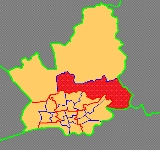
Preston Rural East is an electoral ward in the City of Preston, Lancashire
, England. The ward is in the eastern and northeastern part of the city near the M55 motorway
moving out towards Sherwood and Grimsargh
.
, the ward of Preston Rural East is parished, in that it has within it parish councils with their own structure and elected councillors. The parishes within Preston Rural East are Grimsargh
, Haighton
, and Broughton-in-Amounderness.
, the electorate of the ward was 3,905.
The ward forms, in conjunction with its neighbour Preston Rural North
, the Lancashire County Council
electoral division of Preston Rural.
City of Preston, Lancashire
The City of Preston is a city and non-metropolitan district in Lancashire, England. It is located on the north bank of the River Ribble, and was granted city status in 2002, becoming England's 50th city in the 50th year of Queen Elizabeth II's reign...
, England. The ward is in the eastern and northeastern part of the city near the M55 motorway
M55 motorway
The M55 is a motorway in Lancashire, England, which can also be referred to as the Preston Northern Bypass. It connects the seaside resort of Blackpool to the M6 at Preston. It is 11.4 miles in length.-Route:...
moving out towards Sherwood and Grimsargh
Grimsargh
Grimsargh is a village and civil parish in the City of Preston, Lancashire, England. According to the 2001 census the parish had a population of 2,164. The parish is part of the electoral ward of Preston Rural East.-Geography:...
.
Parishes
Unlike many other districts of PrestonDistricts of Preston
Preston is a city of Lancashire, England. The districts of Preston vary in size and shape, many of which reflect the districts developed from former villages and boroughs which now lie within the boundaries of the city of Preston. Districts of Preston have little administrative purpose: for local...
, the ward of Preston Rural East is parished, in that it has within it parish councils with their own structure and elected councillors. The parishes within Preston Rural East are Grimsargh
Grimsargh
Grimsargh is a village and civil parish in the City of Preston, Lancashire, England. According to the 2001 census the parish had a population of 2,164. The parish is part of the electoral ward of Preston Rural East.-Geography:...
, Haighton
Haighton
Haighton is a civil parish in the City of Preston, Lancashire, England. It is a rural area north east of the urban city of Preston, beyond Fulwood and Brookfield.-Geography:Haighton also contains the hamlets of Haighton Green and Haighton Top...
, and Broughton-in-Amounderness.
Current councillors
| Election | Member | Party | |
|---|---|---|---|
| Preston Council election, 2007 | Neil Cartwright | Conservative Party | |
| Preston Council election, 2008 Preston Council election, 2008 Elections to Preston City Council took place on 1 May 2008.Preston council is elected "in thirds" which means one councillor from each three-member ward, and councillors from selected two-member wards, are elected each year, with one year free from all elections to ensure all councillors serve a... |
Thomas Davies | Conservative Party | |
Demographics
At the most recent census in 2001, the electoral ward of Preston Rural East had a population of 3,814. Over 88% described themselves as Christian. Many of the people living in the wards and parishes rely on farming and agriculture for their living. At the most recent elections, the Preston Council election, 2008Preston Council election, 2008
Elections to Preston City Council took place on 1 May 2008.Preston council is elected "in thirds" which means one councillor from each three-member ward, and councillors from selected two-member wards, are elected each year, with one year free from all elections to ensure all councillors serve a...
, the electorate of the ward was 3,905.
The ward forms, in conjunction with its neighbour Preston Rural North
Preston Rural North
Preston Rural North is an electoral ward in the City of Preston, Lancashire, England. The ward is the largest by area in the city, containing the smaller and smallest villages from the northern areas of Preston, from Woodplumpton bordering the M55 motorway junction at Broughton, to Beacon Fell at...
, the Lancashire County Council
Lancashire County Council
Lancashire County Council is the upper-tier local authority for the non-metropolitan county of Lancashire, England. It currently consists of 84 councillors, and is controlled by the Conservative Party, who won control of the council in the local council elections in June 2009, ending 28 years of...
electoral division of Preston Rural.