

Presidente Kubitschek
Encyclopedia
Brazil
Brazil , officially the Federative Republic of Brazil , is the largest country in South America. It is the world's fifth largest country, both by geographical area and by population with over 192 million people...
ian municipality in the state of Minas Gerais
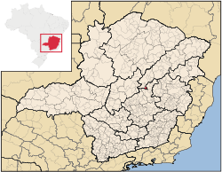
Minas Gerais
Minas Gerais is one of the 26 states of Brazil, of which it is the second most populous, the third richest, and the fourth largest in area. Minas Gerais is the Brazilian state with the largest number of Presidents of Brazil, the current one, Dilma Rousseff, being one of them. The capital is the...
. Its population as of 2007 was 2,978 living in a total area of 189 km². The city belongs to the statistical mesoregion
Mesoregion (Brazil)
Mesoregions are subdivisions of Brazilian states, grouping together various municipalities in proximity and with common characteristics. They were created by the Brazilian Institute of Geography and Statistics for statistical purposes and do not, therefore, constitute an administrative area....
of Jequitinhonha
Jequitinhonha
Jequitinhonha is a Brazilian municipality located in the northeast of the state of Minas Gerais.The population as of 2007 was estimated to be 23,982 people living in a total area of 3,518 km². The city belongs to the mesoregion of Jequitinhonha and to the microregion of Almenara. ...
and to the statistical microregion
Microregion (Brazil)
Microregions are legally defined administrative areas in Brazil consisting of groups of municipalities bordering urban areas. Microregions are grouped together into mesoregions....
of Diamantina. It became a municipality in 1962.
The municipal seat of Presidente Kubitschek is located at an elevation of 1109 meters in the upper Jequitinhonha River
Jequitinhonha River
thumb|Source of the river in [[Serro]]|rightThe Jequitinhonha River is a river that flows mainly through the Brazilian state of Minas Gerais. Its source lies near Diamantina in the Serra do Espinhaço at an elevation of 1,200 m, after which it flows northward and then east-northeastward across the...
valley. It is south of Diamantina to which it is connected by state highways MG-259 and federal highway BR-267. The nearest major population center is Diamantina.
The distance to Diamantina is 54 km; and the distance to Belo Horizonte
Belo Horizonte
Belo Horizonte is the capital of and largest city in the state of Minas Gerais, located in the southeastern region of Brazil. It is the third largest metropolitan area in the country...
is 298 km. Neighboring municipalities are: Datas
Datas
Datas is a Brazilian municipality located in the north-center of the state of Minas Gerais. Its population as of 2007 was 5,418 living in a total area of 309 km². The city belongs to the statistical mesoregion of Jequitinhonha and to the statistical microregion of Diamantina. It became a...
, Santo Antônio do Itambé
Santo Antônio do Itambé
Santo Antônio do Itambé is a town in the state of Minas Gerais, Brazil. Its coordinates are 18.46625/18°27'57" S and the longitude is 43.315/43°18'25" W. It has 4,692 inhabitants and the area is 303.857 km²...
, Conceição do Mato Dentro
Conceição do Mato Dentro
Conceição do Mato Dentro is a Brazilian municipality located in the state of Minas Gerais. The city belongs to the mesoregion Metropolitana de Belo Horizonte and to the microregion of Conceição do Mato Dentro.-See also:...
and Gouveia
Gouveia, Minas Gerais
Gouveia is a Brazilian municipality located in the center of the state of Minas Gerais. Its population as of 2007 was 11,569 living in a total area of 874 km². The city belongs to the statistical mesoregion of Jequitinhonha and to the statistical microregion of Diamantina. It became a municipality...
.
The main economic activities are services, and agriculture. The GDP in 2005 was R$8 million, with 6 million from services, 700 thousand from industry, and 1 million from agriculture. There were 118 rural producers on 3,000 hectares of land. Only 4 farms had tractors (2006). The main crops cultivated were tropical fruits, sugarcane, beans, and corn. There were 1,700 head of cattle (2006). In 2007 there were no banks in the town.
Presidente Kubitschek is ranked in the bottom tier of municipalities in the state and country in human development.
- Municipal Human Development IndexHuman Development IndexThe Human Development Index is a composite statistic used to rank countries by level of "human development" and separate "very high human development", "high human development", "medium human development", and "low human development" countries...
: 0.671 (2000) - State ranking: 668 out of 853 municipalities as of 2000
- National ranking: 3443 out of 5,138 municipalities as of 2000
- Literacy rate: 81%
- Life expectancy: 66 (average of males and females)
The highest ranking municipality in Minas Gerais in 2000 was Poços de Caldas
Poços de Caldas
Poços de Caldas is a city and municipality in south-western Minas Gerais state, Brazil, in the microregion of the same name. Its estimated population in 2009 was 151,449 inhabitants...
with 0.841, while the lowest was Setubinha
Setubinha
Setubinha is a municipality in the northeast of the Brazilian state of Minas Gerais. As of 2007 the population was 10,834 in a total area of 536 km². The elevation is 729 metres. It is part of the IBGE statistical microregion of Teófilo Otoni...
with 0.568. Nationally the highest was São Caetano do Sul
São Caetano do Sul
São Caetano do Sul is a city in São Paulo state in Brazil, located in the Greater São Paulo Metropolitan Area. It is the city with the highest per capita income in Brazil and it also has the highest Human Development Index .-Geography:São Caetano do Sul is located on a plateau that is part of the...
in São Paulo with 0.919, while the lowest was Setubinha. In more recent statistics (considering 5,507 municipalities) Manari in the state of Pernambuco
Pernambuco
Pernambuco is a state of Brazil, located in the Northeast region of the country. To the north are the states of Paraíba and Ceará, to the west is Piauí, to the south are Alagoas and Bahia, and to the east is the Atlantic Ocean. There are about of beaches, some of the most beautiful in the...
has the lowest rating in the country--0,467--putting it in last place.
There were 2 health clinics in 2005. Patients with more serious health conditions are transported to Diamantina. Educational needs were met by 1 primary school (2007).
See also
- List of municipalities in Minas Gerais