
Pilot Peak, Nevada
Encyclopedia
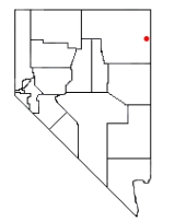
Pilot Peak is the highest point and the predominant mountain of the Pilot Range
in far eastern Elko County
, Nevada
in the western United States
. It rises over 6400 feet (1,951 m) above the Great Salt Lake Desert
to the east, making it one of the largest mountains in terms of local relief in the contiguous United States
.
Pilot Peak was named in 1845 for its use as an easily recognized landmark. John C. Fremont
saw the peak from the east during his third expedition, mapping the Great Basin
. Wondering whether his entire party could cross the desert he sent Kit Carson
ahead to scout for water sources. Finding a perennial spring just east of the peak, Carson lit a large bonfire, the smoke from which signalled Fremont that the crossing was possible.
In 1846 the Donner Party
also used the peak as a landmark for their crossing of the Great Salt Lake Desert, part of the Hastings Cutoff
emigrant route. Running out of water, they had to temporarily abandon their wagons and oxen in order to reach the springs (now called Donner Springs) at the base of the peak. They eventually recovered most of their stock animals and wagons, and continued their journey to the California Trail
and the Sierra Nevada mountains.
Pilot Range
The Pilot Range is a mountain range located in Box Elder County, Utah and Elko County, Nevada, in the Great Basin region, near the northwest side of The Great Salt Lake....
in far eastern Elko County
Elko County, Nevada
-Demographics:As of the census of 2000, there were 45,291 people, 15,638 households, and 11,493 families residing in the county. The population density was 3/sq mi . There were 18,456 housing units at an average density of 1/sq mi...
, Nevada
Nevada
Nevada is a state in the western, mountain west, and southwestern regions of the United States. With an area of and a population of about 2.7 million, it is the 7th-largest and 35th-most populous state. Over two-thirds of Nevada's people live in the Las Vegas metropolitan area, which contains its...
in the western United States
United States
The United States of America is a federal constitutional republic comprising fifty states and a federal district...
. It rises over 6400 feet (1,951 m) above the Great Salt Lake Desert
Great Salt Lake Desert
The Great Salt Lake Desert is a large dry lake in northern Utah between the Great Salt Lake and the Nevada border which is noted for white sand from evaporite Lake Bonneville salt deposits...
to the east, making it one of the largest mountains in terms of local relief in the contiguous United States
Contiguous United States
The contiguous United States are the 48 U.S. states on the continent of North America that are south of Canada and north of Mexico, plus the District of Columbia....
.
Pilot Peak was named in 1845 for its use as an easily recognized landmark. John C. Fremont
John C. Frémont
John Charles Frémont , was an American military officer, explorer, and the first candidate of the anti-slavery Republican Party for the office of President of the United States. During the 1840s, that era's penny press accorded Frémont the sobriquet The Pathfinder...
saw the peak from the east during his third expedition, mapping the Great Basin
Great Basin
The Great Basin is the largest area of contiguous endorheic watersheds in North America and is noted for its arid conditions and Basin and Range topography that varies from the North American low point at Badwater Basin to the highest point of the contiguous United States, less than away at the...
. Wondering whether his entire party could cross the desert he sent Kit Carson
Kit Carson
Christopher Houston "Kit" Carson was an American frontiersman and Indian fighter. Carson left home in rural present-day Missouri at age 16 and became a Mountain man and trapper in the West. Carson explored the west to California, and north through the Rocky Mountains. He lived among and married...
ahead to scout for water sources. Finding a perennial spring just east of the peak, Carson lit a large bonfire, the smoke from which signalled Fremont that the crossing was possible.
In 1846 the Donner Party
Donner Party
The Donner Party was a group of American pioneers who set out for California in a wagon train. Delayed by a series of mishaps, they spent the winter of 1846–47 snowbound in the Sierra Nevada...
also used the peak as a landmark for their crossing of the Great Salt Lake Desert, part of the Hastings Cutoff
Hastings Cutoff
The Hastings Cutoff was an alternate route for emigrants to travel to California, as proposed by Lansford Hastings.In 1845, Hastings published a guide entitled The Emigrant's Guide to Oregon and California...
emigrant route. Running out of water, they had to temporarily abandon their wagons and oxen in order to reach the springs (now called Donner Springs) at the base of the peak. They eventually recovered most of their stock animals and wagons, and continued their journey to the California Trail
California Trail
The California Trail was an emigrant trail of about across the western half of the North American continent from Missouri River towns to what is now the state of California...
and the Sierra Nevada mountains.