
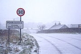
Penruddock
Encyclopedia
Penruddock is a small village in Cumbria
, England
, a few miles to the west of Penrith
. It forms part of the civil parish of Hutton
.
now lies between the two. The village of Penruddock itself is situated over limestone which is visible in many places, with craggy outcrops and a limestone pavement on the eastern boundary, and the remains of an ancient lime burning kiln on the north western boundary. The soil over the limestone is a fairly heavy clay which retains water, with the result of keeping vegetation alive during times of drought, but creating very wet conditions for long periods during the winter months.
, just to the north of the A66 road
.
Its railway station
on the former Cockermouth, Keswick and Penrith Railway
closed in the 1970s and was demolished on 4 March 1997. The closest station is at Penrith
.
Cumbria
Cumbria , is a non-metropolitan county in North West England. The county and Cumbria County Council, its local authority, came into existence in 1974 after the passage of the Local Government Act 1972. Cumbria's largest settlement and county town is Carlisle. It consists of six districts, and in...
, England
England
England is a country that is part of the United Kingdom. It shares land borders with Scotland to the north and Wales to the west; the Irish Sea is to the north west, the Celtic Sea to the south west, with the North Sea to the east and the English Channel to the south separating it from continental...
, a few miles to the west of Penrith
Penrith, Cumbria
Penrith was an urban district between 1894 and 1974, when it was merged into Eden District.The authority's area was coterminous with the civil parish of Penrith although when the council was abolished Penrith became an unparished area....
. It forms part of the civil parish of Hutton
Hutton, Cumbria
Hutton is a small civil parish about west of Penrith in the English county of Cumbria. The parish contains the small mansion and former pele tower of Hutton John, the seat of the Huddleston family....
.
History
The name Penruddock is Cumbric. With both red soil and red sandstone in the area to the south, the word Penruddock is likely derived from the word Pen (hill) and a derivative of the word rhudd (red). Red Hill is also the believed translation of the word Penrith and an area called RedhillsRedhills
Redhills is a hamlet in the civil parish of Dacre, in the Eden District, in the English county of Cumbria.- Location :...
now lies between the two. The village of Penruddock itself is situated over limestone which is visible in many places, with craggy outcrops and a limestone pavement on the eastern boundary, and the remains of an ancient lime burning kiln on the north western boundary. The soil over the limestone is a fairly heavy clay which retains water, with the result of keeping vegetation alive during times of drought, but creating very wet conditions for long periods during the winter months.
Transport
Penruddock can be reached by car approximately 5.5 miles (8.9 km) west of PenrithPenrith, Cumbria
Penrith was an urban district between 1894 and 1974, when it was merged into Eden District.The authority's area was coterminous with the civil parish of Penrith although when the council was abolished Penrith became an unparished area....
, just to the north of the A66 road
A66 road
The A66 is a major road in northern England which in part follows the course of the Roman road from Scotch Corner to Penrith. It runs from east of Middlesbrough in the ceremonial county of North Yorkshire to Workington in Cumbria...
.
Its railway station
Penruddock railway station
Penruddock railway station was situated on the Cockermouth, Keswick and Penrith Railway between Penrith and Cockermouth in Cumbria, England. The station served the village of Penruddock. The station opened to passenger traffic on 2 January 1865, and closed on 6 March 1972.-External links:...
on the former Cockermouth, Keswick and Penrith Railway
Cockermouth, Keswick and Penrith Railway
The Cockermouth, Keswick and Penrith Railway was incorporated by Act of Parliament on 1 August 1861, for a line connecting the town of Cockermouth with the London and North Western Railway West Coast Main Line at Penrith. Arrangements for the use of the stations at either end The Cockermouth,...
closed in the 1970s and was demolished on 4 March 1997. The closest station is at Penrith
Penrith railway station
Penrith railway station is located on the West Coast Main Line in the United Kingdom. It serves the town of Penrith, Cumbria and is less than one mile from its centre...
.