

Pellegrini Avenue (Rosario)
Encyclopedia
Rosario
Rosario is the largest city in the province of Santa Fe, Argentina. It is located northwest of Buenos Aires, on the western shore of the Paraná River and has 1,159,004 residents as of the ....
, Santa Fe Province
Santa Fe Province
The Invincible Province of Santa Fe, in Spanish Provincia Invencible de Santa Fe , is a province of Argentina, located in the center-east of the country. Neighboring provinces are from the north clockwise Chaco , Corrientes, Entre Ríos, Buenos Aires, Córdoba, and Santiago del Estero...
, Argentina
Argentina
Argentina , officially the Argentine Republic , is the second largest country in South America by land area, after Brazil. It is constituted as a federation of 23 provinces and an autonomous city, Buenos Aires...
. It is a two-way
Two-way street
A two-way street is a street that allows vehicles to travel in both directions. On most two-way streets, especially main streets, a line is painted down the middle of the road to remind drivers to stay on their side of the road. Sometimes one portion of a street is two-way, the other portion one-way...
avenue
Street name
A street name or odonym is an identifying name given to a street. The street name usually forms part of the address...
that runs east–west through the center-south of the city, from the coastal avenue by the Paraná River
Paraná River
The Paraná River is a river in south Central South America, running through Brazil, Paraguay and Argentina for some . It is second in length only to the Amazon River among South American rivers. The name Paraná is an abbreviation of the phrase "para rehe onáva", which comes from the Tupi language...
to the western limit of the urbanized area. Together with the river and with Oroño Boulevard
Oroño Boulevard
Oroño Boulevard is a street in Rosario, Santa Fe Province, Argentina. It is a two-way boulevard that runs north–south through the center-east of the city, from the coastal avenue by the Paraná River to the southern limit of the urbanized area...
, it also marks the unofficial limit of the downtown area.
The avenue has two wide lanes and a narrow central reservation
Central reservation
On divided roads, such as divided highways or freeways/motorways, the central reservation , median, parkway , median strip or central nature strip is the area which separates opposing lanes of traffic...
, usually lined with small trees and bushes. It starts near the shore of the Paraná River and climbs towards the downtown between grassy slopes formed by elevated level sidewalks. East of this area there lies the Parque Urquiza
Parque Urquiza
The Parque Urquiza is a public urban park in Rosario, Argentina. It is located in the southeastern end of the city center, on top of the Paraná River ravines. It is bordered by 3 de Febrero St., the coastal Belgrano Avenue, Chacabuco St. and the beginning of Pellegrini Avenue...
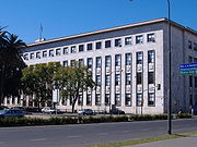
. Upon reaching the level of the rest of the central city area, it passes by the massive building that hosts the School of Engineering
Facultad de Ciencias Exactas, Ingeniería y Agrimensura (UNR)
The Faculty of Exact Sciences, Engineering and Surveying of the National University of Rosario is an institution of higher learning in Rosario, Argentina.-Course offerings:...
of the National University of Rosario
National University of Rosario
The National University of Rosario is a research, educational and public university located in the city of Rosario, province of Santa Fe, Argentina.-Overview:...
, as well as its affiliated Politécnico secondary school. It then becomes a highly commercial street, hosting a large number of fine restaurants, canteens, bars, pizza parlours and icecream shops. A few blocks to the west lie the Tribunals of Rosario. Its intersection with Oroño Boulevard marks one of the corners of the Parque de la Independencia
Parque de la Independencia
The Parque de la Independencia is a large public park in Rosario, province of Santa Fe, Argentina. It is located near the geographical center of the city, its limits defined by Moreno Street and three important avenues: Pellegrini Avenue, Ovidio Lagos Avenue, and 27 de Febrero Boulevard...
, which is the city's largest green area.
Pellegrini is also one of Rosario's arterial road
Arterial road
An arterial road, or arterial thoroughfare, is a high-capacity urban road. The primary function of an arterial road is to deliver traffic from collector roads to freeways, and between urban centres at the highest level of service possible. As such, many arteries are limited-access roads, or feature...
s and one of its primary accesses from the west. After crossing the whole city, it turns into the Rosario–Córdoba Highway
Rosario-Córdoba Highway
The Rosario–Córdoba Highway is a highway under construction in the central region of Argentina, which will link the second- and third-largest cities in the country . Besides these, it will pass by the cities of Carcarañá , Marcos Juárez, and Villa María .The route is scheduled to be finished by the...
.
The avenue was inaugurated in 1868 as Bulevar Argentino, as part of a program of the municipality (created 6 years before) to beautify the city, then home to 23,000 residents, and which also included the opening of Oroño Boulevard (then Bulevar Santafesino). Its current name is an homage to Carlos Pellegrini
Carlos Pellegrini
Carlos Enrique José Pellegrini Bevans was President of Argentina from 6 August 1890 to 12 October 1892....
(president of Argentina from to 1890 to 1892).