
Ortley, Oregon
Encyclopedia

Wasco County, Oregon
Wasco County is a county located in the U.S. state of Oregon. The county is named for a local tribe of Native Americans, the Wasco, a Chinook tribe who lived on the south side of the Columbia River. In 2010, its population was 25,213...
, in the United States
United States
The United States of America is a federal constitutional republic comprising fifty states and a federal district...
. It was originally developed by the Hood River Orchard & Land Company which filed a plat
Plat
A plat in the U.S. is a map, drawn to scale, showing the divisions of a piece of land. Other English-speaking countries generally call such documents a cadastral map or plan....
for the townsite in 1911, naming it for the Ortley
Ortley
Ortley is a variety of apple, medium in size, and light green to yellow in color. Usually ripening for a late fall harvest, it was developed in New Jersey, and was first commercially produced in 1825....
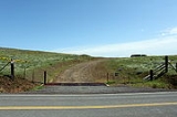
, a variety of apple. The company sold town lots and small orchard parcels, and Ortley quickly grew to a population of 300. The community included a post office, several shops and a hotel. However, the land proved unsuitable for apple production because of the prevailing high winds and scarcity of water. By 1922, the town was all but abandoned, and in that year the post office closed.
The Ortley townsite is located atop Sevenmile Hill, nine miles west of The Dalles
The Dalles, Oregon
The Dalles is the largest city and county seat of Wasco County, Oregon, United States. The name of the city comes from the French word dalle The Dalles is the largest city and county seat of Wasco County, Oregon, United States. The name of the city comes from the French word dalle The Dalles is...
, on the old state highway that used to connect that city and Mosier
Mosier, Oregon
Mosier is a city in Wasco County, Oregon, United States. The population was 410 at the 2000 census.-History:Mosier was first settled in 1854 and incorporated as a city in 1914. The building now known as the post office was at that time the bank, and the original safe is still intact on-site. ...
.
External links
- Photo collection at Columbia Gorge Discovery Center (Type "Ortley" into search box.)
- Ortley page on ghostowns.com
45°39′22"N 121°17′12.98"W