
Oregon Route 452
Encyclopedia
Oregon Route 452 is an Oregon
state highway
running from OR 201 near Adrian
to State Line Road at the Idaho
state line. OR 452 is known as the Parma Spur of the Succor Creek Highway No. 450 (see Oregon highways and routes). It is 2.75 miles (4.4 km) long and runs east–west, entirely within Malheur County
.
OR 452 was established in 2003 as part of Oregon's project to assign route numbers to highways that previously were not assigned, and, as of July 2010, was unsigned.
Oregon
Oregon is a state in the Pacific Northwest region of the United States. It is located on the Pacific coast, with Washington to the north, California to the south, Nevada on the southeast and Idaho to the east. The Columbia and Snake rivers delineate much of Oregon's northern and eastern...
state highway
State highway
State highway, state road or state route can refer to one of three related concepts, two of them related to a state or provincial government in a country that is divided into states or provinces :#A...
running from OR 201 near Adrian
Adrian, Oregon
Adrian is a city in Malheur County, Oregon, United States, near the confluence of the Snake River and the Owyhee River. The population was 147 at the 2000 census and a census estimated population of 140 in 2009. It is part of the Ontario, OR–ID Micropolitan Statistical Area.-History:In 1913,...
to State Line Road at the Idaho
Idaho
Idaho is a state in the Rocky Mountain area of the United States. The state's largest city and capital is Boise. Residents are called "Idahoans". Idaho was admitted to the Union on July 3, 1890, as the 43rd state....
state line. OR 452 is known as the Parma Spur of the Succor Creek Highway No. 450 (see Oregon highways and routes). It is 2.75 miles (4.4 km) long and runs east–west, entirely within Malheur County
Malheur County, Oregon
Malheur County is a county located in the southeast corner of the U.S. state of Oregon. It is included in the eight-county definition of Eastern Oregon. Most of the county observes the Mountain Time Zone, although the southern quarter of the county observes the Pacific Time Zone along with the...
.
OR 452 was established in 2003 as part of Oregon's project to assign route numbers to highways that previously were not assigned, and, as of July 2010, was unsigned.
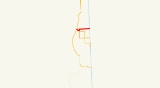
Route description
OR 452 begins at an intersection with OR 201 at Adrian and heads east, crossing OR 454 and continuing to the Idaho state line, where it ends at an intersection with State Line Road.Major intersections
| Milepost | City | Intersection |
|---|---|---|
| Y12.51 | Adrian Adrian, Oregon Adrian is a city in Malheur County, Oregon, United States, near the confluence of the Snake River and the Owyhee River. The population was 147 at the 2000 census and a census estimated population of 140 in 2009. It is part of the Ontario, OR–ID Micropolitan Statistical Area.-History:In 1913,... |
OR 201 |
| Y13.01 | Adrian Adrian, Oregon Adrian is a city in Malheur County, Oregon, United States, near the confluence of the Snake River and the Owyhee River. The population was 147 at the 2000 census and a census estimated population of 140 in 2009. It is part of the Ontario, OR–ID Micropolitan Statistical Area.-History:In 1913,... |
OR 454 Oregon Route 454 Oregon Route 454 is an Oregon state highway running from OR 452 near Adrian to Peckham Road on the Idaho state line near Adrian. OR 454 is known as the Adrian-Caldwell Highway No. 454... |
| Y15.23 | Near Adrian Adrian, Oregon Adrian is a city in Malheur County, Oregon, United States, near the confluence of the Snake River and the Owyhee River. The population was 147 at the 2000 census and a census estimated population of 140 in 2009. It is part of the Ontario, OR–ID Micropolitan Statistical Area.-History:In 1913,... |
Idaho Idaho Idaho is a state in the Rocky Mountain area of the United States. The state's largest city and capital is Boise. Residents are called "Idahoans". Idaho was admitted to the Union on July 3, 1890, as the 43rd state.... state line |