
Oregon Route 182
Encyclopedia
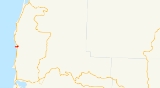
Oregon Route 182 is an Oregon
state highway
running from Devils Punch Bowl State Park
in Lincoln County
to US 101
near Newport, Oregon
, United States. OR 182 is known as the Otter Rock Highway No. 182 (see Oregon highways and routes). It is 0.75 miles (1.2 km) long and runs east–west, entirely within Lincoln County. It primarily functions as a spur route
to the state park.
OR 182 was established in 2002 as part of Oregon's project to assign route numbers to highways that previously were not assigned, and, as of July 2007, was unsigned.
Oregon
Oregon is a state in the Pacific Northwest region of the United States. It is located on the Pacific coast, with Washington to the north, California to the south, Nevada on the southeast and Idaho to the east. The Columbia and Snake rivers delineate much of Oregon's northern and eastern...
state highway
State highway
State highway, state road or state route can refer to one of three related concepts, two of them related to a state or provincial government in a country that is divided into states or provinces :#A...
running from Devils Punch Bowl State Park
Devils Punch Bowl State Natural Area
Devils Punch Bowl State Natural Area is a state day use park on the central Oregon Coast in the United States. It is centered on a large bowl naturally carved in a rock headland which is partially open to the Pacific Ocean. Waves enter the bowl and often violently churn, swirl, and foam...
in Lincoln County
Lincoln County, Oregon
-National protected areas:*Oregon Islands National Wildlife Refuge *Siletz Bay National Wildlife Refuge*Siuslaw National Forest -Demographics:...
to US 101
U.S. Route 101 in Oregon
In the U.S. state of Oregon, U.S. Route 101, a major north–south U.S. Highway, runs through the state along the coastline near the Pacific Ocean. In Oregon, it runs from the Oregon–California border, south of Brookings, to the Oregon–Washington border on the Columbia River, between Astoria,...
near Newport, Oregon
Newport, Oregon
Newport is a city in Lincoln County, Oregon, United States. It was incorporated in 1882, though the name dates back to the establishment of a post office in 1868...
, United States. OR 182 is known as the Otter Rock Highway No. 182 (see Oregon highways and routes). It is 0.75 miles (1.2 km) long and runs east–west, entirely within Lincoln County. It primarily functions as a spur route
Spur route
A spur route is a short road forming a branch from a longer, more important route . A bypass or beltway is never considered a true spur route as it typically reconnects with the major road...
to the state park.
OR 182 was established in 2002 as part of Oregon's project to assign route numbers to highways that previously were not assigned, and, as of July 2007, was unsigned.
Route description
OR 182 begins at Devils Punch Bowl State Park. It heads east to an intersection with US 101 approximately four miles north of Newport, where it ends.Major intersections
| Milepost | City | Intersection |
|---|---|---|
| 0.00 | Devils Punch Bowl State Park Devils Punch Bowl State Natural Area Devils Punch Bowl State Natural Area is a state day use park on the central Oregon Coast in the United States. It is centered on a large bowl naturally carved in a rock headland which is partially open to the Pacific Ocean. Waves enter the bowl and often violently churn, swirl, and foam... |
Beginning of Route |
| 0.75 | Near Newport Newport, Oregon Newport is a city in Lincoln County, Oregon, United States. It was incorporated in 1882, though the name dates back to the establishment of a post office in 1868... |
US 101 U.S. Route 101 in Oregon In the U.S. state of Oregon, U.S. Route 101, a major north–south U.S. Highway, runs through the state along the coastline near the Pacific Ocean. In Oregon, it runs from the Oregon–California border, south of Brookings, to the Oregon–Washington border on the Columbia River, between Astoria,... |