
Ohio State Route 167
Encyclopedia
State Route 167 is an east–west state highway
in the northeastern portion of the U.S. state
of Ohio
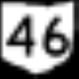
. Its western terminus is at the northern end of the State Route 46 and State Route 307 concurrency in Jefferson
, and its eastern terminus is at the Pennsylvania
state line about 13 miles (20.9 km) south of Conneaut
; Pennsylvania Route 198
continues east.
State highway
State highway, state road or state route can refer to one of three related concepts, two of them related to a state or provincial government in a country that is divided into states or provinces :#A...
in the northeastern portion of the U.S. state
U.S. state
A U.S. state is any one of the 50 federated states of the United States of America that share sovereignty with the federal government. Because of this shared sovereignty, an American is a citizen both of the federal entity and of his or her state of domicile. Four states use the official title of...
of Ohio
Ohio
Ohio is a Midwestern state in the United States. The 34th largest state by area in the U.S.,it is the 7th‑most populous with over 11.5 million residents, containing several major American cities and seven metropolitan areas with populations of 500,000 or more.The state's capital is Columbus...
. Its western terminus is at the northern end of the State Route 46 and State Route 307 concurrency in Jefferson
Jefferson, Ohio
Jefferson is a village in Ashtabula County, Ohio, United States. The population was 3,572 at the 2000 census. It is the county seat of Ashtabula County. Modern-day Jefferson sports the world's only perambulator museum and a historical complex including several restored 18th century buildings....
, and its eastern terminus is at the Pennsylvania
Pennsylvania
The Commonwealth of Pennsylvania is a U.S. state that is located in the Northeastern and Mid-Atlantic regions of the United States. The state borders Delaware and Maryland to the south, West Virginia to the southwest, Ohio to the west, New York and Ontario, Canada, to the north, and New Jersey to...
state line about 13 miles (20.9 km) south of Conneaut
Conneaut, Ohio
As of the census of 2000, there were 12,485 people, 5,038 households, and 3,410 families residing in the city. The population density was 473.4 people per square mile . There were 5,710 housing units at an average density of 216.5 per square mile...
; Pennsylvania Route 198
Pennsylvania Route 198
Pennsylvania Route 198 is a long state highway located in Crawford County in Pennsylvania. The western terminus is at the Ohio state line near Pierpont, OH where it continues as Ohio SR 167. The eastern terminus is at PA 27 near Mount Hope....
continues east.
History
- 1924 – Original route established; originally routed from Dorset (about 7 miles (11.3 km) southeast of JeffersonJefferson, OhioJefferson is a village in Ashtabula County, Ohio, United States. The population was 3,572 at the 2000 census. It is the county seat of Ashtabula County. Modern-day Jefferson sports the world's only perambulator museum and a historical complex including several restored 18th century buildings....
to the PennsylvaniaPennsylvaniaThe Commonwealth of Pennsylvania is a U.S. state that is located in the Northeastern and Mid-Atlantic regions of the United States. The state borders Delaware and Maryland to the south, West Virginia to the southwest, Ohio to the west, New York and Ontario, Canada, to the north, and New Jersey to...
state line 2½ miles east of Richmond Center (about 5 miles (8 km) north of AndoverAndover, OhioAndover is a village located in the south-east of Ashtabula County, Ohio, United States. The population was 1,269 at the 2000 census.The closest village to the Ohio side of Pymatuning State Park, the settlement supports a regional tourism industry...
. - 1926 – Rerouted from Jefferson to Pennsylvania state line 2½ east of North Richmond (about 7½ miles north of Andover) along a currently unnumbered road from Jefferson to 2½ miles east of Jefferson, its current routing from 2½ east of Jefferson to Pierpont (about 10 miles (16.1 km) north of Andover), along State Route 7 from Pierpont to North Richmond, and along current U.S. Route 6 from North Richmond to the state line; former alignment decertified.
- 1932 – Truncated at Pierpont; North Richmond to the state line certified as U.S. Route 6.
- 1940 – Extended from Pierpont to the Pennsylvania state line along State Route 7 from Pierpont to 1 miles (1.6 km) north of Pierpont, and along the former State Route 538 alignment from 1 miles (1.6 km) north of Pierpont to the state line (this alignment was unnumbered before 1938).
- unknown – Realigned from 2 miles (3.2 km) east of Jefferson to 2½ miles east of Jefferson along new road (probably in the 1950s or 1960s).
- unknown – Realigned from Jefferson to 2 miles (3.2 km) east of Jefferson along previously unnumbered roads (some time in the 1970s).