
Ogasawara, Tokyo
Encyclopedia
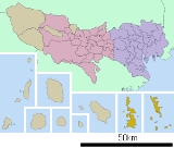
Ogasawara Subprefecture
is a subprefecture of Tokyo, Japan. The subprefecture covers the Bonin Islands and includes the village of Ogasawara; and the prefectural government maintains a main office on Chichijima and a branch office on Hahajima....
, Tokyo
Tokyo
, ; officially , is one of the 47 prefectures of Japan. Tokyo is the capital of Japan, the center of the Greater Tokyo Area, and the largest metropolitan area of Japan. It is the seat of the Japanese government and the Imperial Palace, and the home of the Japanese Imperial Family...
, Japan
Japan
Japan is an island nation in East Asia. Located in the Pacific Ocean, it lies to the east of the Sea of Japan, China, North Korea, South Korea and Russia, stretching from the Sea of Okhotsk in the north to the East China Sea and Taiwan in the south...
, that governs the Bonin Islands, Volcano Islands
Volcano Islands
The Volcano Islands is a group of three Japanese islands south of the Bonin Islands that belong to the municipality of Ogasawara...
and three remote islands (Nishinoshima, Minami Torishima
Minami Torishima
or Marcus Island is an isolated Japanese coral atoll in the northwestern Pacific Ocean, located some SE of Tokyo and east of the closest Japanese island, South Iwo Jima of the Ogasawara Islands, and nearly on a straight line between Tokyo and Wake Island, which is east southeast...
and Okinotorishima
Okinotorishima
is an atoll, which in English has multiple designations . Its original name was Parece Vela Spanish for "looks like a sail"...
).
Geography
The municipality consists of the following groups and single isolated islands:- Bonin Islands (小笠原群島, Ogasawara Guntō) 73.00 km²
- Mukojima rettō (聟島列島) 6.57 km²
- Chichijima rettō (父島列島) 38.89 km²
- Hahajima rettō (母島列島) 27.54 km²
- Nishino shima (西之島, literally: Western Island, also: Rosario Island), a single isolated Island west of Hahajima rettō and north of the Volcano Islands, 0.29 km²
- Volcano IslandsVolcano IslandsThe Volcano Islands is a group of three Japanese islands south of the Bonin Islands that belong to the municipality of Ogasawara...
(火山列島, Kazan-rettō) 29.71 km²- Kita IwojimaNorth Iwo JimaNorth Iwo Jima is the northernmost island of the Volcano Islands group of the Ogasawara Islands, 80 km north of Iwo Jima. It is 1170 km south of Tokyo, 207 km SSW of Chichijima.-Geography :...
(北硫黄島, Kita-Iōtō, literally: North Sulphur Island) 5.57 km² - Iwojima (硫黄島, Iōtō, literally: Sulphur Island) 20.60 km²
- Minami IwojimaSouth Iwo JimaSouth Iwo Jima is the southernmost island of the Volcano Islands group of the Ogasawara Islands, 60 km south of Iwo Jima. It is 1300 km south of Tokyo, 330 km SSW of Chichijima. Its area is 3.4 km², shore length, 7.5 km, and highest point 916m, the highest in the...
(南硫黄島, Minami-Iōtō, literally: South Sulphur Island) 3.54 km²
- Kita Iwojima
- Okinotorishima (沖ノ鳥島 or 沖鳥島, literally: Remote Bird Island) 0.01 km²
- Minamitorishima (南鳥島, literally: Southern Bird Island, also: Marcus Island) 1.40 km²
The southernmost (uninhabited) group is known as the Volcano Islands. 700 km further south is Okino Torishima, and 1,900 km further east is Minamitorishima.
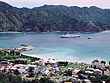
The population of the municipality resides on Chichi-jima
Chichi-jima
, formerly known as Peel Island and in the 19th century known to the English as part of the Bonin Islands, is the largest island in the Ogasawara archipelago. Chichi-jima is approximately 150 miles north of Iwo Jima. The island is within the political boundaries of Ogasawara Town, Ogasawara...
(pop. about 2300) and Haha-jima
Haha-jima
is the second-largest island of the Ogasawara Islands or Bonin Islands south of the Japanese main island chain. It is about 21 km² in area.The highest points are Mt. Chibusa , approximately 462m, and Mt. Sakaigatake , 443m. The largest island of the group, Chichi-jima is approximately...
(pop. about 500). The administration and village hall is located in the village of Omura on Chichi-jima. Besides, there is an air base with 400 soldiers on Iwojima of the Volcano Islands.
History
In 1940, five municipalities were created in the islands, which had been unincorporatedUnincorporated area
In law, an unincorporated area is a region of land that is not a part of any municipality.To "incorporate" in this context means to form a municipal corporation, a city, town, or village with its own government. An unincorporated community is usually not subject to or taxed by a municipal government...
before, two on Chichijima, two on Hahajima, and one on Iwojima
- Ōmura on Chichijima
- Ōgimura-Fukurosawa on Chichijima
- Kitamura on Hahajima
- Okimura on Hahajima
- Iōtō on Iwojima (Iōtō) (including all Volcano IslandsVolcano IslandsThe Volcano Islands is a group of three Japanese islands south of the Bonin Islands that belong to the municipality of Ogasawara...
)
Both villages of Kita Iwo Jima
North Iwo Jima
North Iwo Jima is the northernmost island of the Volcano Islands group of the Ogasawara Islands, 80 km north of Iwo Jima. It is 1170 km south of Tokyo, 207 km SSW of Chichijima.-Geography :...
became part of newly created Iwojima municipality in 1940:
- Ishinomura (east)
- Nishimura (west)
Education
Ogasawara Village operates the island's public elementary and junior high schools.Tokyo Metropolitan Government Board of Education
Tokyo Metropolitan Government Board of Education
The Tokyo Metropolitan Government Board of Education is the board of education in Tokyo, Japan. The board manages the individual school systems within the metropolis. The board also directly manages all of the public high schools in Tokyo...
operates Ogasawara High School
Ogasawara High School
is a public high school on Chichi-jima in Ogasawara, Tokyo, Japan. The school is a part of the Tokyo Metropolitan Government Board of Education.The school is the sole public high school in the Bonin Islands.-External links:*...
on Chichi-jima.
External links
- Ogasawara Village (Japanese)
- The Bonin (Ogasawara) Islands Language and Culture Site
- Ogasawara Channel (Japanese)
- Ogasawara subtropical moist forests (World Wildlife Fund)
- National Archives of Japan: The faked map of 1752 mentioned in Hiroyuki Tanaka's 1998 article.
- Tokyo Metropolitan Government, Ogasawara-mura: maps/photos