

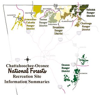
Oconee Ranger District
Encyclopedia
Chattahoochee-Oconee National Forest
The Chattahoochee-Oconee National Forest in northern Georgia comprises two United States National Forests, the Oconee National Forest and Chattahoochee National Forest. The combined total area of the Chattahoochee-Oconee National Forest is , of which the Chattahoochee National Forest comprises ...
. The district is spread over eight Georgia
Georgia (U.S. state)
Georgia is a state located in the southeastern United States. It was established in 1732, the last of the original Thirteen Colonies. The state is named after King George II of Great Britain. Georgia was the fourth state to ratify the United States Constitution, on January 2, 1788...
, United States, counties. The district maintains several hiking and other recreational trails in the Forest (See, Trails of the Oconee National Forest
Trails of the Oconee National Forest
There are 10 trails maintained by the U.S. Forest Service in the Oconee National Forest. These trails include:*Boarding House Trail*Burgess Mountain Trail*Hitchiti Trail*Indian Mounds Trail*Kinnard Creek Trail*Ocmulgee River Trail...
).
Listed below are the counties with land in the district.
- Greene CountyGreene County, GeorgiaGreene County is a county located in the U.S. state of Georgia. It was created on February 3, 1786. As of 2000, the population is 14,406. The 2007 Census Estimate shows a population of 15,662. The county seat is Greensboro...
, 26659 acres (107.9 km²) - Jasper CountyJasper County, GeorgiaJasper County is a county located in the U.S. state of Georgia. As of 2000, the population was 11,426. The 2007 Census Estimate shows a population of 13,660...
, 30312 acres (122.7 km²) - Jones CountyJones County, GeorgiaJones County is a county located in the U.S. state of Georgia. It was created on December 10, 1807. As of 2010, the population was 27,740 . The county seat is Gray.-History:The county is named after U.S...
, 16461 acres (66.6 km²) - Monroe CountyMonroe County, GeorgiaMonroe County is a county located in the U.S. state of Georgia. It was created on May 15, 1821. As of 2000, the population was 21,757. The 2007 Census Estimate showed a population of 25,145...
, 251 acres (1 km²) - Morgan CountyMorgan County, GeorgiaMorgan County is a county located in the U.S. state of Georgia. As of 2000, the population was 15,457. The 2005 Census Estimate shows a population of 17,492. The county seat is Madison, Georgia.-Geography:...
, 308 acres (1.2 km²) - Oconee CountyOconee County, GeorgiaOconee County is a county located in the U.S. state of Georgia. It was created on February 25, 1875. As of the 2000 census, the population was 26,225. Census estimates for 2007 show a population of 31,367...
, 157 acre (0.63535702 km²) - Oglethorpe CountyOglethorpe County, GeorgiaOglethorpe County is a county located in the U.S. state of Georgia. It is the largest county in Northeast Georgia. As of 2000, the population was 12,635. The 2007 Census Estimate showed a population of 13,963...
, 3762 acres (15.2 km²) - Putnam CountyPutnam County, GeorgiaPutnam County is a county located in the U.S. state of Georgia. As of 2000, the population was 18,812. The 2007 Census Estimate showed a population of 21,251...
, 37443 acres (151.5 km²)